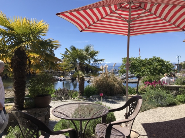
Category: On the Water
Spring Update: Sails and more
It’s been sooooo long! And so much has happened. The last time I saw our boat was June 2019. Three years ago!
Actually the last time we “saw” the boat was in the winter as a friendly neighbourhood YouTuber (Sailing Floating Freedom) was nice enough to send me some pictures. They share the dock with us at Stones. Looks like winter was a tad chilly!

Things that are new
As it’s been so long and we were due to do some maintenance so I knew we would have to do some work. Just how much work was a bit of a surprise.
When we bought the boat I had fully intended to do most of the work myself because a) there is no better way to learn and b) it would be way cheaper. That lasted for the year we were aboard but as soon as we became long-distance owners that went out the window. Which really bums me out.
Just a note: at this point I have seen none of these upgrades/repairs. Sigh.
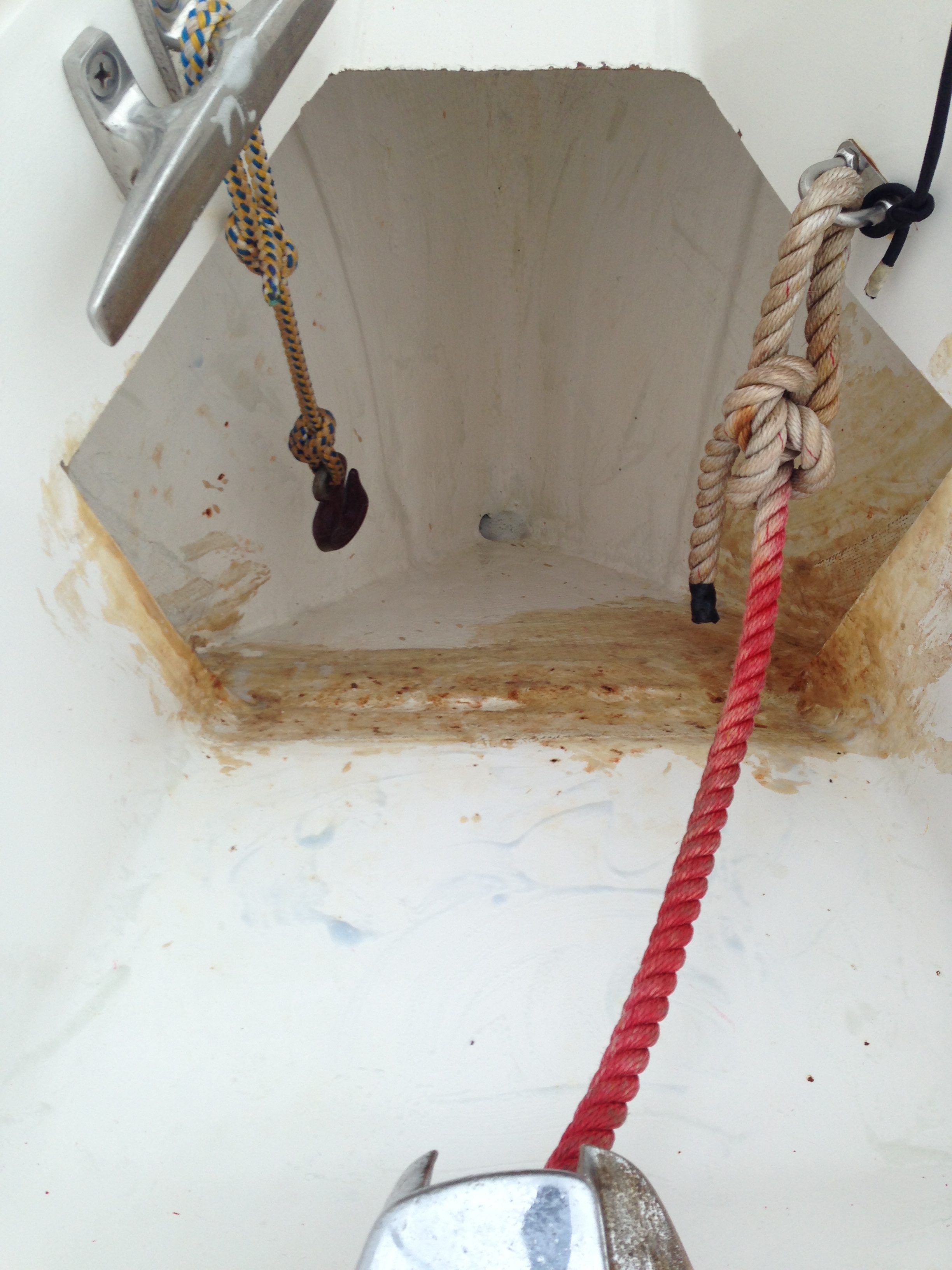
Windlass
Back in 2020 the seals on our windlass finally gave up the ghost and, as usual, parts were no longer available. We knew this was coming but it burned me to replace a perfectly functional windlass just because it leaked water into the the v-berth. then again I don’t sleep in the v-berth 😉
What we replaced it with was a Lewmar Windlass CPX3 Gypsy/Drum for 5/16” g4/bbb (~$2800). This gives us a drum to use—although I am not sure what to use it for other than maybe hauling the dinghy on board :-). The “downside” is they had to cut a hole in anchor locker lid to fit the drum. I will have to wait and see to judge how I really feel about that.

Dinghy
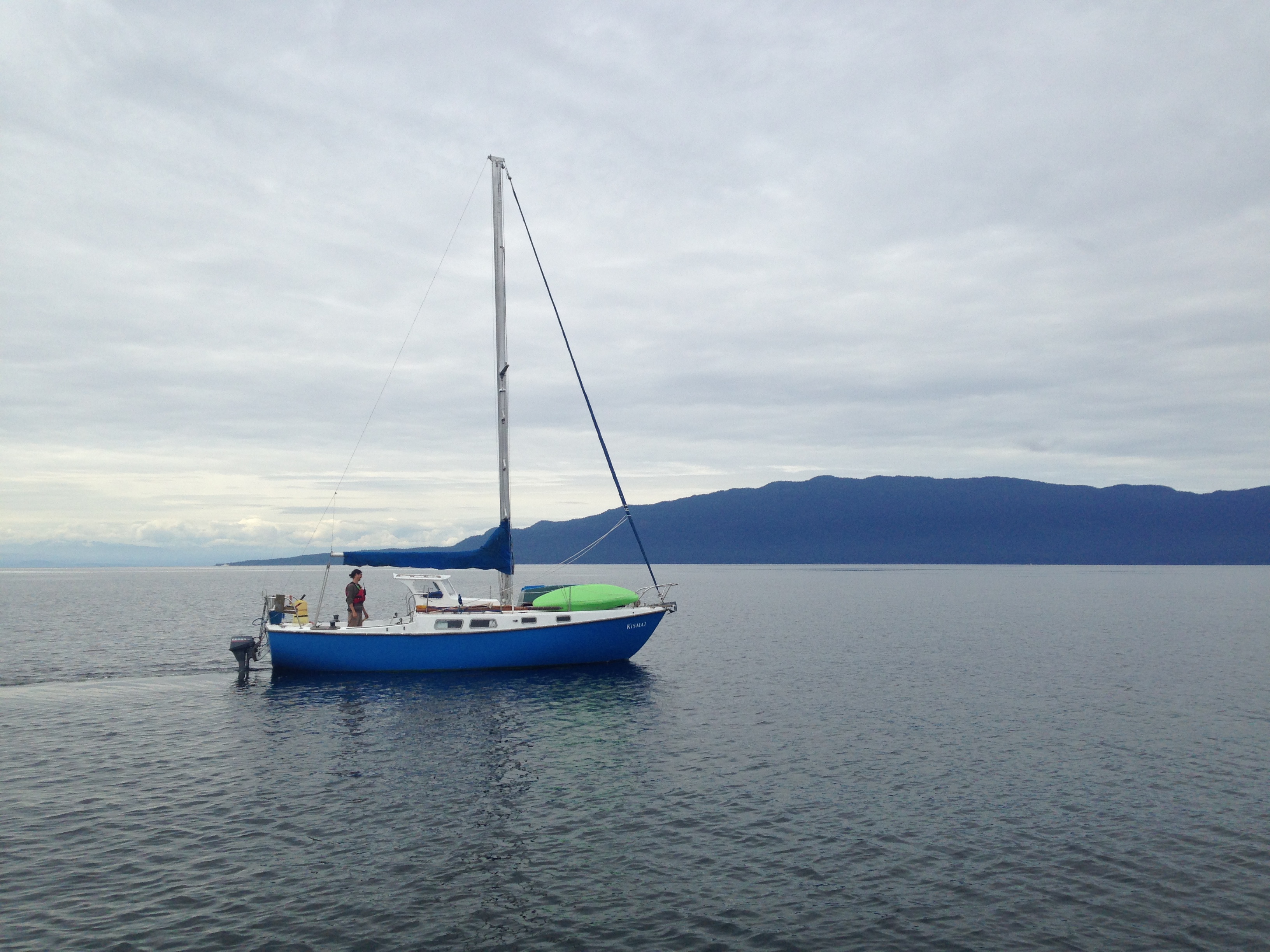
As previously mentioned we had to get a new tender. I picked up a Highfield 290 UL (with aluminum hull for less than $3000, which I consider a steal.

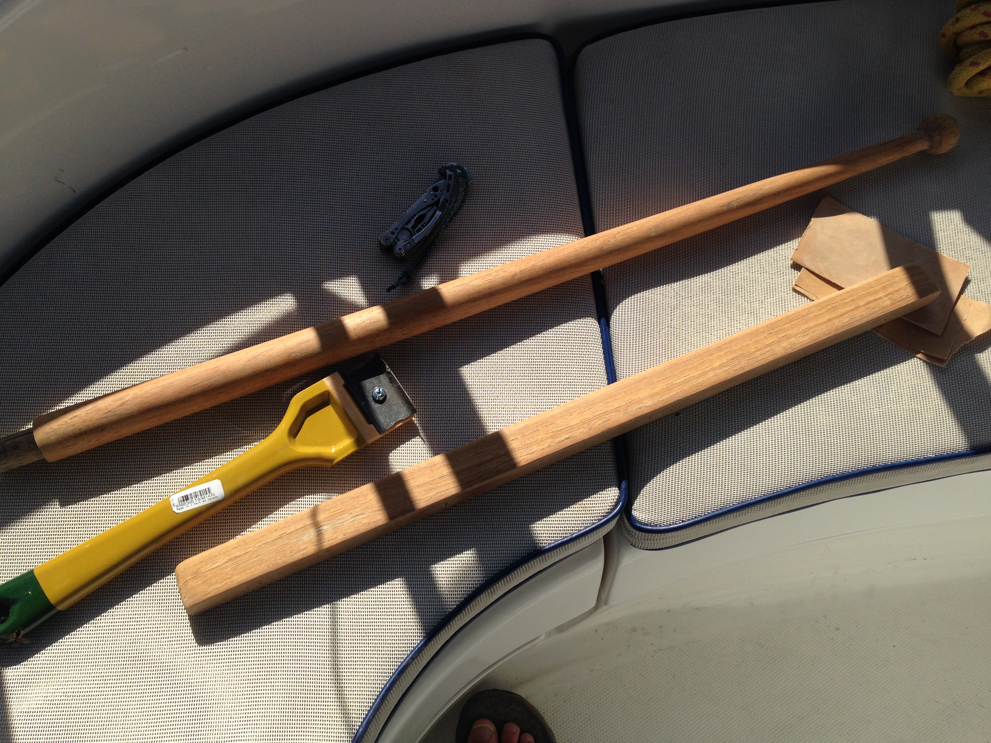
Sails
This was scheduled. We were going to replace them in 2021 but the dinghy took precedence, so this spring I started looking around for a sail loft. I started with the ever popular Precision Sails (they have an awesome marketing department). They are local to Vancouver Island although sails are produced overseas and they are the favourite of all the most popular YouTube channels. Then I looked at a bunch of local lofts: Leitch and McBride, Ballard Sails and a couple who didn’t get back to me.
 I finally settled on Zoom Sails who are associated with Jamie Gilford, husband of author Behan Gilford, and the owners of Sailing Totem. They are another overseas loft but distance didn’t actually seem to be much of a barrier time-wise. Partly it was a trust thing and partly it was a price thing. The price was pretty darn good. I am told the sails look good too, but no pics so far. In total the cost was ~$5000 cad for main and jib (fwiw, the highest quoted price was $7500).
I will write a bit more about the process after I have a chance to see—and use—the final product. Stay tuned.
Chartplotter
I mentioned at the end of our last trip back in 2019 that I had to replace our old e80 chartplotter as the screen was dying. I purchased a refurbished unit from eBay for ~$400. Unfortunately it didn’t last. I had reports last year of it stopping working and, in the middle of a cruise and learn this spring, it died again. You can imagine the instructor thought this was unacceptable.
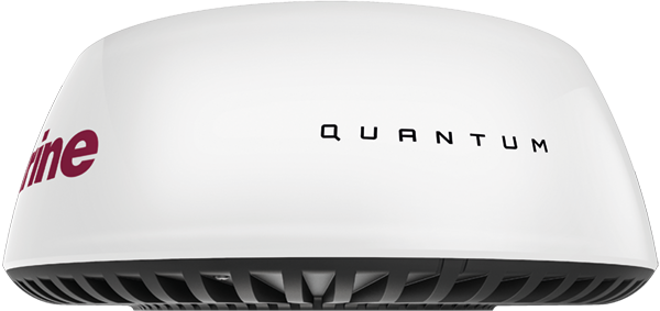
After talking to the technicians at Stones and doing a bunch of research we decided to forgo replacing it with the brand new Axiom MFD (multifunction device) that is its natural successor and go for a cheaper Raymarine ELEMENT 9S for around ~$1400. It does most of what the old e80 did but is missing the touch screen and fancy network integrations, most of which would be useless unless we replace all the instruments as well. As far as I can tell the big thing I will miss is that that radar does not overlay the charts and I will have to use it in split screen mode.
The big downside is that none of the new plotters will work with my old analog radar. So that meant upgrading that as well. So we also ordered a new Quantum digital radar (~$2200). Sigh.

Of course all the old system ( AIS, instruments, GPS etc.) is on Seatalk 1 (NMEA 0186) and the new stuff is Seatalk ng (NMEA 2000). So we will have to get a bunch of bridging hardware and hope and pray it all connects. More on that after we get it all installed and running. The device does have WiFi but I am currently unclear if I will be use an app to access it. So much to learn.
I do now how a perfectly functional e80 with a bad screen and a less than functional e80 with a good screen. The spring project will be to see if I can make one functional e80 chartplotter.
USB

More inconsequentially, since the guys are going to have to run some new cables to the binnacle I thought they could run few more wires and add a USB outlet so we can power our phones/tablets etc. in the cockpit. It’s something I keep meaning to do but haven’t actually gotten around to. So that will be nice.
Concluding…
So who’s counting. Since 2019, not including regular maintenance items we have forked out around $14,500 for a boat we haven’t been able to use. I will say that Covid, after a rocky start in 2020, was a big windfall for the charter industry and bookings have been really, really good. So how much this actually costs me out of pocket remains to be seen—but it won’t be anywhere near that, thank goodness. And of course hoping that nothing else breaks.
Future costs?
In the next bunch of years these sorts of things are going to keep poppin’ up. Off the top of my head:
- I think there is going to be some major canvas work in our future
- I also think the mattresses are tired and that certainly needs to be addressed; likely along with all the other cushions
- Eventually the rest of the instruments will need to be upgraded
- The batteries are getting on
- The running rigging is also going to need looking at
- And of course the standing rigging.
By which time the cycle will start all over again… The joys of owning a boat 🙂
Oh, and btw, our flights are booked. We will be back aboard at the end of April, and if all goes well, we might actually have 2 months aboard to make up for the all the non-sailing years.
W00t.
—Bruce #Equipment
What kind of cruiser?
Bored of the lack of thoughtfulness and reading comprehension on a cruising forum I frequent I post the following post (the original post). I got some good feedback on my attempt at humour so I thought I would repost it and a few of my follow-up posts…
Warning: the following is mostly tongue-in-cheek, although there is an underlying truth to the issue.
It seems to me that many of the discussions on CF go off the rails because we are all so different in both our ambitions and realities. “How much does it cost to cruise?” You’d think this was a pretty straightforward question but it really isn’t and the topic generally goes sideways faster than a drunken docking attempt on a windy day. Even seemingly innocuous discussions like “How much chain do I need in such-and-such area” often become completely nonsensical because no one can agree on what we are actually talking about.
It seems to me we all stubbornly live in our own bubbles. Of course he means to be on the hook 99% of the time! vs. No sensible person would ever anchor out if there was a marina nearby! is never considered when joining the discussion—we just dive in and start the pontificating.
So I propose we find a solution.
I started with a simple chart. “That,” I said to myself, “would solve everything.” “It’s simple Self,” I said, “Simply find your place on the chart and colour code your answers so as to clear up any potential misunderstandings with all our fellow CFers.”

But then I got to thinking. It just wasn’t enough. Where was the geography? We needed a plane for warm vs cold, anchorages vs moorings… And what about round-the-world vs regional? Or a scale for single-handers all the way up to large crew?
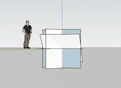
(I tried to make a chart—it turned into a disaster )

This was getting complicated. So maybe a chart is out. How about codes?
Crew size |Crew Period |Climate | Expenses | Area | Moorage Style etc.
So for example I would be a 2PTCMRA (2 crewed, part-time, cold-water, moderate spending, regional anchorer). We could have a big chart … or an app…this is a great opportunity for an app developer—wait…ummm, we need a code for electronics too, with sub codes for radios, GPS, trackers, weather systems… hmmm…
So… ya. A chart. A BIG chart! We will need codes for anchor types too, and gun preferences, probably sub charts for specific regions cause we all know that the Med is different kettle of fish than the Caribbean— I mean literally, totally different fish and what we have here in the PNW is obviously so much better than anywhere else so…but I digress.
We will need indicators for partiers, outgoing folk, introverts, singles, people who can rebuild transmissions blindfolded, those who are still unsure what the pointy bits on a hammer are for… Oh, and most especially some way to differentiate where we fall on the scale of way over-prepared to “I bought a boat on the internet and cast off tomorrow—can someone show me how to sail?”
I guess we need a code for sailing purists. And one for those of us who have a funny stick in the middle of our powerboats. And racers. And dock-bound liveaboards. Is specifying whale preferences going too far? I like orca myself. What the hell let’s add it in.
So now would start any thread participation with “I am a 2PTCMRAPNWNGIMIEMPSO…” and as a result any potential misunderstandings would immediately be averted.
Ok so that about covers it. I am starting to grid this out and will announce the official chart when its completed and will have to get the mods onboard to enforce total compliance. Won’t work otherwise and this would have been a total waste of effort. Hmmm, I guess we will have to access penalties as well. Maybe a grid to determine just how serious breaches, cases of mis-information, and what the levels of incompleteness are and empower Guardians of the Grid to deliver appropriate punishments. That can be phase 2.
This is going to be so cool!
Or… I guess… We could…I mean… Maybe…
Could we all just take a moment to thank god (and/or whatever diety, spirit or scientific principle you believe in) that we are all able to get out on the water in whatever way we can and that that is a whole lot of different ways?
Seriously, if we all just took a moment to consider an OP’s situation or even a fellow thread participant’s perspective there would be so many fewer stupid, inadvertent pissing contests. And then we could get on with the intentional ones.
Just a thought. Let me know if you still want me to go ahead with the grid idea.
The thread continued. Both Mike O’ and L independently thought Venn diagrams were the way to go:
Maybe what you need is a series of Venn diagrams. Cruisers are liveaboards, but not all liveaboards are cruisers. Racers and cruisers overlap, but some are just racers, and some are just cruisers. Some cruisers anchor out, some marina hop, and some do both.
So I gave this a try:

Then Wolfgal suggested:
What fun, Macblaze! Your ever-growing charts are so complicatedly fun! a holograph chart that actually turns around in space, popping up from my personal R2-D2 would take your idea to the next level. could you do this?. 
I thought, I can do that…
I almost lost control of the whole idea when Tayana42 tried to outsmart me with:
Curiosity
Reigns
Until
I’ve
Seen
Enough
Or
Casually
Roving
Upon
Iceless
Seas
In
No
Great hurry
Clever, clever! It went on for pages and pages after that.
Desolation 2019 week two
Je suis désolé
Previously…
When last we blogged we were tied up in the Copelands starting to get into the cruising groove. We have been binge-watching a lot of Episodes lately which was Matt Le Blanc’s Showtime series about a fictional Matt LeBlanc. It stars Tamsin Greg and Stephen Mangen who I just adored on the British series Green Wing. If you are at all into absurd British humour you really need to watch Green Wing. Episodes always starts with a Previously… so… This week: Desolation Sound!
8 May
Another beautiful day. The morning was again work for L and after lunch we took off to explore. I see a pattern emerging. We motored up to the cove in the central island that seems to be the popular anchorage of the Copelands. It is however open to all the wakes from boats transiting Thulin Passage so it doesn’t really appeal — but the approach is much less nerve-wracking than our little hidey hole.
Speaking of nerve-wracking, we are still having some low, low tides left over from the new moon. and when we putted out the entrance of our cove at low tide we could see a large metal spar actually poking above the surface of the water by a few inches; it emanated from the charted wreck that lies along the east shore. I never realize just how close to the surface it was. The wreck is directly below a large conifer up on the ridge and lies about 20 feet off the shore at low tide; closer to 30 at high tide. Be aware. That still gives you 30–40 feet before you have to worry about the rocks on the west side of the narrow passage. While I still recommend entering this anchorage at low tide so you can see said rocks, maybe it might be better to do it a couple of hours earlier or later.
There was one boat anchored in the centre of the cove we headed for, eschewing any of the new fancy stern-tie chains that have been recently installed — seemingly all over Desolation Sound and the Sunshine coast; there must of been a government grant or something. We did a slow reconnaissance to check out the chains for future reference and then used one to tie up the dinghy and head ashore. There a bunch of easy paths to follow that wind around the south portion of the island but couldn’t find anything that led to the north portion.

On the way back we check out the southern-most island and it looks like it has a bunch more trails so we will have to head over one day. Next trip though, as our batteries look to be around 55% tomorrow and it is time to think about a recharge.
Out in the Passage we had got enough signal for me to discover that SV Violet Passage has tied up in Campbell River. A quick Instagram message confirmed they are ready to head north so it looks like we definitely missed them this year.
9 May
I awoke to a very loud, very bossy eagle. And a couple of equally noisy Canada geese. What a racket! I thought these hideaways were supposed to be peaceful.
With batteries almost dead we now had basically two choices. We could find a marina and plug in or go for a long motor and try and pack as much juice back into them as possible. With topped up batteries we have 3 or 4 nights power but ft we just rely on the engine to recharge we can’t usually get them past 90% (which will take 5 or 6 hours of motoring) and that leaves us with only 2– 3 nights on anchor.
Batteries
For those that are interested we use about 15% of our total batteries capacity in one 24hr cycle. Our lead acid battery bank holds 450 amp hours at 12v, only 50% of which is available to be used (lead acid batteries don’t like to be drained less than 50%). That means we use around 67 amps a day—the majority of which goes to powering our fridge and freezer and running the stereo.
I would love to pick up an alternate power source, but solar panels aren’t really appropriate for a charter boat and I waffle over the cost effectiveness of a small generator. They are worth around $1200 — the equivalent of around 20 visits to a marina. Since we usually see only 2 or 3 marinas a trip, that’s a lot of years of amortization.
After some back and forth we had a plan. We decided to head to a marina, which meant Lund, Gorge Harbour (which we were visiting next week anyway) or across to Quadra Island and Taku Resort. A bit more consulting of the charts and calendar and we decided to head to Lund for a night. Then we could spend a week in a couple of anchorages (tentatively Tenedos Bay and Von Donop Inlet) and make our way around the back of Cortes to Taku where we could reprovision, do laundry and top up on power and water. That would leave us in a good position to meet up with the flotilla either in Comox or Gorge by the 16th.
As we puttered around getting ready to cast off I noticed our two loud goose friends on the cliff behind us. Then I noticed the six goslings also scattered across the cliffside. Let me tell you watching tiny little yellow fluff balls scale cliffs is another pretty nerve-wracking activity. And mom and dad didn’t seem to even notice…someone should call social services…
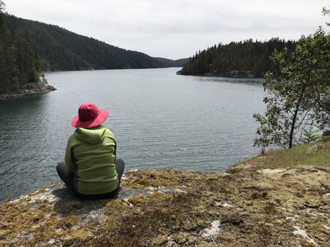
Speaking of wildlife I had forgotten to mention the 6-inch squid who spent quite a bit of time checking out the yellow paint on our chain rode way back in Smuggler Cove. I have never seen one before; according to the guide book he (she?) was likely a Loligo opalescens also know as an Opal Squid, or a Market Squid, or even more commonly known in a restaurant near you as calamari. Mmmmmm…calamari…
We left on a rising tide and both the wreck and the rocks were invisible. All this was made a bit more sketchy by the fact the chart plotter is still pretty dim, almost unviewable in dim light. But no objects were hit. I spent a few minutes once we were clear of the cove looking at my macerator. I don’t think it is operating properly, but luckily enough I have two. We switched over to the back-up and were “rewarded” with a blast of…well…crap. Now we can empty the holding tank later on.
Lund had a slip for us on the north side of A dock. (Slips can be at a premium at Lund and it is a strictly regulated first-come first-served. They won’t even give you slip assignment until they see you approach the breakwater.) We tied up, plugged in and walked up to the harbourmasters office to check in. $34 later (which is a real deal) we were all registered and decided to go pick up a few provisions at the store. And since we were spending money anyway we indulged in lunch at Nancy’s Bakery — I had a most delicious grilled Monte Cristo — and later again in dinner at the Boardwalk Restaurant.
Back on the docks, I noticed we were tied up alongside a 50-ish foot Ocean Alexander and right behind them, a huge 64-foot Northern Something-or-other. 10 feet in boat length makes a huge difference in overall boat size. We felt positively puny. Cruising never fails to remind me about the relative scales of wealth.
10 May
We grabbed a last shower with our newly heated water (such luxuries at dock), before topping up the tank and unplugging from the dock with fully charged batteries. There was no wind to speak of as we motored north through thulium Passage. We had definitely decided on Tenedos Bay as our next destination. It’s another of those “popular” anchorages in Desolation that we had yet to visit, so we decided to give it a try since it was more likely to be empty at the time of year. As we rounded Sarah Point we finally “officially” entered Desolation Sound and the view, as always, was stunning. I took etc same pictures and video I take every time although you would thin by this time I would have realized it was nothing new. And the water was empty of boats other than one smaller powerboat fishing off the point. The wind did come up a bit but we’ve already fallen into the trap of laziness and didn’t bother to raise the sails for the short trip. I think we are going to regret that when we finally join the flotilla which I predict will be stuffed with landlocked sailors desperate for a breath of wind. I predict we will get our asses kicked in the inevitable racing.
Tenedos had a large expedition type yacht on the hook in the main anchorage off the mouth of the stream. It had to be 60–70 feet and had the look of something more likely to be found in the Arctic than cruising around here. Unfortunately it was gone the next day when we took out the dinghy so I never did catch a name other than the OP emblazoned on the side of the forward superstructure. Other than that we had the place to ourselves. We anchored in the west arm on the north side of the bay just off the tombolo that joined the small island to the mainland. We dropped in about 40 feet of water and just swung in the middle of the small cove rather than fussing with stern lines.
Later I finally got to row the dinghy — stealing control from the oaring fanatic I travel with by the simple expedient of jumping in the boat first before she noticed. We toured around the anchorage spotting hundreds of the small red starfish (leather stars?) and lots of the purple and pink ones as well. Two small deer were wading in the shallows off the point and back at the boat we discovered that the rocks on the north side of us were apparently a favoured haulout for about 15 harbour seals. They remained around us for the entire stay, coming and going with the tide and occasionally, when basking in the sun like a loud pile of cats, all came crashing back into the water when some loud noise startled them.
We did discover a few more items on my “Oops I forgot pack that” list. Earlier the amount of mosquito bites on my ankle pointed out our complete lack of bug repellant (I usually pack it though we’ve never used it before but…), and my rapidly reddening forearms pointed out that leaving the sunscreen at home on the counter was a dumber mistake than leaving my good kitchen knife behind.
Late that night we were joined (although off in the centre between the two arms) by a 50-ish foot Meridien named Bad Habit. They were pretty good neighbours except for the generator. They only ran it in the late mornings though, so that was all right.
11 May
What a warm sunny day. [Insert sigh of contentment here] We spent the day mostly relaxing and watching the seals noisily fight over the best sunning spot on the rocks. Later on a nature watching boat came scooting over the submerged tombolo with a load of eager junior naturalists and paused briefly by the pile of pinnipeds… they didn’t even budge. I guess they are used to being an attraction, because every time we even sneeze they all go crashing into the water as if we had set off a bomb.
Later in the day we were joined in our cove by a small trawler-type with 4 men and their toys. They were ok neighbours if you had to have neighbours. L suggests to me that my article in Pacific Yachting encouraging people to take in Desolation Sound during the early season worked…which is a bit of a bummer, albeit an ironic one.
We mounted the outboard and scooted over to the trail head for a hike to the lake. It was more of a walk and all of 7 minutes long. Disappointing. We did back track and take the more “rigorous” south trail which consumed another 15 minutes and was a bit more interesting as it terminated on some sunny rocks with a nice view and a rocky “beach” one could wade or bath in —something one of our trawler buddies was currently doing. When the sun got too hot he meandered back and spent a half an hour of so sitting on the rough bridge over the stream enjoying the miniature rapids and noisy babble of the lake water slowly emptying into the sea. “Everyone should be quiet near a little stream and listen.” This is a quote from Ruth Krause that was illustrated by Maurice Sendak and I use it as one of my desktop pictures. Every one really should…
Back at the trailhead there is a campsite and we chatted with a nice couple from Colorado who had just kayaked in. He helped me drag our dinghy back into the water as it had receded a good 30 feet and heavy and awkward when the 8hp outboard is on it. They were out for week and then heading north by car to Alaska. Watching them unload was fascinating. Two adults and a dog is cargo enough but the amount of stuff they unpacked from the two person kayak was kind of astounding.
Heading back to the boat we were flagged down by a couple on a trimaran wanting to know about the “hike.” It turns out they had driven out from Montreal to buy their boat in Comox and were taking a few days to explore Desolation before they trucked it back to Quebec to cruise the east coast. Apparently the current exchange rate made a west coast purchase and subsequent trucking way more affordable than buying something from the eastern States.
12 May
Wake up. Drink coffee in the morning sun. Bake muffins for lunch. Go for an afternoon motor to tour the bay. Relax in the sun. Drink some more coffee. Sigh.
The only highlight of the day was the departure of trawler boys and the early evening appearance of Swell. She’s a 60-something foot converted ocean-going tug that we had been docked near in our last few weeks in Victoria. They do excursion tours from Victoria all the way to Haida Gwaii. While it was nice to see her, the fact that she didn’t turn her engine off at all was a bit annoying and our peaceful anchorage was no more. I know, I know, first world problems…
13 May
Cooler and less sunny, yet somehow one of the warmer mornings so far with the temperature being 15° in the cabin when I crawled out of bed. I bet if we hadn’t gone back for the heater repair it would have been a solid 11° all week.
Swell was gone when I emerged from the cabin, but a commercial prawn boat was anchored across the bay and they leave the engine running all the time to keep their catch cool so you could still hear a rumble echoing across the anchorage and drowning out that early morning serenity. Still, it was a bit quieter than Swell had been and we had the seals anyway.
Coffee and leftover muffins ensued.
The batteries were down to 57% (which was a bit lower than I expected — I suspect we are playing the stereo a bit more than usual) so we got ready to raise anchor and depart. We were off by 9. The chart plotter is almost completely useless now, but I have gotten a confirmation that the new one has cleared customs so it should be there by the time we get back. There are a series of shallow spots and drying rocks at the entrance to Tendedos that I normally would have woven my way through, but this time I opted to just go around — better safe than sorry, eh…
An hour and half later we tied up at the public wharf at Squirrel Cove (in a spot that was vacated mere moments before we arrived). We wandered up to the store in search of skim milk for someone’s morning tea —supplies were getting critically low and bit suspect. We had checked at Lund and now at Squirrel Cove and there has been absolutely no sign of skim milk. 2%, homo, half-and-half there was plenty of but absolutely no skim or even 1%. We have concluded that Central BCers either hate skim milk with an all consuming passion and thus the stores don’t dare carry it or they absolutely love the stuff and the stores can’t keep it in stock. The truth remains a mystery.
Then we headed north. We fired up the inverter to charge the laptops and as soon as the water was hot I had a nice shower and shave and broke out some clean clothes. Life is good. The weather had been nice enough that we have managed a couple of solar showers over the previous week, but the forecast has the wind turning southerly which usually brings cooler temperatures and rain so the likelihood of another water-warming day is pretty low. Take the showers when you can get them.
No whales in The channel this trip. We’ve been lucky there several times before. As we passed the cove midway down Von Donop we noticed it was a) empty and b) very calm. We turned hard a-port and wandered in to check it out. The depths were 11-12 feet (below our 5-foot keel) with the tide predicted to drop another 6 feet. After some maundering and negotiating (I was voting for our usual anchor at the end of the inlet) it was decided to give it a try. And wouldn’t you know it, the anchor was being fussy, and for one of a few very rare instances kept dragging rather than setting right away. That’ll teach us to try something new. But after a few tries we got it stuck in and both of us satisfied that we wouldn’t move. So here we are, for a few nights at least.
There is zero cell signal and the batteries only managed to get up to 82%, so I think two nights will be our max and we will head off to Herriot Bay or Taku a day early for laundry and the opportunity to visit a fully-stocked grocery store. At this point I doubt we will make the long sail south to Comox to meet up with my brother, so it will be only a short hop across to Gorge on Friday.
In Summary
It been a good week. We’ve had plenty of good weather (although that is predicted to end tomorrow) and some beautiful scenery to enjoy. We’ve also added a few creatures to our ever growing list of west coast wildlife which is always good.
We’ve got a few days until the flotilla to kick back and then it will be go, go, go for a week.
—Bruce #Cruising
Desolation 2019—week one
And we are off. We had planned on heading to the coast on the 25th but unfortunate circumstances meant we had to cancel our flights last minute (Ouch!—but it’s only money right?). A couple of extra days and we got everything fixed up and took off on the 29th.

The plan was to cruise Desolation for a few weeks and meet up with the Calgary Yacht Club’s annual flotilla. My brother had joined them last year aboard his friend’s Kelly Peterson 44 which apparently had enough room for him and his wheelchair—something our Hunter just can’t manage. The flotilla was heading north from Comox, up to Blind Channel and then circling back by way of Toba Inlet. It looks to be a pretty busy agenda, so hopefully we will get our relaxing in first. And I imagine they will all be keen to actually sail.
And we’re off…
29 April
We left Edmonton around 9 am, abjuring our usual seaplane flight from Vancouver to Nanaimo in favour of a flight into Nanaimo’s airport because that got us on the boat about 4 hours earlier. Ian from Nanaimo Yacht Charters picked us up at the airport and we had a nice visit on the drive in.
I’d forgotten our keys (among other things) and so I grabbed NYCSS’s set from Beth and we started hauling our gear on board. A few hour later we were mostly moved in and took a break to lunch with L’s parents who had driven in to meet us. Then we finished unpacking and headed off to the grocery store to provision. Eventually everything was done and we kicked back to try and relax after a long day.
Speaking of forgetting things. So far, because I got cocky and didn’t consult my pre-departure provisioning lists, I have realized I didn’t bring: a long sleeved button down (useful for cool evenings), my good kitchen knife, my gorilla pod for the go-pro knockoff, the aforementioned boat keys, my radio license renewal and enough long sleeved t-shirts. That’ll teach me. Or not.
30 April
We woke up to 10°C — a cold start to the day. We had intended to be off dock early but you know, one thing or another… Eventually we did cast off and headed across the Strait for the Sunshine Coast and the start of this year’s adventure.
We discovered right away the bearings on the wind transducer were shot. In what was obviously ~15 knots of wind, the wind instrument was reading from -1 knots up to a peak of 3 knots. I found later this was probably due to a big storm early in the year which had abused a few of the boats in the fleet. As per usual, after a year of being off the boat, we were a little off balance and since we opted to head straight out rather than have our normal couple of days at anchor in Nanaimo to settle in, we were a bit jangling. So the lack of accurate info about the wind and an initially bouncy ride led us to decided to motor sail rather than sail. I know, I know… we’re so weak-willed. What can I say…
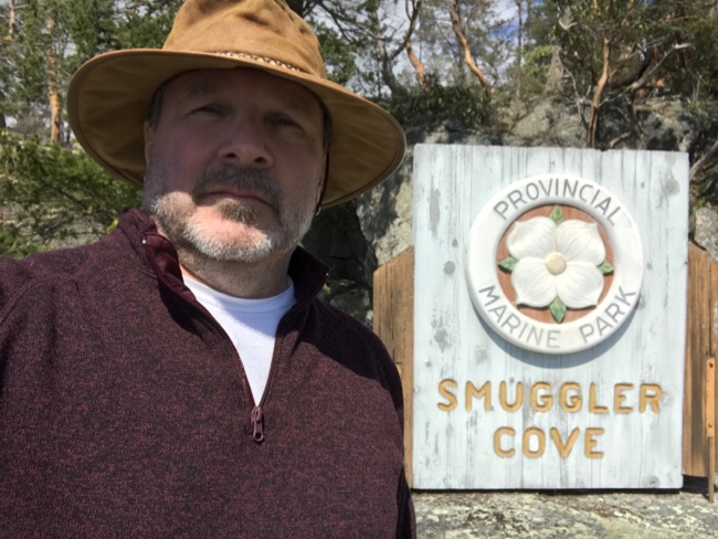
I also discovered that the issues we had been having with the chart plotter last year were worse. I had assumed last year it was a battery/power issue which we had dealt with at the end of our cruise; but the screen was still dimming as time went on and the faint odour of ozone could be smelled. It got so bad that by the point we were ready to transit the narrow, rocky entrance to Smuggler Cove I couldn’t see the screen in the sunlight and decided to fire up Navionics on my phone to double-check our position.

But we made it in safely, dropped anchor and took out a stern line to the fancy new chains that had been installed. L took the line out in a change of our usual procedure. Seems she was tired of me yelling instructions from shore on how to maneuver the boat. So she had to put up with me yelling instructions from the boat on how to run the stern line. Some people just can’t win…
After dinner we discovered a horrible fact that almost ruined the whole trip. There was no kitchen drain plug! We searched high and low but to no avail. Horror! We quickly started researching places to head off to in order to find a replacement. In the meantime I McGyvered a temporary fix out of Press-and-Seal and a side plate. Disaster averted and dishes were duly done.
We were treated to about 3 hours of helicopters repeatedly coming by and dipping their buckets in the south cove. The fire couldn’t have been too far away as they were back every 4 minutes or so. Exciting stuff.
1 May
We awoke to 11°C and moored in the shade of a cliff which meant there was no hope of warming sunshine for at least 3 hours. Since 13° is our cut off for firing up the heater, I decided to fire up the heater. What I got was a horrible noise. Long time followers of this blog will note that my relationship with our Webasto Hydronic heater is not the best. In fact I would estimate that at least 50% of the time that I have gone to fire up the bloody thing it has failed to satisfy my need for heat. It again did not fail to disappoint me.
As soon as I flicked the breaker a horrible noise came from the aft locker. I glanced over at the thermostat control and noted it was already on (this is not good in my experience as it means it wasn’t shut down properly). I shut it all down after a few minutes and tried again. After my third try the thermostat control now started giving me an error message in the form of a series of indecipherable coloured blinks. And that was that. I wasn’t going to go through another whole cruise with no heater—it was now a matter of principle. Besides, we need a new drain plug.
I called Ian, let him know we were headed back and asked him to have a technician on standby. He thought it might be the bearings in the pump and cautioned that a replacement might be several days away. But I stuck to my guns and said were gonna get it fixed. I can get stubborn about the oddest things.
It was glass calm as we motored back across. That will serve me right for not sailing when I had the chance. I also noticed on the way back that the stitching on the Sunbrella edging of the jib had frayed and was now flapping a bit. That was a bit of a problem because given a little bit of wind, it was sure to get a lot worse.
Back at NYCSS, it became apparent that the issue was the recirc pump. Unbeknownst to me (I have been mystified by the setup of that bloody Webasto from day one and no one has been able to explain it to me) our install had an external pump—which is apparently just your typical freshwater pressure pump—plumbed in to pressure up the system. This pump turns on as soon as the breaker is turned on, before the Webasto’s internal pressure pump is actually fired up. Apparently the logic is that because the Webasto Diesel system is originally designed for trucks, there might not be enough oomph in the built-in pump to deal with the elevation changes and length of runs. An external pump ensures that airlocks are less of an issue.
So we swapped out the pump (which was still working and “probably” would have lasted the whole trip) but unfortunately the new pump had manufacturing defect and we had to put in a cheaper one. This means I can now hear the recirc pump running, but since the whole system generally sounds like an airliner running up its turbines, I figured it wasn’t much of a big deal. And the error code had reset itself. We successfully fired up the heater several times. Success! Of course in the week or so since we had it fixed the mornings have all been pretty good and I have yet to have had occasion to actually use the stupid thing. Sigh.
After a quick consult, we decided to haul down the jib. A & M canvas is just up the hill and theY agreed to do a quick sew job; we had it back in just a couple of hours. In the process we did notice that the foil that the jib slides into was loose and then had to find a couple of new set screws to get that taken care of.
I also decided that the chart plotter was unacceptable as it was. We will be okay because I had both my phone and my iPad to use and frankly I prefer using paper charts except for very narrow entrances and exits. We talked it over and decided that anything newer risked having to replace a lot of other instruments that talked to the chart plotter and that it could quickly run to almost $10,000 if we got carried away. I found several refurbished Raymarine e80’s on line and decided that for several hundred dollars it was worth it. So I bought one and it should be waiting when we finally get back. Hopefully it will be an easy swap.
All in all it was a busy and expensive day. Oh, and Beth found us a replacement plug…but it wasn’t as good as the original constarn it… We cast off and a few minutes later dropped anchor in Mark Bay around 5 pm. Then we dinghy’d over to the Dinghy Dock Pub for dinner and some cider.

2 May
These will get shorter, I promise. In any case we awoke, phoned the municipal dock to see if we could tie up for an hour instead of having to lower the outboard off and on. They said yes and we headed in. At first we were supposed to raft onto some crabbing boats but they were already getting pretty dense, so the harbour guys had us tie up in an empty slip normally occupied by the Spill Response boat.
I screwed up that dock. I wanted to reverse in but the wind kept catching the bow and swinging me out. As usual I got stubborn before I got smart and at one point even touched my anchor to the rail on one of the aluminum boats. Eventually I smartened up and just went in bow first. Easy-peasy. We dropped off some mail, bought some batteries and found another replacement drain plug (which still wasn’t as good as the original) and cast off again.
The winds were lighter but we managed to sail for for 40 minutes or soon until they died and we were left only making 2 knots of boat speed. Really starting to regret not sailing that first day…
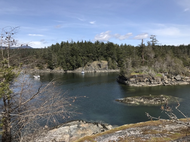
A few hours later it was windy stern tie in Smuggler and there a lot of shenanigans until I was satisfied. It’s not as quiet as it was two years ago at this time of year. We shared the anchorage with 3 boats the first night (with two more in the back cove) and there was never less than 2 the entire time we were there.
3 May
The next morning Leslie wrote a proposal for a conference that she had left to the last moment. Around noon we managed to scrabble together enough internet signal to send it off. I on the other hand, discovered the shelf life of FSR is about 4 years. My wondrous blue rust-eating jelly was now a watery pink. So much for me spending some time working on the inevitable creep of rust stains.
So I let L row me around the anchorage. Eventually we tied up to the north shore and went for a hike out to the point—something we’d never done. Dinner was the first pizza of the year!
4 May
Another lazy morning followed by a longer hike that pretty much covered all the available trails. Lots of tourists and local availing themselves of the sunny day and beautiful scenery.
5 May
I wanted to get north, so we headed out with the intention of making Sturt Bay or maybe even Lund. One of my objectives is to try an meet up with S/V Violet Hour. Violet Hour is a C&C 38—if memory serves me—that Patrick and his partner (whose name completely escapes me at the moment) bought right around the time I was researching our own purchase. Them, Matt (on Gudgeon—who we finally met up with last year in Von Donop) and us make up a trio of sailors who all bought boats and started blogs right about the same time. The three journeys make an interesting compare and contrast for anyone contemplating life on the water in the PNW.
They were a couple of days ahead of us heading north at the time of our first abortive attempt to cast off and now were already exploring Desolation. As their intent was to head further north I wasn’t sure if they would still be around when we eventually arrived in Desolation.
The forecast called for 10–15 knots from the N and as usual the Malaspina was uninviting. We could have sailed but once again wimped out and decided a straight line was more efficient than spending the day tacking back and forth. Just outside Pender Harbour I spotted a dorsal fin and we were treated to a pod of 8 or so orca about 300 feet off the port side. We killed the engine and drifted alongside for 15 minutes or so as they headed south.
In the end it turned out that banging into the waves was not to our taste and we aborted our northward journey and decided to duck into Blind Bay. We had been to the Hardy Island anchorage there before; Dave (R Shack Island) had meant to take us to Ballet Bay on the south side one day but we’d never made it. So we decided to give it a try on our own. We arrived a low, low water and anchored in 20 ft surrounded by rocks. Six hours later the rocks had completely disappeared and suddenly all the warning in the guide books about approaching with caution made a lot more sense.
I am still refining my anchoring distance sense — we settled in slightly off centre in the small bay and I would have sworn there was barely enough room for us. An hour or so later another boat came in and dropped anchor a comfortable distance off our bow. Later when we went for a row we realized there was probably enough room for a couple more boats as well. So much for getting better at judging distance…
6 May
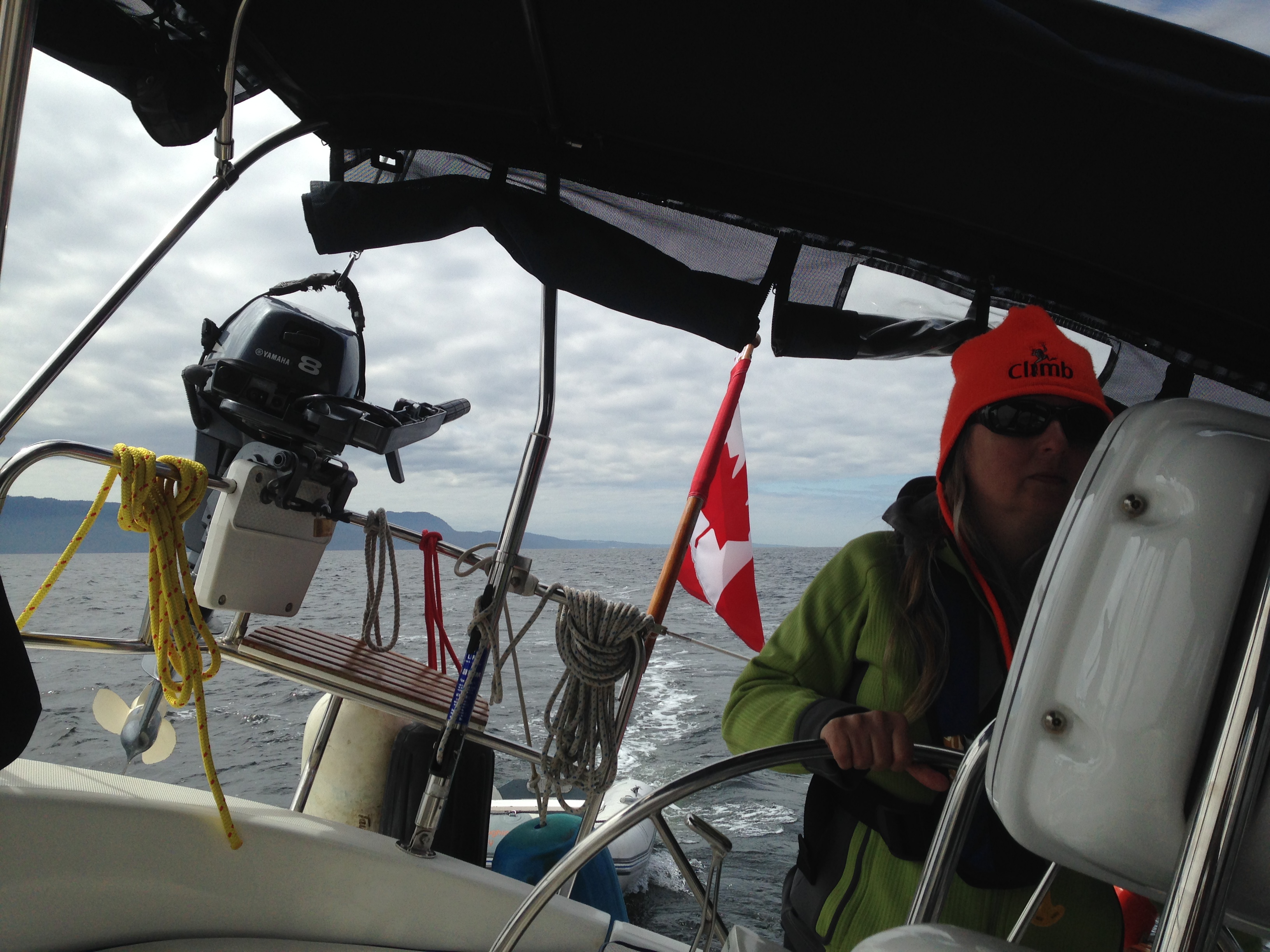
The winds were gone again. So we motored out of the bay and headed north up a much calmer Malaspina Strait. A bit later we spotted a sailboat on the AIS gaining on us. Eventually it turned out to be a Hunter 38 (pretty much the same boat as us but a few years newer). We had been running at close to 2500 RPM this trip which is much higher than our normal 2200 “Dave speed.” But these guys were beating us by almost half a knot in what was pretty much the exact same hull. L wouldn’t let me speed up. She’s mean.
We followed the other Hunter into Lund about 20 minutes behind. I tried to stern into the fuel dock and lost my bow to the wind. Again. That’s three times already. You think I’d learn. Anyway we backed out and came in on the other side after the the other boat had finished refuelling and cast off. Much easier. Then we picked up some more cider, topped up the water and took off again.
By this time I was just looking to find someplace to settle into for a few days. Violet Hour was supposedly heading for Cortes Bay but that didn’t appeal. Apparently according to our spiffy new 20919 Waggoners there were a bunch of new chains in the Copeland Islands and that was barely 2nm out from Lund. So we decided to give them a try.
The wind had picked up out of the northwest and our chosen anchorage looked a bit choppy so we bailed and went back to our cozy nook in the south islands for 2 years earlier. The entrance is a bit nerve-wracking but it was low tide and at least we could see the rocks instead of guesstimating where they were. We passed over one section where there was less than 2 feet under the keel but then passed into deeper (8 feet under the keel) water. Since we were about 3 feet above low tide we figured we were good for a few days.

As soon as we settled were greeted by the local seal. Later dinner was interrupted by a trio of noisy otters transiting the cove with their own victuals and we watched a bald eagle catch and consume a fish just off our stern. Idyllic. Leslie went for a row.
7 May
L spent the morning working (she is delivering a paper at the Learneds June 3 in YVR and still hasn’t finished her paper). I relaxed and thought about cleaning rust. Then we lowered the outboard and went for a cruise around the various islands in the group. The strait was dead calm so we crossed over to Major Islet and killed the engine just to the west of where the sea lions were gathered. We slowly drifted past these loud pinnipeds, managing to not disconcert them too much (although they did object to us when we attempted to row a bit further out…loudly). We also spotted some seal pups sunning themselves on the shore. Seriously cute.
We finished the day up with some shore exploration by drifting along the rocks: tons of starfish, sea cucumbers, anemones and all sorts of unidentified sea creatures—guide books are not as helpful as one would suppose. A quick hike next to watch the waves off the west side of the island and it was back on board for dinner and some episodes of Episodes.
Starting to relax
That pretty much wraps up our first week aboard. A bit more hectic than we could wish for but an improvement on the rush of try to head to the Broughtons that we went through last year. We have about 10 days before we meet up with the flotilla boats—either in Comox or a day later in Gorge. We haven’t decided yet. Everything in Desolation is pretty close to everything else so hopefully we can get in some sails without worrying about schedules.

I’d also like to find a chandlery and buy some cleaning supplies. The canvas could use a good scrub and the stainless needs some work. But our options are limited and I’m not that committed to it yet.
—Bruce #Cruising
Cover Story
I’ve made the cover of a national magazine… both cover story and the cover image are from our spring cruise last year. My first national sale. Should be out in the next week or so…
Charter Season Update
This is an autopost from neverforever.ca but it still counts as a post 🙂
Last year I did a roundup of our first charter season so I thought I would briefly follow up again this year.
Disclaimer: I am a notorious “rounder” of numbers and the most incompetent accountant I know. None of this is intended to provide any more than a reasonably forthright account of how I view our financial outcomes. Your mileage, as they say, may vary.
Year 2
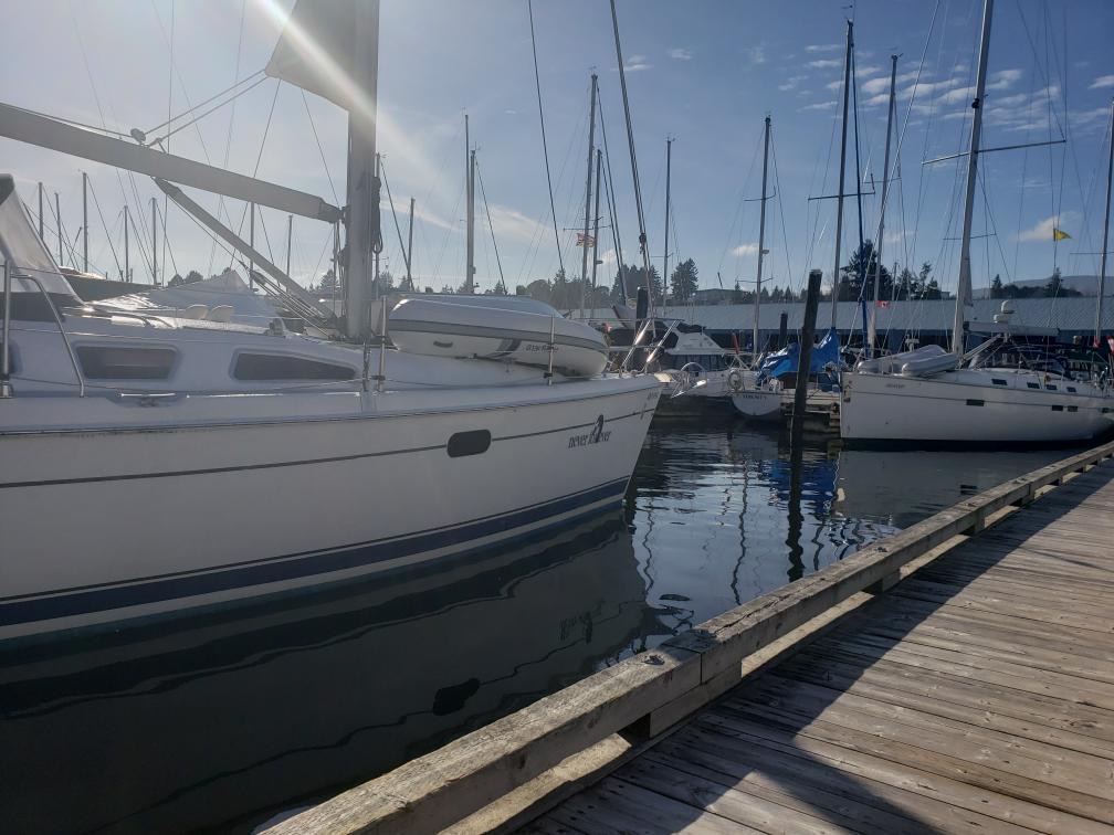
We originally booked Never for Ever for ourselves for all of April, May and June but a late booking was requested for mid-June which we agreed on. So we boarded our boat on April 20 and had it back in Nanaimo for her first charter by June 16.
I did return to the boat in October for a short week-long cruise with some friends, so all in all we used the boat for a total of ten and a half weeks.

The boat was in good shape when we showed up in April. The canvas over the arch hadn’t been removed (by agreement and due to poor design) over the winter so it was pretty cruddy. A bunch of the kitchenware had changed or been substituted and one of the winch handles was missing (which NYCSS promptly replaced). The only major irritant (and it was pretty minor) was our perfectly-sized dish rack was missing. It took us a month to find another —and it went into storage at the end of our season.
The dinghy painter was worn out so I replaced it and also replaced a few of the lines on fenders. We also had to hunt for a few things like the regulator knob off the BBQ and some of the canvas panels for the enclosure. All that stuff had been stripped and stored for the winter. There is more on this in my previous post called Whose Boat Is It?
The Numbers 2017
| Weeks | Net Income |
| 1 | $1600 |
| 2 | $2500 |
| 1 | $1700 |
| 1 | $1700 |
| 1 | $1400 |
| 1 | $900 |
| 1 | $1600 |
| 1 | $1600 |
| $13000 |
Overall we had the same number of weeks chartered as 2016 and basically the same revenue. The big difference this year was in costs.
| Winterize | |
| Trace and repair small leaks | |
| Windlass repair | |
| Fire extinguishers certified | |
| Ports & Passes 2017 | |
| Spring prep | |
| Tow and replace Engine Mounts | |
| Turn around (cleaning), new chain | |
| Moorage, insurance & locker rental | |
| Misc: thermocouple, light, small leak | |
| Leaks, sail repair | |
| $20000 | |
The costs were up almost $8000 from last year. There were 3 major factors: I had the windlass rebuilt over the winter as the seal had corroded and it was leaking into the vberth; I replaced the chain and I had that little incident with running over the dinghy painter and wrecking my motor mounts. That last little screwup cost me over $4000 and any hope of breaking even.

After it was all counted and totted up, I wrote out a a pretty hefty cheque. I have to admit it hurt a little bit since we weren’t expecting it. But then again I guess we got 10 weeks of sailing for less than $500/week so I really shouldn’t complain.
Next Year
We’ve already got 2 weeks booked for 2018 (one is at the end of May, which is a bummer). I don’t know how much we will get out this year as we are currently considering a series of shorter trips rather than one, big, long one. But so far there has been no talk of selling the boat (except when I start dreaming of a new one) and for us, putting the boat in charter has definitely been a good decision.
—Bruce #Charter
Spring 2017 Roundup
April 20–June 16

Well, we are back from our first—and likely only—cruise this year. And I think I can safely say it was a success. We saw some new anchorages, hiked some new trails, met some new people, had some great sails (and finally some good downwind ones) and learned quite a few things.
Quick Numbers
- 58 days
- 8 (-ish) weeks
- 434.8 nm (805.3 km) travelled
- 26 days traveling
- 8 marinas visited
- 20 nights in a marina (only 8 were paid for—the other nights were in our home berth)
- 33 nights at anchor
- 5 nights on the hard
- 0 nights on a mooring ball
- 7 new anchorages visited
- 5 popular Desolation Sound anchorages that we had to ourselves
- 1 new marina visited
- 120′ of new G4 chain
- 4 new motor mounts
- 2 pieces of teak refinished
- 0 whales, dolphins or any other large sea mammals 🙁
- 681 images captures
- 333 film clips (62 gigabytes of files)
Our Summary
We had so wanted to make it back to the Broughtons, but after talking to a few of the marinas up there about services in April, and the fact that Leslie was going to break up our trip by flying to YYZ at the end of May, we decided to limit our trip to Desolation Sound. And it was magnificent. Over and over again we had popular places like Smuggler Cove, Garden Bay, Laura Cove, Squirrel Cove and Teakerne Arm all to ourselves. For the first 25 days our definition of a busy anchorage was 4 boats. And when we headed south in mid-May you could see the stream of bigger boats heading north and we smirked in self-satisfaction.
Sure there was rain. And cold. But on average we saw some blue sky every second day and there were always times we could go for a hike or walk without being poured on. We quickly settled into a 13° C rule (55° F). If the temperature in the cabin was 13° or lower when we (I) crawled out of the berth, then we fired up the Webasto diesel heater. If it was 14° (60°F) or higher, we just boiled water for tea and toughed it out with blankets.
And the weather meant we moved a bit more than previous trips since there was less lolling around in the sun. In the past we have tended to try to stay 4 nights and max out our battery capacity before heading to a marina to do a bulk recharge. But since we were only staying in anchorages 2-3 nights, generally the couple of hours engine time going from one anchorage to another was enough to recharge the batteries sufficiently to keep ahead of the dreaded 50%-discharged level. And that saved us tons of marina fees.
The only downside of the trip was we when we both caught colds and discovered that rain + colds + wilderness anchorages = misery. So we spent a few unnecessary days tied up at an off-season resort (cheap!) and pampered ourselves with unlimited heat and hot showers.
And we had some great sails. Maybe not as many as we had expected, but it was nice to sail in moderate winds for once. It seems too often on this boat, we have sailed in light winds or reefed down and holding on for dear life. And we got some good downwind sails in 10–20 knots — and I finally experienced the real deficiency of the B & R rig. In Ganges, I ran into a fellow with Hunter 380 who had spent ~$9000 to add a slick roller-furling gennaker to compensate for the poor direct-downwind performance, but at that price, I think I will stick to just gybing my way downwind. At least cranking in the main over and over is good exercise.
Conclusion
Will we do the early-season trip again? I sure hope so. We had a ton of fun and there were very few negatives. If we can continue to cover most of our boat ownership costs with July-August-September charters, then having the boat for up to 2 and half months in the shoulder seems a perfect solution. This year we were off mid-June because we had a charter booked for the last two weeks of the month, but I might consider not doing that next year as it would be nice to finish off the cruise with some really warm days for ourselves. But then again, maybe not. We had some nice days and I remember all those boats heading north—I wonder if we might be turning into sailing misanthropes? Oh well, there is always Alaska.
Now all I have to do is see if there is anything worth posting in all that video I shot.

The Interactive Map
I broke the map up into three legs: Desolation Sound, our return via the Sunshine Coast and the Gulf Islands. You can see some of the stats from the Navionics tracks from the sidebar or if you go to the Google maps site, although they aren’t completely trustworthy as I run Navionics on my old iPad and it has a tendency to crash—so I have to go in later and edit the tracks by hand thus screwing up the stats. There seriously has to be a better way…
Itinerary
| 20-Apr | Stones | 19-May | Smuggler Cove | ||
| 21-Apr | Stones | 20-May | Smuggler Cove | ||
| 22-Apr | Stones | 21-May | Gibsons | ||
| 23-Apr | Stones | 22-May | Gibsons | ||
| 24-Apr | Nanaimo Harbour, Newcastle | 23-May | Plumper Cove | ||
| 25-Apr | Nanaimo Harbour, Newcastle | 24-May | Plumper Cove | ||
| 26-Apr | Smuggler Cove | 25-May | Nanaimo Harbour, Newcastle | ||
| 27-Apr | Smuggler Cove | 26-May | Stones Boatyard | ||
| 28-Apr | Garden Bay | 27-May | Stones Boatyard | ||
| 29-Apr | Garden Bay | 28-May | Stones Boatyard | ||
| 30-Apr | Westview | 29-May | Stones Boatyard | ||
| 01-May | Copeland Islands | 30-May | Stones Boatyard | ||
| 02-May | Melanie Cove | 31-May | Stones | ||
| 03-May | Melanie Cove | 01-Jun | Stones | ||
| 04-May | Squirrel Cove | 02-Jun | Stones | ||
| 05-May | Squirrel Cove | 03-Jun | Clam Bay | ||
| 06-May | Cassel Lake/Von Donop | 04-Jun | Clam Bay | ||
| 07-May | Von Donop | 05-Jun | James Bay, Prevost Island | ||
| 08-May | Taku Resort | 06-Jun | James Bay, Prevost Island | ||
| 09-May | Taku Resort | 07-Jun | James Bay, Prevost Island | ||
| 08-May | Octopus Islands | 08-Jun | Ganges | ||
| 11-May | Octopus Islands | 09-Jun | Russell Island | ||
| 12-May | Octopus Islands | 08-Jun | Russell Island | ||
| 13-May | Laura Cove | 11-Jun | Sidney | ||
| 14-May | Lund | 12-Jun | Montague | ||
| 15-May | Lund | 13-Jun | Montague | ||
| 16-May | Texada Island Boat Club | 14-Jun | Stones | ||
| 17-May | Garden Bay | 15-Jun | Stones | ||
| 18-May | Garden Bay | 16-Jun | Stones | ||
—Bruce #Cruising
The next, next week or so
More excerpts from the logs of Never for Ever.
16 May
- Off the dock at around 1045 hr
- There is a nice NW wind and we are heading south…
- We roll out the jib and then, around noon, we raise the main.
- after a while we were back to motor sailing but around 1400 we caught the wind again and had a lovely downwind sail to the bay (Sturt) at Van Anda on Texada Island.
- Pulled into the Texada Boat club into our favourite spot around 1545 hrs.
- an American Bavaria pulls in in front of us filled with gregarious friendly boaters heading to Desolation
- Then a cutter-rigged Nauticat (very unusual) from Victoria ties up along side them. Nice boat.
- Had a lovely chat with Bob, the wharfinger. Seems the pub and restaurant might actually be reopened for the main cruising season. Bob ( his wife actually) maintains a database of batters so he always greets you by name when he comes down to the dock.
17 May
- off the dock around 10.
- it’s a grey day and the winds are 15-20 from the SE, right on the nose…sigh, Malaspina always does that to us. Maybe we should have kept going yesterday with the lovely downwind sailing.
- L is jonesing to sail so around noon she convinces me to raise the sails. We haul out the main with our nominal “first reef.”
- I man the helm for the first 20 minutes or so then she takes over. We add a bit more reef and she and skippers the rest of the day.
- We tack back and forth for 3 or 4 hours ranging from 5.5 to 6.5 knots of SOG.
- At one point we cross in front of a huge barge by a couple of hundred yards. We had the nominal right of way, but he was a tug under tow with limited maneuverability so had precedence.
- Drop sails around Quarry Bay — the same place we did last time we beat down Malaspina. Great day.
- Dropped anchor in Garden Bay around 1745 hrs
18 May
- I call the Pender Harbour Health Centre to see where L can see a Dr. about her ear. They say they can see us around 11.
- We dinghy over to Maderia Park and then meander down the Sunshine Coast Highway for 15 minutes or so, encountering our very first Turtle Crossing along the way.
- I have to say that was a great clinic. Small towns are great that way.
- We stop at the pharmacy on the way home, load up on drugs and head back to the boat.
19 May
- Up anchor at 0930.
- Fuel up on the way out and then head south to Smuggler Cove for the long weekend.
- Just outside Pender I spot a small; blue boat and check it out as I have every other small blue boat. Turns out it is indeed Kismet and Peter (from Victoria).
- After a brief chat on the radio we decide to raft up in the middle of the Malaspina. There is zero wind. we visit for 15 minutes or so and then say our goodbyes. Peter is headed north to start work at Heriot Bay (Kayak guide at Spirit of the West Adventures).
- Arrive Smuggler Cove around 1300 hrs. Stern tie on second try. Cross currents are a real bugger.
- Three Hunters in row after we tie up.
20 May
- Cove fills up. Up to 10 boats at one point just in front cove; more in the back one.
- We head off to Thoramsby Island to explore beach. Hot and beautiful.
- Call and make a reservation at Gibsons Marina…full. 🙁
- They call back a bit later and say a spot opens up 🙂

21 May
- Raise anchor by 8 am.
- A long motor to Gibbons.
- We cross the bar (shoal) mid-tide in 10 feet of water.
- It’s a tight squeeze into our berth; barely a few inches wider than the fender. Docking successful!
- L’s Uncle comes down to pick us up and we head to Roberts Creek for lunch and a visit. Stunning hillside home!
- Dinner is at the pub.
22 May
- Quiet day while Leslie works on her presentation.
- I clean the boat. It needed it.
23 May
- Move 2 nm to Plumper Cove.
- We anchor with a little less scope than I want as the winds start to climb.
- There is a older gent in an aluminum powerboat towing around stray logs…Relic lives!
- Eventually the boat behind us moves to a mooring buoy so we let out more scope and have a bumpy night.
24 May
- I can see the bar through my binoculars and at low tide, with the wind, it looks like one big long standing wave.
- Winds die.
- Explore Keats Island and do the Marine Park Loop. LOTS of uphill!
25 May
- Raise anchor around 0945 hrs. We take the long way around Keats.
- I take a shower and L runs out the jib in 12-15 knots of wind. We leave the engine running because we want to charge up the batteries for our stay in Nanaimo.
- Bumpy but we do 6 – 6.5 knots pretty consistently in 15-19 knot winds.
- Pull into Nanaimo Harbour around 1430 with the winds still around 15 knots.
- Decide to set anchor using the wind. Works, but when I go to set it using the engine I get the dinghy painter caught in the prop (the whole story).
- Stay at anchor until we can get a tow the next day.
26 May
- 0100 hrs we are up and fending off a Bayfield with too much scope that banged into us. Decide to raft up for the night.
- 0630 hrs we cast off the Bayfield.
- We go into town to shop and walk.
- Visit NewCastle Island at low, low tide. Almost zero water between the two islands.
- Ian from NYCSS shows up with crew and tows us to Stones Boatyard.
- Hauled out and on blocks for at least 24 hrs.
- Cut painter from prop shaft. Turns out the motor mounts are broken. Now we are here for the weekend.
27 May
- HOT!
- Drop off L at Harbour Air for her seaplane ride to #YVR
- Scrape teak from hatch and flagstaff. Sand.
- Fill stripped holes for strap brackets in dinghy
- Remove anchor chain and rode

28 May
- Resand teak
- Meet Jim (from Sea Esta X) and Gwen wandering the yard. They are there waiting to pick up Tim and Donna at the ferry.
- Laundry day.
29 May
- First coat of varnish on teak.
- Take down bimini to replace worn velcro and try and build dams from silicone to prevent water dripping.
- Drilled pilot holes for reattaching strap brackets in dinghy. Drill hole strait through 🙁 Luckily the brackets have watertight gaskets so I can stop the damn thing from sinking.
30 May
- Cold and rainy.
- 2nd coat of varnish on teak
- 2 mounts go in in the am.
- Tim and Donna drop by for a visit.
- The last two mounts are installed.
- Try and replace impeller in knot meter. I get it out but a replacement is $120+ so I put the damaged one back in.
- I scrub the anchor locker and get it ready for new chain.
- Supposedly we are back in the water at 09:30 hrs tomorrow. Fingers crossed.
31 May
- Up at 0530 hrs. Why? I have no idea.
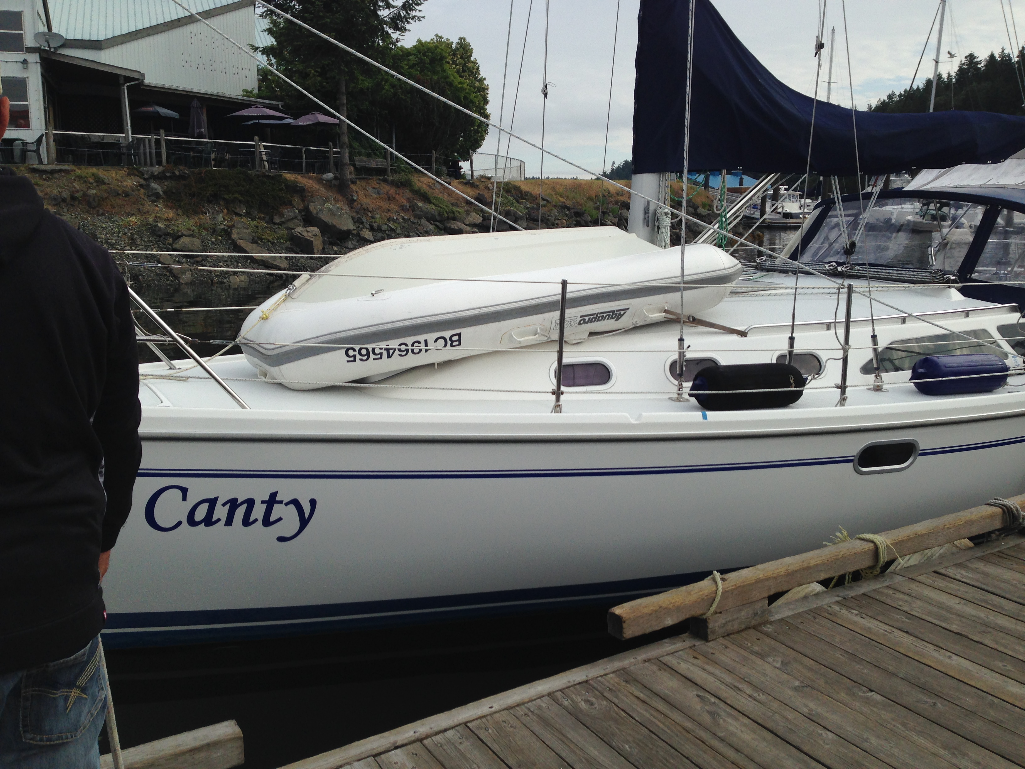
- Spot Canty at the boat lift dock so I go down to chat with Paul and Kristie. They are in for bottom paint.
- As soon as the lift drops Canty, it comes for Never for Ever. We are back in the water. Jared checks engine, tightens injector and Darcy hops aboard to help me move us back to a slip.
- The boat has shifted a bit on the stands so we need to let it settle for a day and then they will check and align the shaft.
- Put the final coat on the teak.
- Anchor is still ashore, waiting for new chain and splice.
- Darryl stops by and we have coffee. Being on the hard is certainly turning out to be social…
- Haul out dinghy on foredeck to clean and prep my drilled hole in hull.
- Alas no chain (it’s G4 and a special order) until Friday
- I’ve got highspeed so I watch Rush on Netflix. Not bad

Making Videos, Animating Graphics
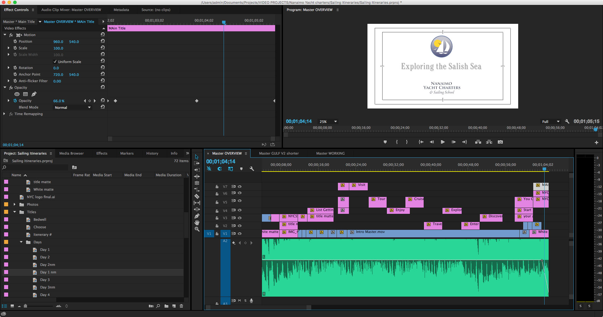
I consider the video below a partial success. I managed to do what I set out to do, but frankly it didn’t end up meeting my minimum standards to call it good. But I have been humming and hawing for days now and finally decided to just post it and move on, because anything else would mean starting from scratch and I think it would be a waste to toss the whole thing. So check out the first of a series of planned sailing itineraries:
Method
The first thing I need was a map. The problem is that maps aren’t free despite what you might think given Google’s presence online. And I wanted something I could manipulate the way I wanted to. So I started with a bunch of base maps that I stitched together and started tracing.
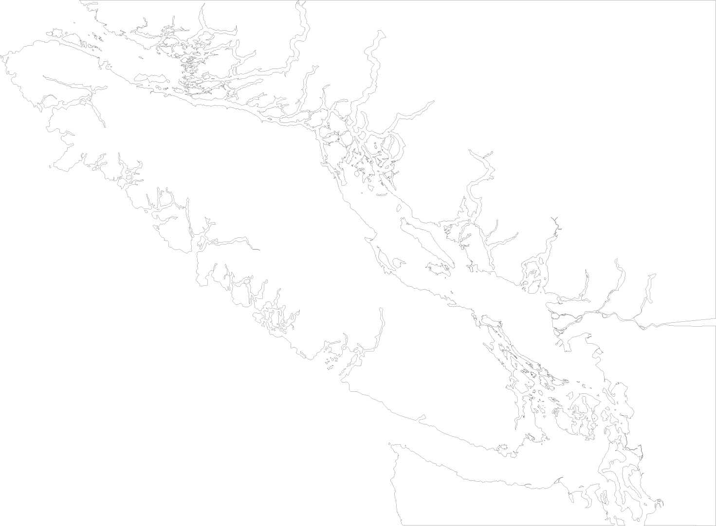 Layer one was the base map that was a not-so-simple outline. Back in my book publishing days, I made a ton of these, oddly enough mostly of BC. But that was when I was still using Freehand before it disappeared and Illustrator became the de facto standard. And I really hate Illustrator. Well, I don’t so much hate it as resent the fact that all those years of learning Freehand now work against me. But such is life in the design community: move on and keep learning. At least the hours spent working on this map have helped get my Illustrator skills a little more polished. would have liked to add even more detail but the file was starting to balloon in size and it wasn’t actually necessary to have that much accuracy — so I started to slack a bit in places like the west coast of the Island.
Then I added in coloured layers, borders, labels and whipped up a quick compass rose. After that was done I started building a series of layers with smaller area maps that I could use later to highlight the cruising grounds.

With that done I saved the file and I fired up a new project in Adobe After Effects, then imported the Illustrator file into it. One of the great things about after Effects is that it imports the files with the layering intact and, even better, maintains a hot link to the original file so if you have to go back and change something it updates automatically (which I did several times). In After Effects I proceeded to divide the project into two main sections: the Salish Sea intro and the first planned itinerary, add some more labels and build in animations. I had an idea of what I wanted to do but no idea of how to do it. YouTube to the rescue. All the graphic animations of the map were done in After Effects including the zooms and the move pathways of the route itself.

Once those were done I exported it as two videos so I could move on to Premiere. After Effects and Premiere do support the a method of hot linking files but some of the effects I used were not supported so I was forced to render the After Effects files. This just meant that any changes that needed to be done would mean re-rendering the files and updating them in Premiere — a matter of something like 15 minutes work for each video, each time I did it. So I tried not to do it. And pretty much failed.
In Premiere imported the two videos, a selection of still images from my archives and my intros/outros. Then I proceeded to build the initial text graphics and started breaking the videos down into a rough cut.
Once the rough cut was done I stared animating the text, fine tuning the timing and playing with the narrative to try and get my point across. Although by this time I was starting to wonder what my point was —which was a huge learning lesson in itself.
Eventually I got it to some place that wasn’t particularly horrible and brought in some music. Originally I wanted to do the project with a scripted voice-over but finally decided that was too much additional work for what it was looking like I was going to be able to produce as a final product. I will likely revisit that decision on the next video (if I go ahead with the project) and be able to better anticipate what I will need to have done in what order to support that sort of narrative. And then I unfortunately got carried away laying the audio track and managed to box myself into a few more corners that would take too much work to back out of.
Lessons Learned
At this point I essentially gave up on trying to improve deficiencies and focussed on completing something. I’d spent a little over a month on this so far and it was increasingly looking like I would have to go back and start from scratch (well, not quite from scratch, as the Illustrator map was perfect) in order to be able to get the result I was looking for. So I decided to get it to good enough and move on. And that’s what you see here.
Preplanning
I learned a few things about planning such an extensive media project. The first thing —which I already knew, or thought I did — is that eh more pre planning you do the less pain and problems you will encounter further down the road. I don’t think I truly appreciated how much I have learned about graphic and print production over the years that has allowed me to work fairly smoothly and problem solve on the fly without excessive documentation. Not so for motion graphics; I have a lot to learn and until I do, working out the kinks before I go into production is going to have to be the rule of the day.
Editing yourself
Again, less is more is a graphic design mantra I have long since internalized but it didn’t manage to make the transition to motion graphics. The amount of time I wasted on fancy-dancy effects that ultimately got left on the digital cutting room floor accounted for a huge percentage of the effort I have put into this. With every iteration I found myself cutting and editing things to try and simply the narrative. And frankly I still think I could have done a lot more.
Shortcuts, shortcuts, shortcuts
Know your tools. I have a personal rule that states if you do a set of actions more than three times in one session then take the time to learn shortcuts. Whether it is keyboard shortcuts, macros or simply a more efficient way of achieving your goal it almost always pays dividends when you take some time to explore your toolkit.
And organization helps a lot. I started out with a free for all of files and eventually found myself making more and more bins and folders to organize image, title bars, video clips and sequences. Next time I will start out with a whole lot of empty folders and keep it tidy as I go.
Teams
One of the reasons graphic designers can work alone and filmmakers generally don’t is that it take a huge set of disparate skills and talents to bring together motion graphics. Simply melding the audio and visual components is a massive sideways shift in perspective and I have a renewed respect for those who are auditorially skilled — I’m certainly not. As an audience we experience video differently than we do a static page and there is a whole language I am learning to describe how viewers interact with the screen. A lot of it comes from how we read and view the printed page, but a lot it does not. I am going to have to learn more than a few software programs if if I want to get better at this.
In conclusion
Anyway, I have called this project a wrap and will move on to the next and hopefully do a better job. Because every time I look at this particular video I still want to go in and change something — and I think it’s time to stop looking.
If you have any interest in seeing more sailing related video, my youtube channel can be found here:
Not So Offshore: the Vancouver to LA Summary
(originally posted on neverforever.ca)
In my last post I mentioned I was heading down the coast in a friend’s Baltic 42. The goal was to take it from Vancouver to San Diego so they could join the Baja Haha at the end of October. We allotted approximately 3 weeks for the journey and I imagined that it would primarily be an offshore trip with two or three legs.
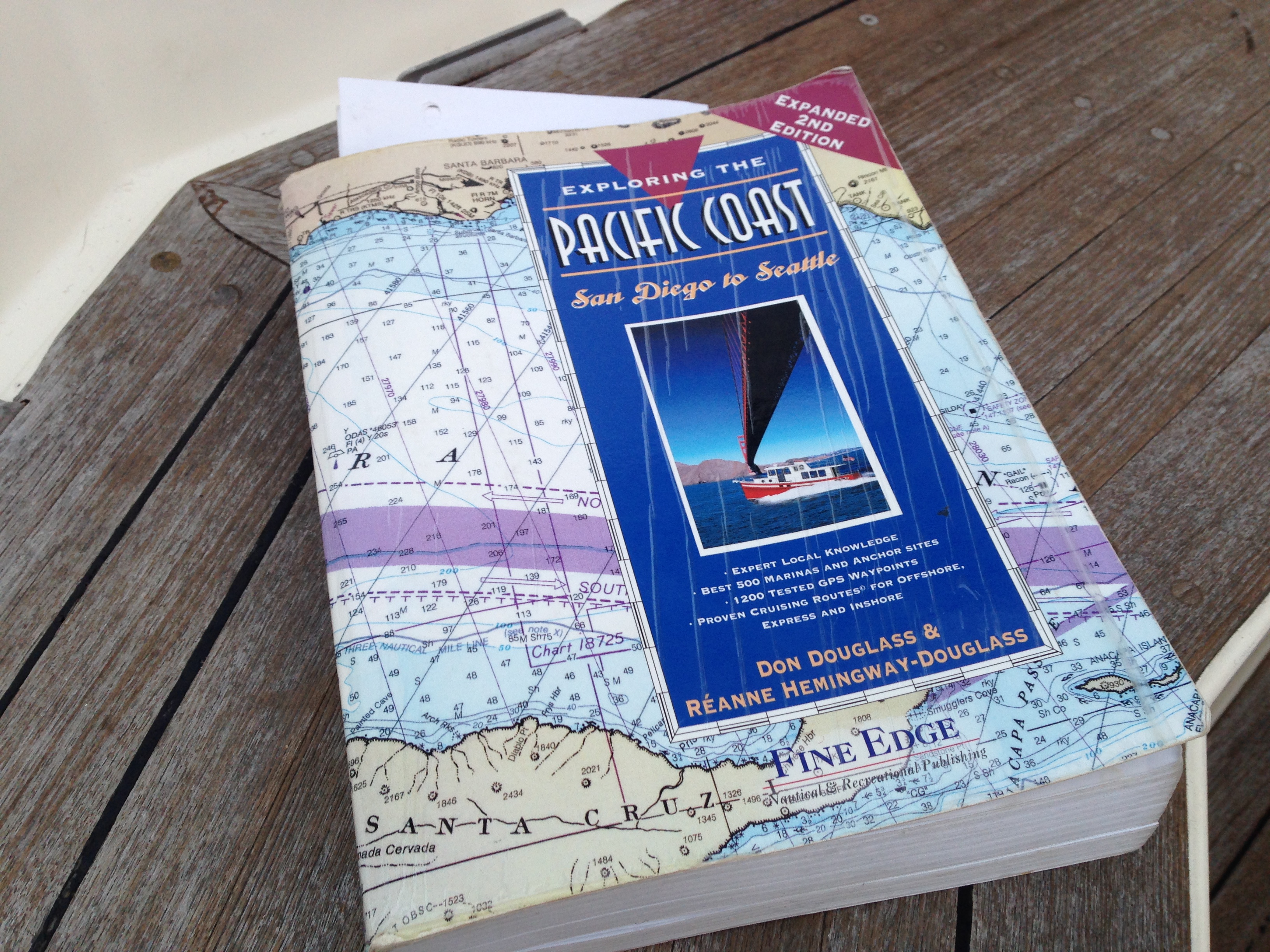 Well it turned out that they —and their buddy boat Sea Esta X — decided to loosely follow the “Express Route” as set out in Exploring the Pacific Coast: San Diego to Seattle by Don Douglass and Réanne Hemingway-Douglass. This meant the voyage would mostly be day trips—albeit some fairly long ones— with only a few overnighters.
We got some good downwind sailing and a remarkable amount of motoring. That is, in my lowly opinion, the big downside to harbour-hopping down the coast. The nature of the bars at most of the ports is such that entering and exiting them is often tide and weather dependent: so trying to hit a schedule becomes a bit more important and it’s hard to justify much sailing in light winds.
When we hit Marina del Rey in Los Angeles, it really was time to start taking it easy, so rather than rush the last couple of days to San Diego, I decided to take advantage of the proximity to LAX and fly home from there. Northwest Passage continued on without me and, as of today, I think they still haven’t completed the “two day” trip to San Diego. Good on ’em.
 Bars
Bars

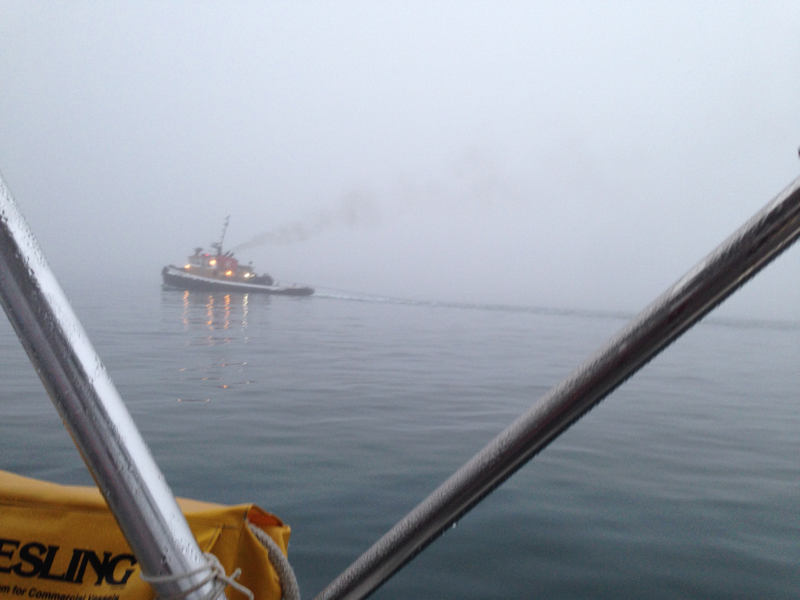
Most of the ports on the pacific side of North America are in the mouths of rivers. This generally means you are negotiating breakwaters, dredged channels and bars. Bars are really what can make entering and exiting these ports uncomfortable or even impossible. Bars are formed by the sediments deposited by the rivers outflow and when the incoming swell hits this suddenly shallow area, steep and dangerous waves can occur. Quite often these bars will be closed to small boat traffic and occasionally they will be closed altogether. That means if you arrive at a bar at the wrong time you can’t come in to the harbour and will have to head offshore again to either wait, or move on to the next port in hopes their bar will remain open. The coast guard is constantly going out in these super tough little aluminum boats (47-foot MLBs) to physically check on the conditions and then report them on channel 16.
We were pretty lucky and got into all our ports without incident, although sometimes in the middle of the night, the middle of dense fog, or in one memorable entry, both. There were numerable small boat closures though.
Details?
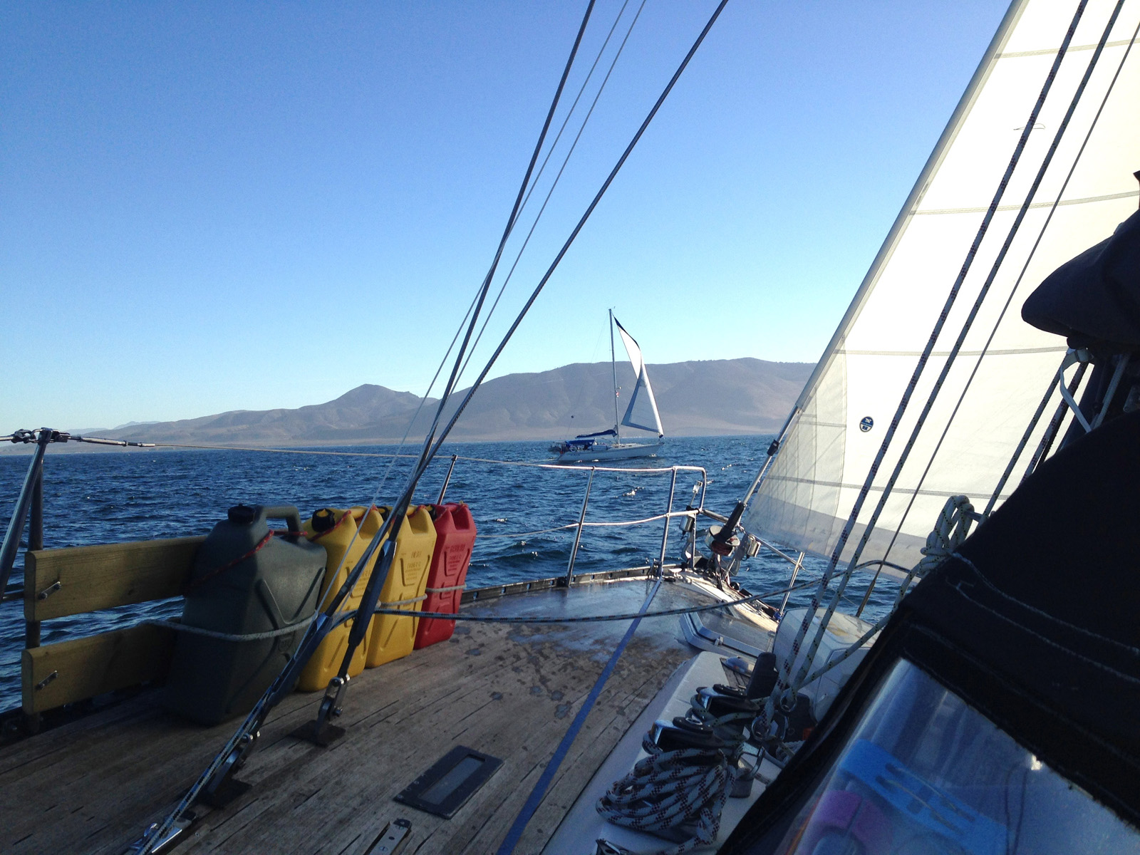
I blogged about the whole trip in near real time and you can read about it over on macblaze.ca although it intended was more for family and friends and rife with errors and typos. I learned a lot about downwind sailing, saw hundreds of whales, dolphins and sea lions and thoroughly enjoyed myself, with the most memorable moment being alone on deck going around Cape Mendocino at 3 am in 30 knot winds. I’ve also posted a bunch of images at the end of this post.

 The Stats

- Trip length: 29 days
- Travel days: 20 days
- Legs: 16
- Travel hours: 232:25
- Total km: 2392.4
- Total nm: 1291.9
- Hours motoring: 200 hrs
- Fuel used 520 L
- Overnight sails: 3
- Longest leg: 54 hrs
- Ports (marinas): 12
- Anchorages: 4
- Mooring Balls: 1
The Trip
| Day | Kilometers | Nautical Miles | Hours | |
| 1 | Granville Island, Vancouver to Shallow Bay, Sucia Island (via Point Roberts) | 84.4 | 45.576 | 5:00 |
| 2 | Sucia Island to Anacortes, Washington (via Vendovi Island) | 45.7 | 24.678 | 5:20 |
| 3 | Anacortes to Neah Bay | 165 | 89.1 | 15:40 |
| 4 | Neah Bay to La Push (around Cape Flattery) | 76.1 | 41.094 | 7:25 |
| 5 | La Push to Westport Marina, Gray’s Harbor | 130 | 70.2 | 12:25 |
| 6 | Gray’s Harbor to Newport, Oregon (overnight) | 271 | 146.34 | 25.75 |
| 7 | 0 | 0 | 0:00 | |
| 8 | 0 | 0 | 0:00 | |
| 9 | 0 | 0 | 0:00 | |
| 10 | Newport to Charleston Marina, Coos Bay | 151 | 81.54 | 13:45 |
| 11 | 0 | 0 | 0:00 | |
| 12 | 0 | 0 | 0:00 | |
| 13 | Coos Bay to Noyo River Basin Marina, Fort Bragg, California (around Cape Mendocino; via Crescent City) | 498 | 268.92 | 54.00 |
| 14 | 0 | 0 | 0:00 | |
| 15 | 0 | 0 | 0:00 | |
| 16 | Fort Bragg to Bodego Bay | 166 | 89.64 | 16:25 |
| 17 | Bogego Bay to Pillar Point Harbour, Half Moon Bay | 120 | 64.8 | 11:45 |
| 18 | Pillar Point Harbor to Moss Landing | 114 | 61.56 | 10:50 |
| 19 | 0 | 0:00 | ||
| 20 | Moss Landing to Morro Bay | 212 | 114.48 | 20:50 |
| 21 | 0 | 0:00 | ||
| 22 | 0 | 0:00 | ||
| 23 | 0 | 0:00 | ||
| 24 | Morro Bay to Cojo Bay (around Point Conception) | 141 | 76.14 | 11:45 |
| 25 | Cojo Bay to Santa Barbara | 71.6 | 38.664 | 7:10 |
| 26 | Santa Barbara to Ventura | 43.6 | 23.544 | 4:00 |
| 27 | Ventura to Pacific Mariners Yacht Club, Marina del Rey | 103 | 55.62 | 10:20 |
| 28 | 0 | 0:00 | ||
| 29 | 0 | 0:00 |
Google My Maps version
Google My Maps seems to need a Google account to access it, although I can’t prove that. But zoom in if you can and check out some of the harbour entrances and remember most of them were done in the fog or the dark or both.
Some Images


Humpbacks and grey whales abounded.

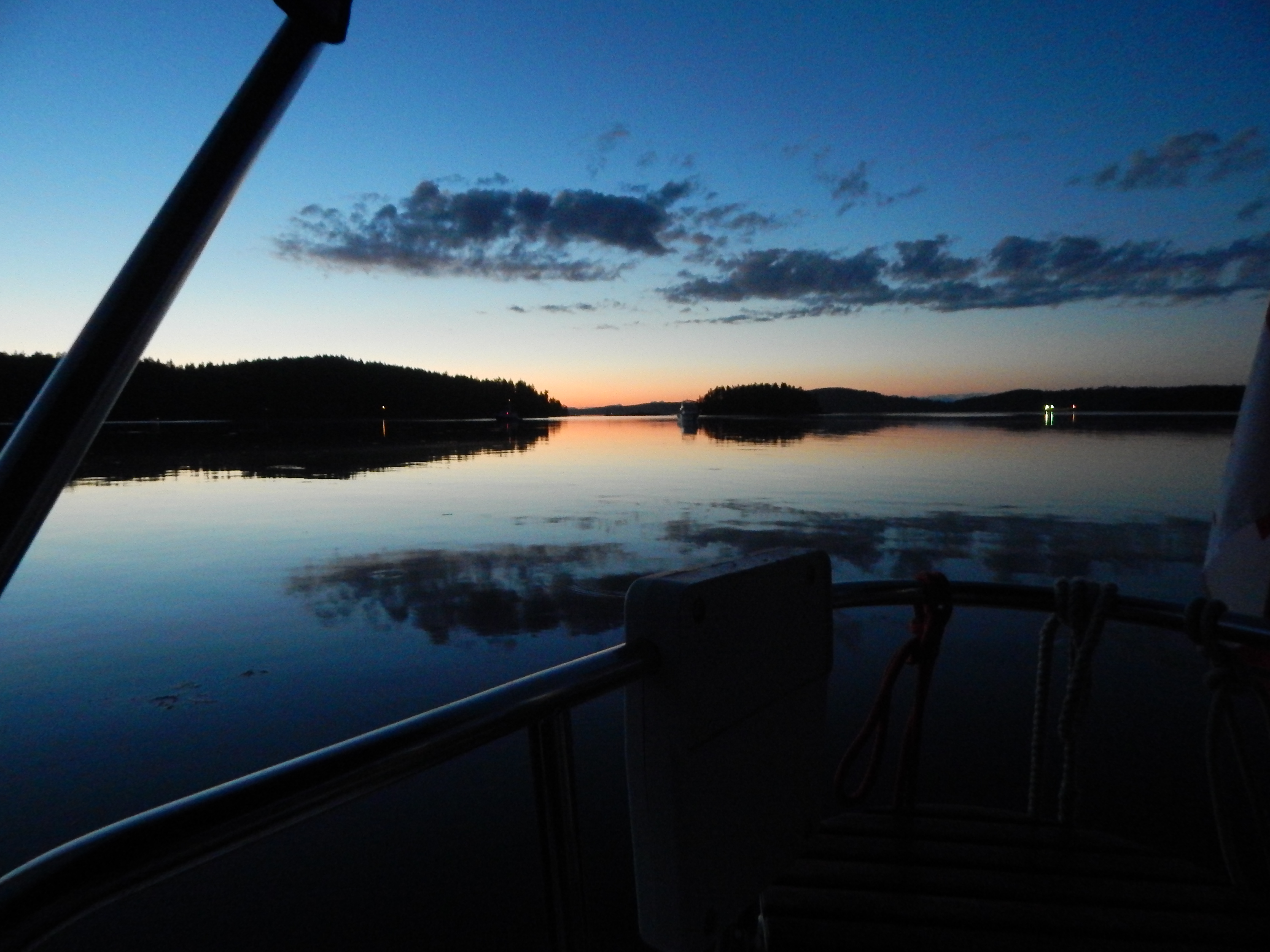
The first part of the trip was often cold and foggy.

Newport Oregon emerges from the fog

Entering Coos Bay in the fog

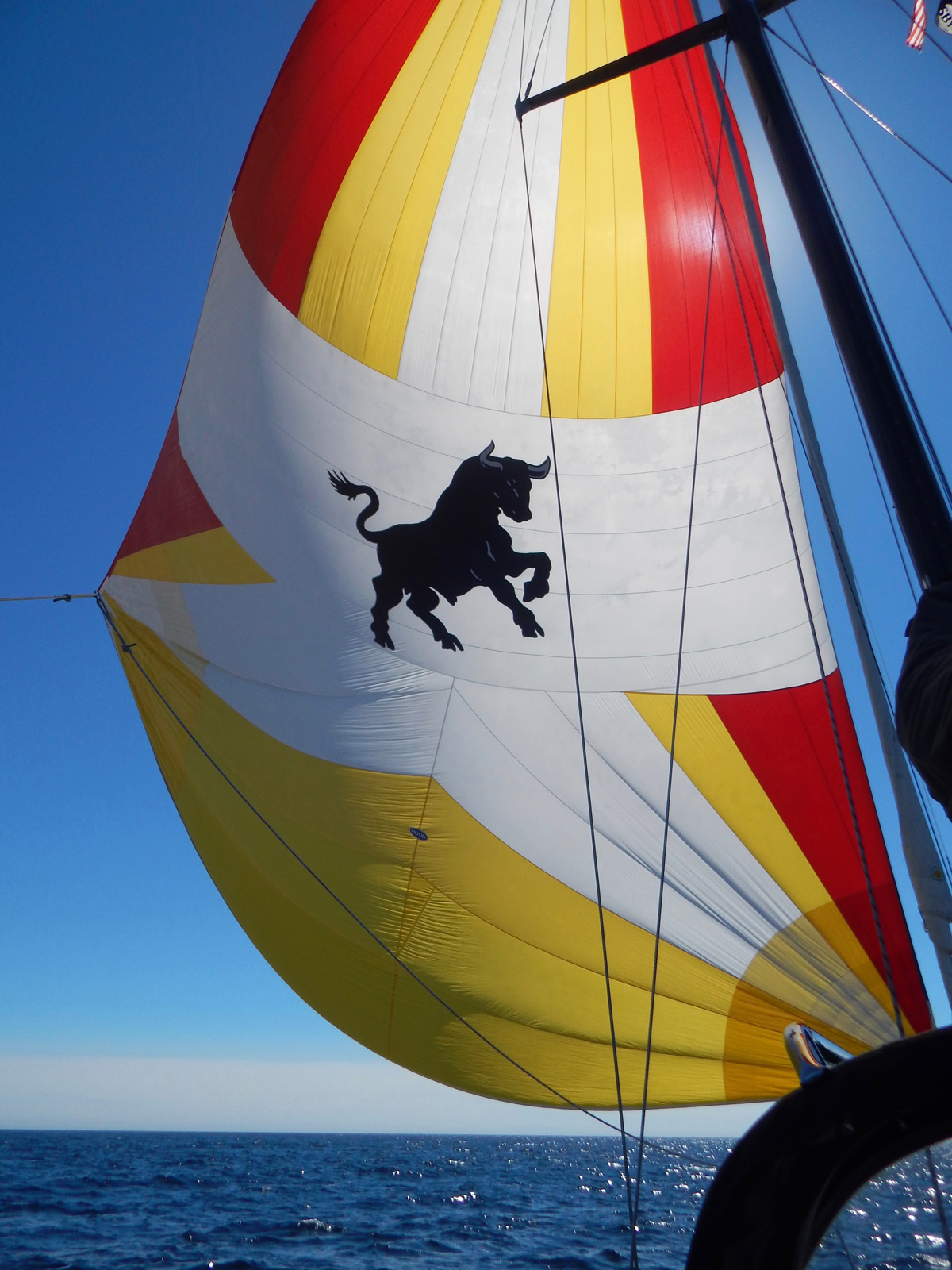
The old spinnaker cut down to a gennaker. It made for some great (and easy) downwind sailing.


Morro rock in Morro Bay.
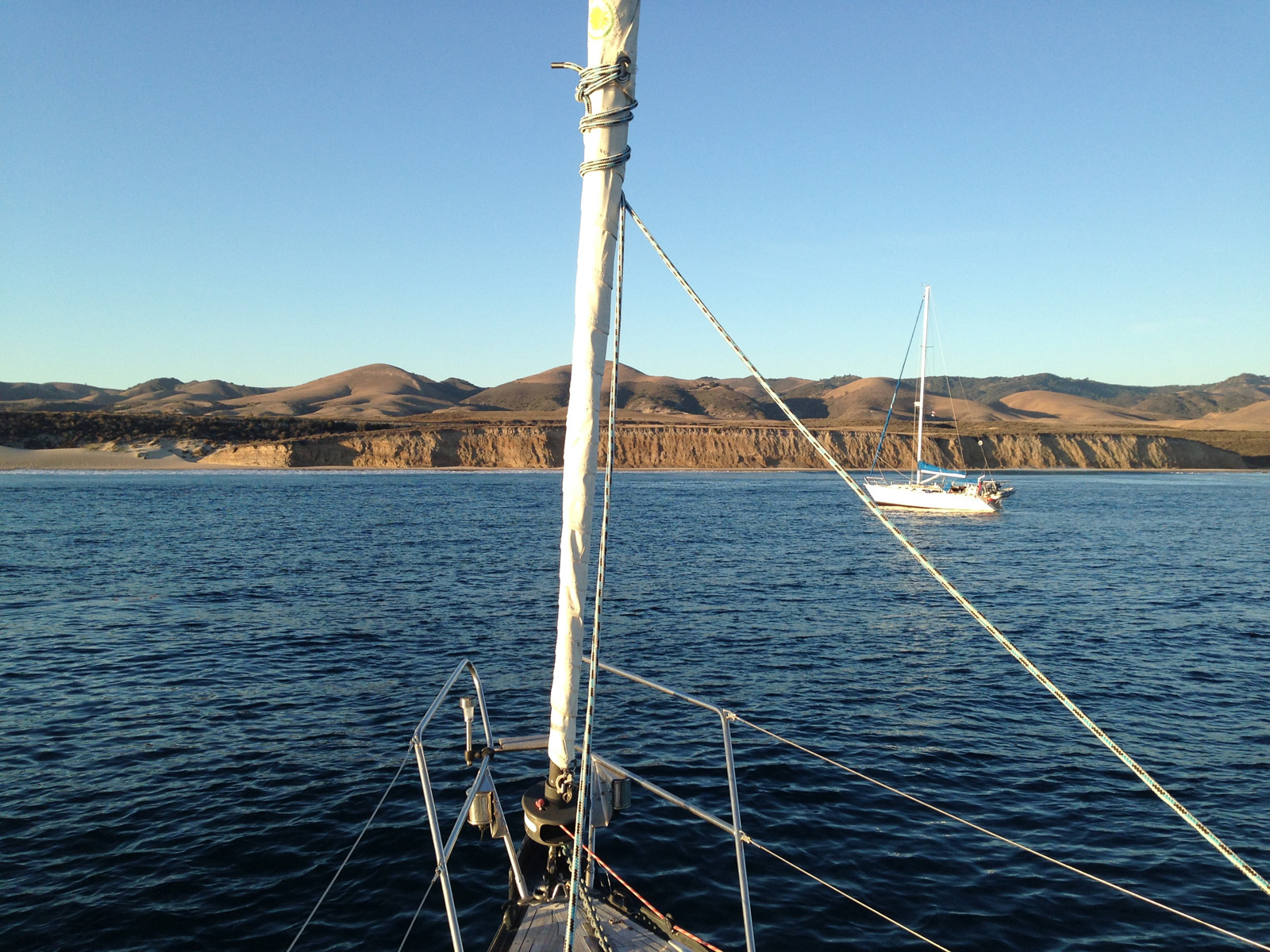
Cojo Bay anchorage

And then suddenly, immediately after rounding Point Conception, it was warm

At anchor in Santa Barbara

Our last sail of the trip

Santa Monica Pier from the ocean side


Malibu from the air
—Captain Why #Posts