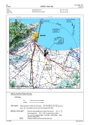
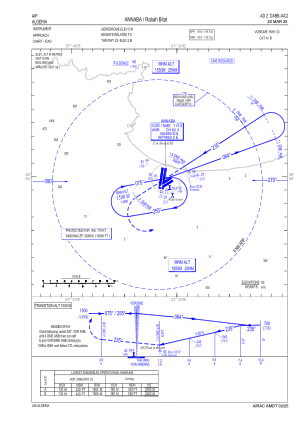
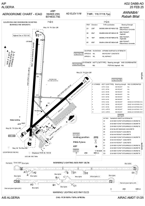


DABB - Annaba / Rabah Bitat
Located in Annaba, Algeria
ICAO - DABB, IATA - AAE
Data provided by AirmateGeneral information
Coordinates: N36°49'20" E7°48'34"
Elevation is 16 feet MSL.
View others Airports in El Tarf Province
Operational data
Special qualification required
Current time UTC:
Current local time:
Weather
METAR: DABB 281300Z 01015KT 9999 FEW023 23/12 Q1011
TAF: TAF DABB 281100Z 2812/2912 02014KT 9999 FEW023 TEMPO 2812/2816 02015G25KT BECMG 2818/2821 VRB02KT
Communications frequencies: [VIEW]
Runways:
| RWY identifier | QFU | Length (ft) | Width (ft) | Surface | LDA (ft) |
| 05 | 52° | 7513 | 148 | ASP | |
| 23 | 232° | 7513 | 148 | ASP | |
| 18 | 186° | 9843 | 148 | UNK | |
| 36 | 6° | 9843 | 148 | UNK |
Airport contact information
Address: Annaba Algeria