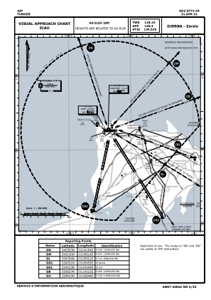
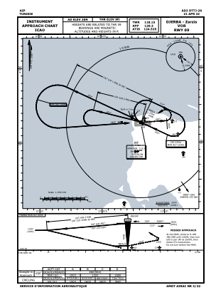
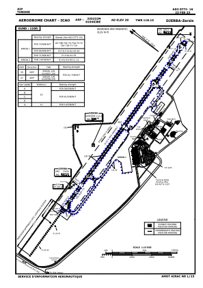


DTTJ - Djerba/Zarzis
Located in Djerba, Tunisia
ICAO - DTTJ, IATA - DJE
Data provided by AirmateGeneral information
Coordinates: N33°52'32" E10°46'38"
Elevation is 20 feet MSL.
Magnetic variation is 3° East View others Airports in Medenine Governorate
Operational data
Special qualification required
Current time UTC:
Current local time:
Weather
METAR: DTTJ 060900Z 13007KT 110V170 CAVOK 26/14 Q1015
TAF: TAF DTTJ 060500Z 0606/0706 10005KT CAVOK BECMG 0618/0620 13015KT
Communications frequencies: [VIEW]
Runways:
| RWY identifier | QFU | Length (ft) | Width (ft) | Surface | LDA (ft) |
| 09 | 88° | 10210 | 148 | ASP | |
| 27 | 268° | 10210 | 148 | ASP |
Airport contact information
Address: Djerba Tunisia