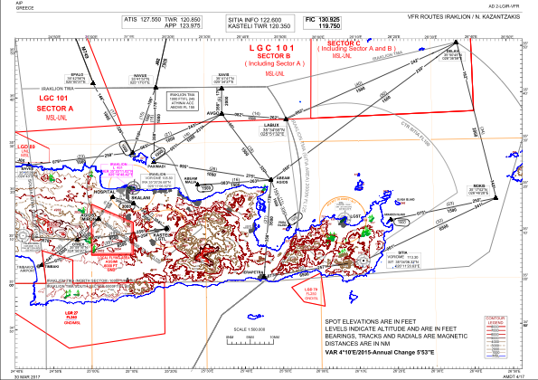
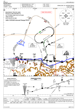
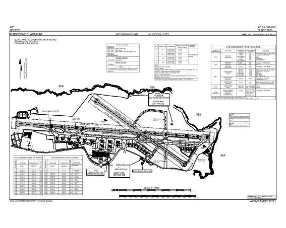


LGIR - Iraklion/ Nikos Kazantzakis
Located in , Greece
ICAO - LGIR, IATA - HER
Data provided by AirmateGeneral information
Coordinates: N35°20'23" E25°10'49"
Elevation is 115 feet MSL.
View others Airports in Irakleion
Operational data
Special qualification required
Current time UTC:
Current local time:
Weather
METAR: LGIR 021620Z VRB03KT 9999 FEW020 20/15 Q1011 NOSIG
TAF: TAF LGIR 021100Z 0212/0312 33010KT 9999 FEW020 BECMG 0217/0219 18010KT BECMG 0301/0303 27012KT BECMG 0307/0309 30016G26KT
Communications frequencies: [VIEW]
Runways:
| RWY identifier | QFU | Length (ft) | Width (ft) | Surface | LDA (ft) |
| 09 | 95° | 8904 | 148 | ASP | |
| 27 | 275° | 8904 | 148 | ASP | |
| 12 | 126° | 5138 | 164 | ASP | |
| 30 | 306° | 5138 | 164 | ASP |
Airport contact information
Address: Greece

