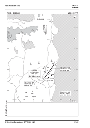
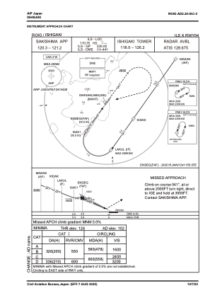
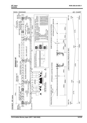


ROIG - New Ishigaki
Located in Ishigaki, Japan
ICAO - ROIG, IATA - ISG
Data provided by AirmateGeneral information
Coordinates: N24°23'47" E124°14'42"
Elevation is 102 feet MSL.
View others Airports in Okinawa Prefecture
Operational data
Special qualification required
Current time UTC:
Current local time:
Weather
METAR: ROIG 022100Z AUTO 01007KT 9999 FEW038 BKN060 23/22 Q1013
TAF: TAF ROIG 021710Z 0218/0400 04010KT 9999 FEW010 BKN020
Communications frequencies: [VIEW]
Runways:
| RWY identifier | QFU | Length (ft) | Width (ft) | Surface | LDA (ft) |
| 04 | 36° | 6562 | 148 | ASP | |
| 22 | 216° | 6562 | 148 | ASP |
Airport contact information
Address: Ishigaki Japan