METAR-TAF
Airports :
Bassel Al-Assad International Airport
Latakia, Syria
latitude: 35-32N, longitude: 035-46E, elevation: 7 m
Current weather observation
The report was made 54 minutes ago, at 18:00 UTC
Wind 10 kt from the South with gusts up to 20 kt
Temperature 21°C
Humidity 78%
Pressure 1008 hPa
Visibility: 8000 m
Few clouds at a height of 2600 ft
Scattered clouds at a height of 3000 ft
Scattered clouds at a height of 3000 ft
METAR: OSLK 021800Z 19010G20KT 8000 FEW026 TCU SCT030 21/17 Q1008
Time: 21:54 (18:54 UTC)
Forecast
Forecast valid from 02 at 18 UTC to 03 at 18 UTC
Wind 12 kt from the Southwest with gusts up to 25 kt
Visibility: 5000 m
Scattered clouds at a height of 3000 ft
Broken clouds at a height of 10000 ft
Broken clouds at a height of 10000 ft
haze
Becoming
from 02 at 21 UTC to 02 at 23 UTC
from 02 at 21 UTC to 02 at 23 UTC
Wind 15 kt from the South with gusts up to 30 kt
Visibility: 6000 m
Few clouds at a height of 2500 ft
Broken clouds at a height of 3000 ft
Overcast at a height of 10000 ft
Broken clouds at a height of 3000 ft
Overcast at a height of 10000 ft
rain showers
Becoming
from 03 at 10 UTC to 03 at 12 UTC
from 03 at 10 UTC to 03 at 12 UTC
Wind 12 kt from the West/Southwest
Visibility 10 km or more
Scattered clouds at a height of 3000 ft
TAF: OSLK 0218/0318 22012G25KT 5000 HZ SCT030 BKN100 BECMG 0221/0223 18015G30KT 6000 SHRA FEW025 CB BKN030 OVC100 BECMG 0310/0312 24012KT 9999 SCT030
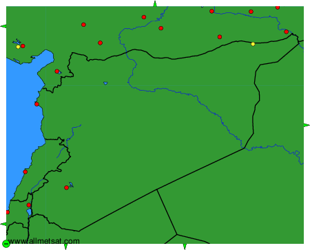
Weather observations and forecasts of more than 4000 airports (METAR and TAF reports).
The available stations are represented by yellow and red dots on the map.
Hover mouse over dot to see the name of the station.
Then click to see weather observations and forecasts.
To change the map : click on the green buttons with a black cross to zoom in, on the green button with a dash to zoom out, or on the green arrows for adjacent maps.