CNN8 Gananoque, Ontario, Canada scenery modification for Microsoft Flight Simulator 2020.
VERSION 0.5 - May 2022
FREE AND EXCLUSIVE TO FLIGHTSIM.TO (If you find this file elsewhere, let me know).
Installation:
arh-cnn8-gananoque-apt = contains the CNN8 airport and all the surrounding scenery including the landmark locations indicating the placement of horses.
Place the folder in your community folder. I hope you enjoy the updated area!
You may wish to filter out POIs on your World Map > Open Filters > Points of Interest (turn them off), and for a full sense of immersion, turn POIs off with your Assistance > Navigation Aids settings.
Scenery:
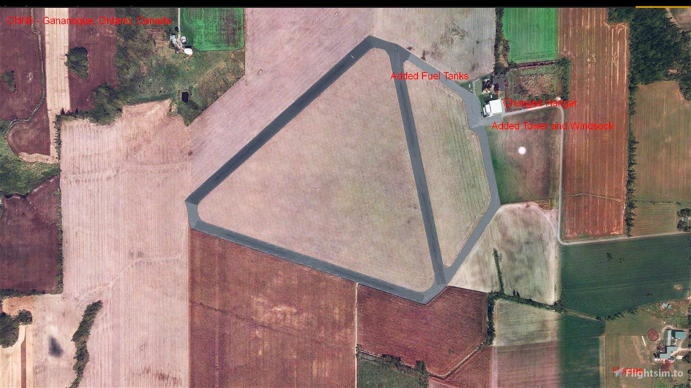
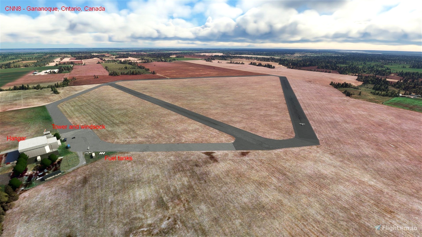
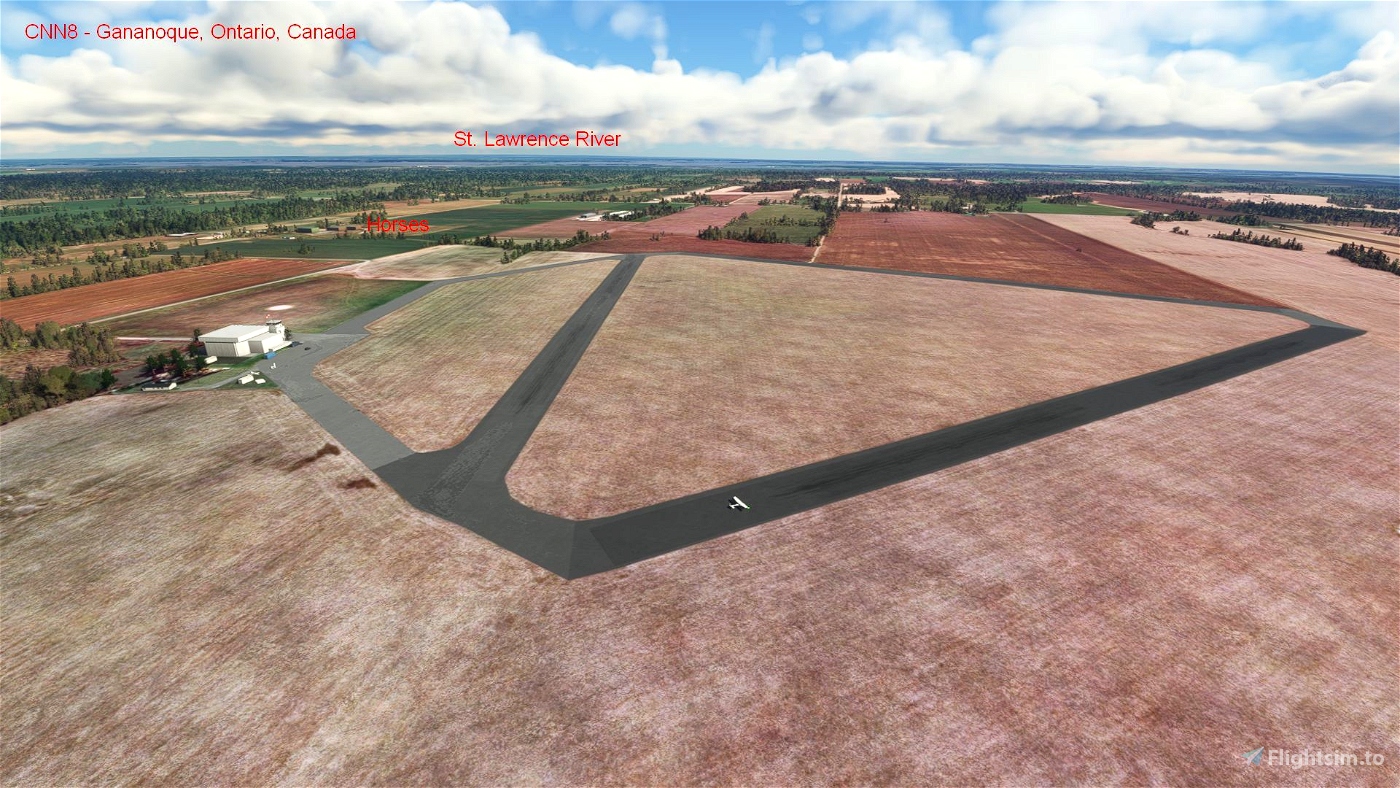
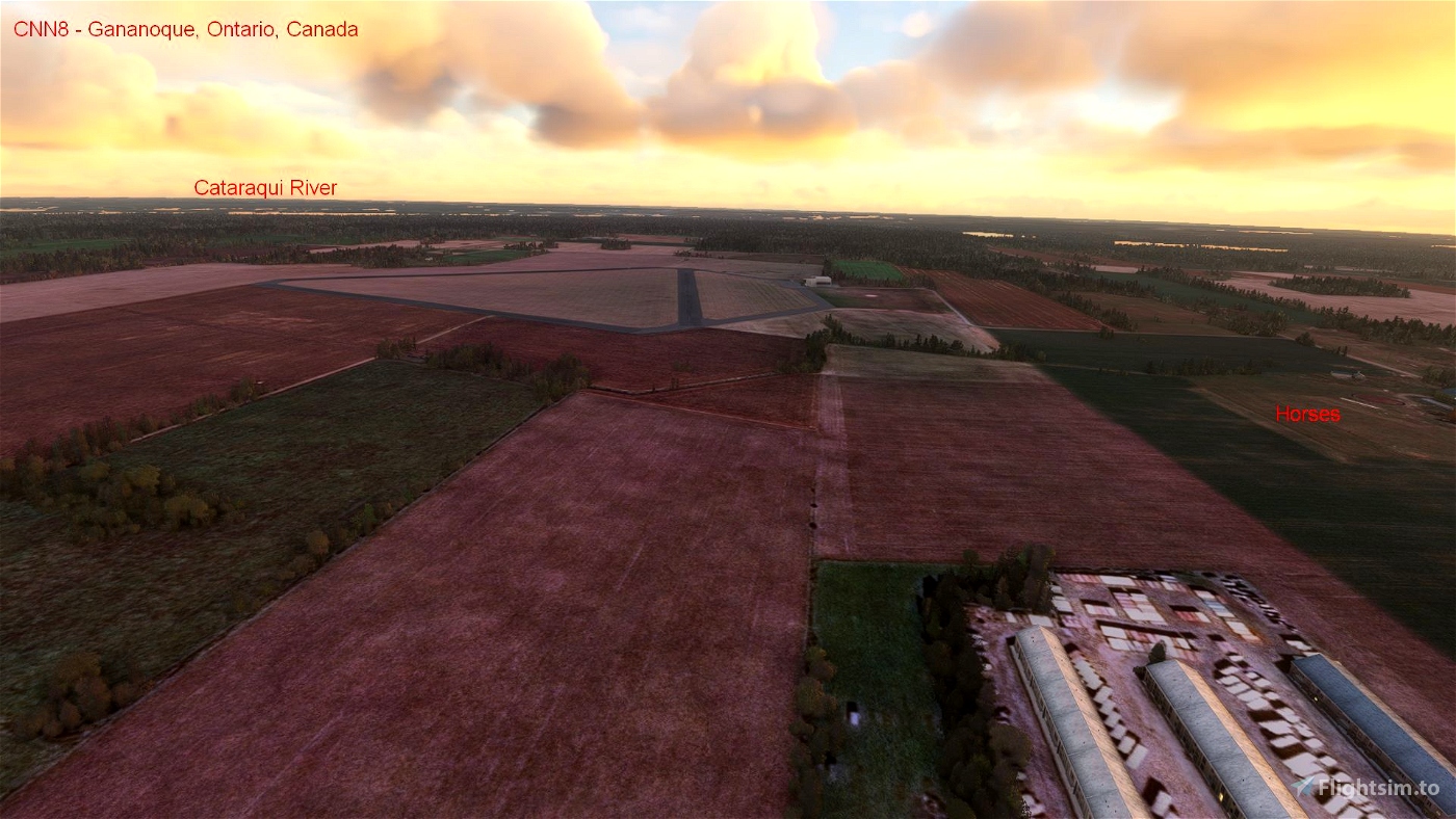
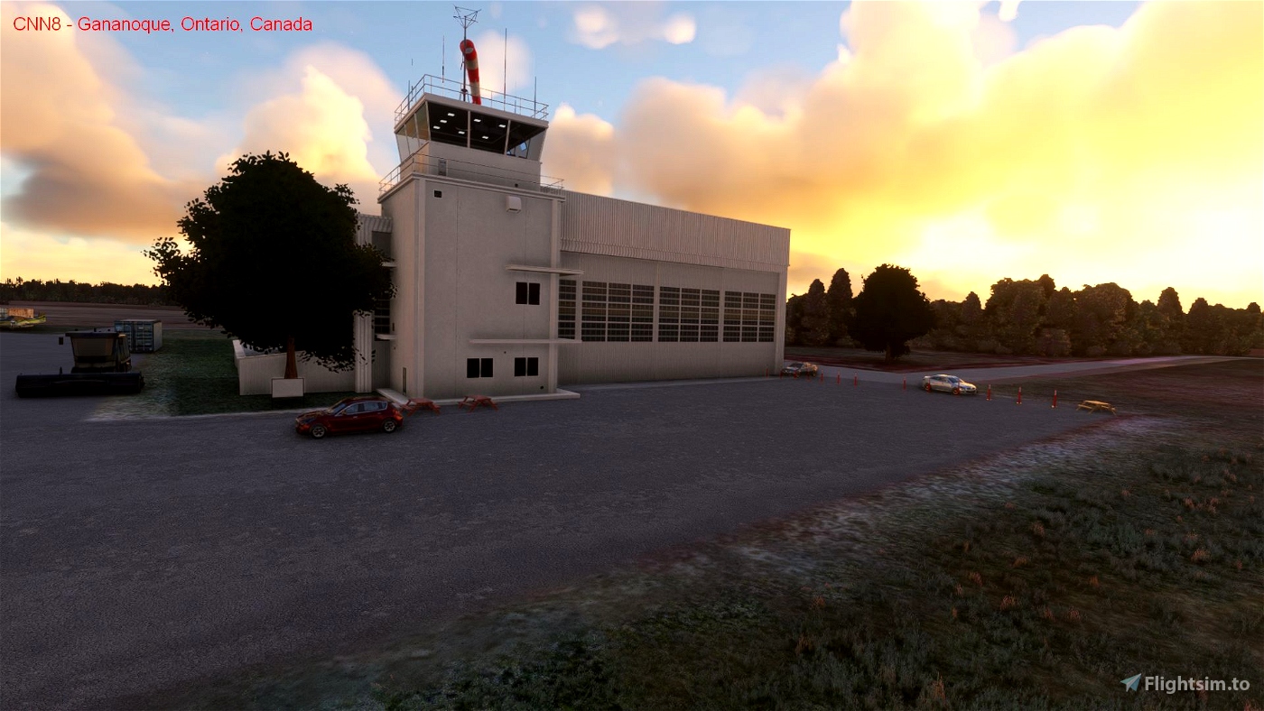
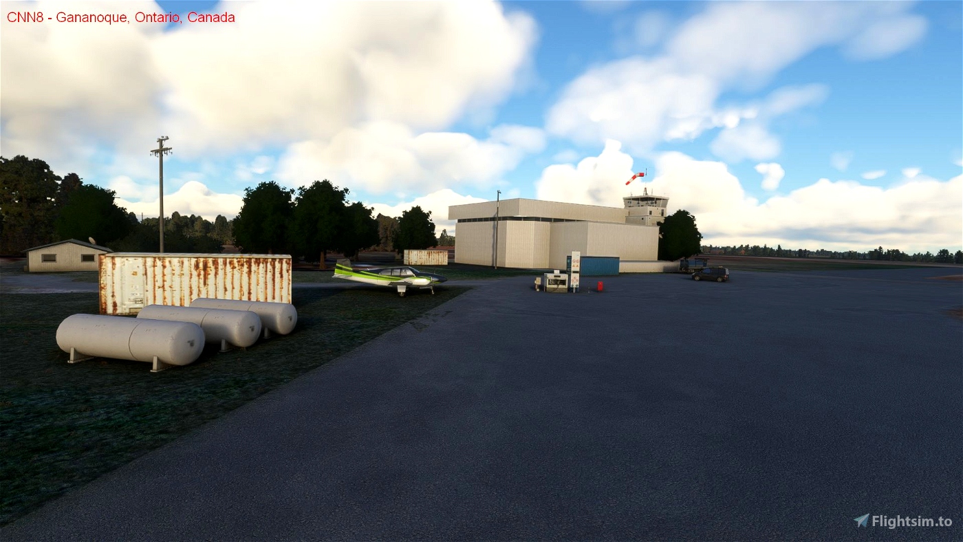
In the default scenery, Gananoque (CNN8) airport exists but there are incorrect windsocks, hangar faces the wrong direction and there is a sparcity of scenery elements. This scenery modification removes the windsocks and hangar and replaces the hangar, adds a tower (with no beacon as the airport is closed at night and has no lighting) and adds the windsock to the roof of the tower. Also, the surrounding area has details added. This scenery was created using information from the Canadian Flight Supplement and Canada Air Pilot (expired editions) and an examination of various internet mapping sites. At this time, this scenery uses only default SDK elements and each has been placed at appropriate locations by examining the various internet mapping sites.
Location details of the airport:
* ICAO: CNN8
* IATA: none
* Airport location: 44-24-07 N, 76-14-39 W (44.401944, -76.244167)
CNN8 Gananoque Airport scenery includes items placed at accurate locations, including:
* replaced hangar
* control tower without beacon (airport closed at night and in winter)
* windsock on roof of tower
* replaced apron near hangar
* removed 3 incorrect windsocks.
* added airport fuel tanks, signage, picnic tables, cones, cars etc...
* static aircraft.
Scenery placed at actual locations include:
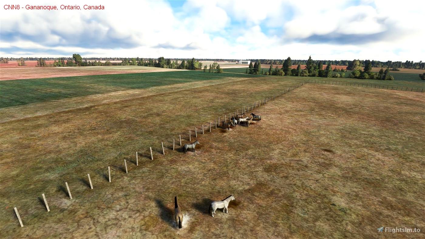
* street lighting, telephone poles and road signs.
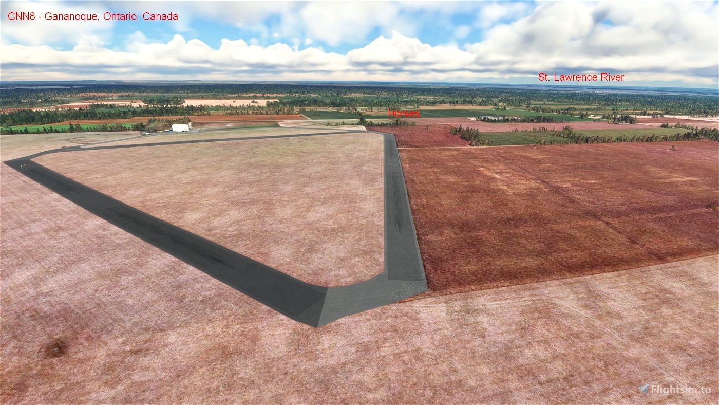
* horses.
* point of interests (POI) for fauna (horses in 4 locations).
Improvements to come:
* At CNN8 Gananoque Airport:
- possible replacement of runways with aged textures and grass going through asphalt.
- Better hangar representation (more delapitated).
- more fencing.
- added grass and crops within airport perimeter.
* Better building representations.
* Adjusting night lighting patterns.
- Adjust height of lighting structures.
- Add more street lighting.
* Addition of boats and vehicles to the surrounding area.
* Addition of marine navigation aids, including lighted buoys and lighthouses on the St. Lawrence River.
* Add more electrical lines.
* Addition of more Points of Interest (POIs) identifying nearby features.
CNN8 Gananoque Airport is located approximately:
* 10.2 km northwest of Gananoque town centre.
* 21 km west of the Thousand Island's International Bridge at Ivy Lea, Ontario, Canada.
* 35 km northeast of CYGK Kingston Airport, Ontario, Canada.
* 47 km southwest of CNL3 Brockville Airport, Ontario, Canada.
* 49 km north of KART Watertown Airport, New York, USA.
* 111 km southwest of CYOW Ottawa International Airport, Ontario, Canada
* 228 km southwest of CYUL Montreal-Pierre Elliot Trudeau International Airport (Dorval), Quebec, Canada
* 282 km east of CYYZ Toronto Lester B Pearson International Airport, Ontario, Canada
History:
CNN8 Gananoque Airport opened around 1940 as Royal Canadian Air Force (RCAF) Detachment Gananoque, and in 1942 became a relief airfield for the Royal Air Force Service Flying Training School in Kingston thus becoming part of the British Commonwealth Air Training Plan (BCATP). It has the distinctive triangular runway pattern, hangar and control tower associated with the BCATP. The station closed in 1945. Currently the runways are not well maintained and have vegetation infiltrating the asphalt. Since 1971 the airport is the hub of sky diving activity during the warmer months. Gananoque itself has about 5,380 full time residents in 2021 but grows each summer with the tourist influx. The name is a First Nation name for town on two rivers, in this case the Gananoque and St. Lawrence Rivers.
ARH64CDN - contact on flightsim.to or www.flightsimulator.com
May 2022

 ARH64CDN

