2nd Annual Mudspike Christmas Flight AAR Thread

So I have two legs to post that I flew over the last 48 hours. The first one up was from Cruzeiro do Sul (SBCZ) into the fantastic airport of La Paz, El Alto (SLLP). La Paz is at an insane altitude of 13,123’ - near the service ceiling of some light piston aircraft. In fact, if I touched down in our King Air at La Paz without disarming the passenger O2 system, the O2 masks would drop automatically as the cabin dump valve opened on the squat switch (the masks drop above 12,500’)…!

Taxiing out for departure. That is an odd light pole placement for sure…

This is my last flight with SkyMaxx Pro v3…so even though these clouds look pretty good, they will be even better on the next leg…!

In the turning bay, preparing for takeoff…

Off we go…

This leg has large expanses that are not covered by traditional VOR navigation legs (Jet or Victor-type airways) - so I’m forced (for the first time on this entire trip) to use the GPS to navigate on one of the RNAV routes…

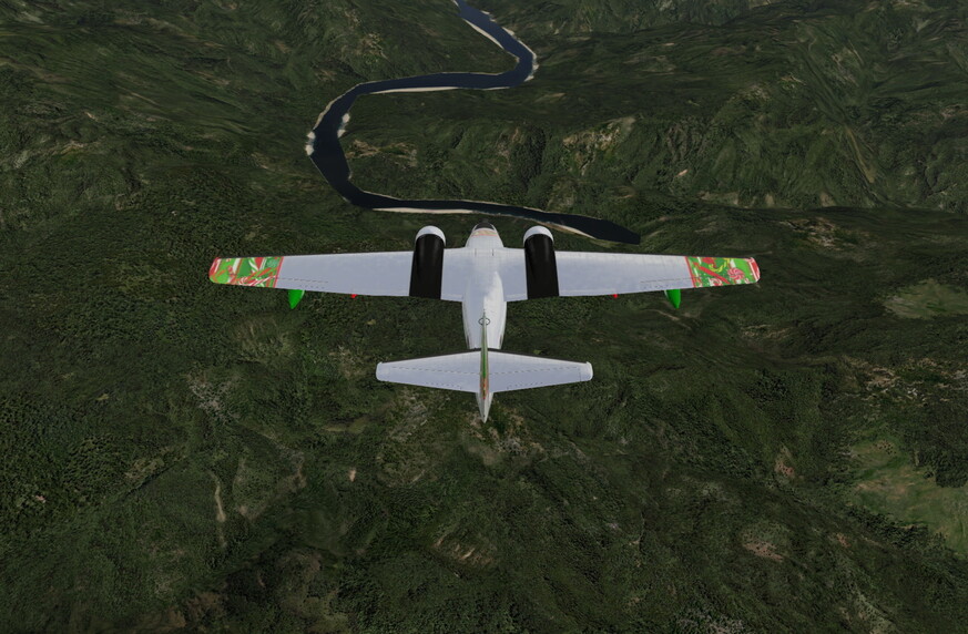
Soon we are once again approaching the high mountains of the Andes - this time, to extreme heights!


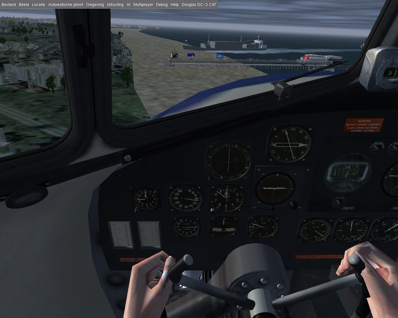
Flying over the foothills of the Andes…

When low clouds start to fill the valleys and shroud the flanks of the higher mountains - you start to worry about whether you will be able to get in to your destination airport (and thus, start planning for contingencies!)…


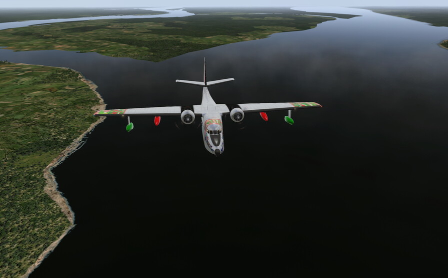
We cross the expanse of Lake Titicaca…


We’ve descended to FL180 - the approved altitude for the arrival into La Paz on UA304 off of Juliaca. The segment takes us directly onto the La Paz 12 DME arc, which feeds to the ILS 10…

Flying the arc and getting ready to intercept the ILS…


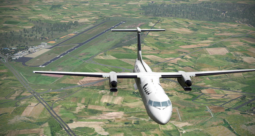
Established on the ILS - I see the massive 13,123’ long runway ahead…

Flight conditions are not ideal - with showers and low clouds lingering around the airport, but I want to see how the Q400 responds to more austere runways (in anticipation of Antarctica) so I elect to make a sidestep to the shorter 6,725’ grass/dirt parallel(ish) runway…

Conditions are not good though…and I briefly am waffling between continuing the visual approach and going for the miss when I spot the end of the turf runway just poking out of the clouds…


Touchdown on the turf runway…

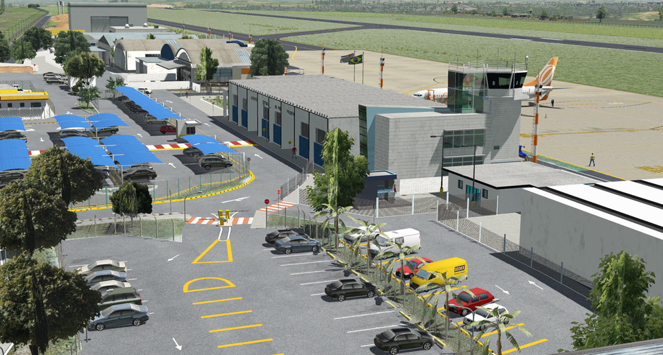
…and a rollout to the end and the terminal area…

Apparently the Q400 is no Antanov though…as I suffer a flat nosewheel tire after the turf runway landing…


The arrival, short arc segment, and ILS track…

A fine representation of La Paz by goda…

Now to get that tire changed…!

3 Likes

Our next leg will traverse Bolivia and much of south central Brazil as we make our way by invitation from La Paz to Presidente Prudente, SBDN…

Taxiing past the ornate air traffic control tower in La Paz…

Due to extreme altitude, aircraft take a long time to get airborne from La Paz, necessitating the 13,000+ long runway. Here my Q400 takes nearly 6,500’ to lift off…!

This leg is my first flown with the newly released SkyMaxx Pro v4 weather package…

The initial results are impressive…the clouds look fantastic!

The La Paz area is definitely primed for lots of “what is that mountain goat doing up here?” opportunities…

As we head further east - the jagged peaks give way to foothills, then eventually farmland which borders on vast expanses of rainforest…I wonder if the mesh accurately represents deforestation type changes…(?)

Coming across the Parana River - approaching Presidente Prudente…

I choose to fly the full VOR approach to the airfield even though the weather is good. I have a checkride this week…and the practice is good mental floss…

Due to my approach direction, I will hit the VOR, enter a teardrop in the hold to establish on the 310 inbound / outbound radial, then complete the teardrop on the west side of the field to the final approach course…

The approach goes well - the Q400 is a dream to fly on “green needles” and the autopilot/flight director is so nice to manage…

I’m using payware SBDN scenery that I picked up for $5 on sale…it is fantastic, but the AlpilotX mesh might make the runway a bit lumpy (I’ve found no way to turn off runway contours in XP11)…

But the scenery package is very nice…

Taxiing to the ramp…

The track of the VOR approach…

I find a parking spot on the west end of the apron - out of the way from the air carrier spots…the airfield is abuzz with activity…

I shut down - and await the arrival of the people who are hosting my visit… :thinking:

6 Likes

Are you sure about this? unless you didn’t actually have your cabin altitude on decent and it was already above 12 500(13 500 for some aircraft mind you) you would not have that deployment. The dump valve’s are to equalize the cabin with the ambient air pressure to avoid(or atleast try) damaging the pressure hull on landing.

Note that I might be totally misinterpreting what you said :smiley:

Oh wait, I missed the altitude of the airfield. Yeah that one has a few fun and special regulations! It’s insane that we consider that hypoxia altitude but people happily live there!

1 Like

Turning south to enter the VOR pattern at FAPE Port Elizabeth, the Antarctica is just behind the the blue lace…

And Learjet is just awesome airplane to go far and fast. Now I have some spare time in South Africa, but is it bit safer here than in Chilliwack!? :smiley:

2 Likes

Most definitely. (From what I’ve seen…LOL…)

Haha yep, off course you do! the regulations concerning deployment of the O2 masks are very reasonable in that regard! especially given the reuse of compressed air on a modern airliner!

1 Like

Keep in mind folks - according to the “rules” posted in the original article - you have until New Year’s Day to complete the Christmas flight…so don’t feel pressured to get there by Christmas! (Whew…because I have some distance to cover!)

2 Likes

SLVR Viru Viru, Bolivia to SPQT Iquitos, Peru

Our plan and path: direct toward La Paz at the MEA of FL22, over Lake Titicaca and lake-jump to the small village of Callyoma where the Apurímac River starts which will ultimately (tomorrow or the day after) lead us to the Atlantic Ocean.

We bid the (expensive but carbonically-satisfying) soda machine adieu and departed at 0600 local time. The wind was calm and the sky was clear.

We climbed briskly (donning our oxygen masks) to FL18 with the sun at our back…

Passing the mountain named Illimani

At 6000 feet AGL, we fly over La Paz and its El Alto Airport


I’m posting my AAR’s about three days after the fact, so we just missed having a radio chat with BeachAV8R on his way South.

Flying over Lake Titicaca, a ground station reported that their current temperature was 43.65 degrees Celsius (that’s 110 deg Fahrenheit). Muy Caliente!

And here it (the Amazon’s furthest tributary) begins …Callyoma and the Apurímac River. Neither are represented by X-Plane but the terrain depression is strong enough to follow.

North of SPIY Yauri at Espinar, the river valley is easy enough to track…

The first visible river-water occurs south of SPPE Palmapampa…

Where the Mantaro River joined the Apurimac, the name changes to the Ene River. We slowly dropped to FL10 and then 4500 feet ASL. At Puerto Prado, the Ene merges with the Rio Tambo.

At SPAY Atalaya, this water combines with the Urubamba River to create the Ucayali River. By this time, we’ve dropped down to 2500 feet since the terrain has flattened considerably and the river starts to meander a lot. Ground stations were now reporting air temperatures of around 90 degrees F.

X-Plane and real-life satellite images diverge on account of XP missing many of the islands formed by elbows and splits in the river, making them look like lakes when they are not in RL.

An unusual airfield (SPQN Requena) that spans a tributary of the Ucayali River…

A short distance upstream from today’s destination, the Ucayali and Marañón combine to form the proper Amazon River. The first two paragraphs of Wikipedia’s entry is worth reading to appreciate the scale of the Amazon.

We land without incident at SPQT Iquitos, still within the borders of Peru…

6 Likes

Having done all Sunday’s man tasks, there’s a window of opportunity for a longer flight.

Dakhla to Monrovia Roberts Airport (GLRB)

Starting in the Western Sahara, crossing over Senegal, Gambia, Guinea, clipping Sierra Leone and finally landing in Liberia.

The weather is marginally better than when we landed, though the cloud that we’re bringing south is still there.

Heading along the coast and climbing up to our cruising altitude, we’ve started to outrun the cloud and can see miles and miles of desert.

The miles are ticking by and the day is starting to heat up.

Leaving the coast, we cross into Gambia, the sand starts to give way to trees. ASN update confirms what I can see, visibility 10+. There’s still a long way to go, but I’m already looking forward to the luxury of a visual approach and landing.

I’ve been getting more comfortable with using the autopilot for a while now and have it following the flight plan quite nicely. I still don’t fully understand how the nav computer works, so use the time on this flight to flick a few switches and see what happens. Perhaps its me, but its not as user friendly as the Garmin 1000. More study and googling required.

As we cross into Guinea, some broken cloud. Nothing to worry about.

After more miles we begin our decent into Monrovia. I tell myself that can’t be overcast as I can still see the ground, its only haze, we’re in Africa and almost at the equator, its going to be flip flop time when we land.

Here’s a different shot of an A400 descending in cloud…

ATC tell me to come straight in and call visual when I can see the runway. Understandably I see it late and need a bit of correction. With all the practise I’m getting at ILS approaches, I should be better at this.

On finals, I’m a little high, but the runway is in a bit of a dip.

Touchdown. This could be anywhere in the UK in December, only the trees have changed.

Ladies and Gentlement, welcome to Liberia… or Liverpool.

Slowly getting there… :slight_smile:

7 Likes

I think I read a book about some adventure that started there…some kayakers that wanted to kayak the Amazon from source to sea…

I am loving this thread, well done all!

2 Likes

Sounds like you could have used an F-14 escort.

1 Like

SPQT Iquitos, Peru to SMBQ Macapá, Brazil

Today we tackled most of the length of the mighty Amazon River, 1590 miles as the SkyVector flies…


A few SIGMETs were issued along the way, but the worst we encountered was some brief rain showers during a favorable flying day.

This picture pretty much represents the bulk of what we saw all day long…


A big rambling river, flanked by endless jungle, with the occasional sign of civilization. As we progressed, the river got wider, meandered in ever-greater curves and never ceased to impress the crew and passengers aboard the Candy Cane.

We flew over places called…
Caballococha
Leticia
Tabatinga
São Paulo de Olivença
Fonte Boa
Tefe
Coari
Manaus
Ponta Palada
Itacoatiara
Parintins
Satarem
Prainha

Manaus, Brazil was the highlight of the day. The capital of the Amazonas region, it lies where the Solimões and Negro rivers meet and join to form the Amazon. A big tourist draw is the dramatic confluence of the rivers, such that it is referred to as the Meeting of Waters. Alas, X-Plane does not represent this drama, but Google Earth’s satellite images do. Here is a sample of what we should have seen…

I found a cockpit video of a flight in a Cessna 208 from Manaus to Coari and back…
https://www.youtube.com/watch?v=bNFspztD2_U

As the sun set, we arrived at SMBQ Macapá to complete our transit of the Amazon river basin. It was pretty impressive, and has inspired me to consider a similar journey along its North American rival, the Mississippi.

2 Likes

Time to post up my first three legs, the ones with the most miles and the most cargo.

I decided to fly from the airport nearest to my hometown of Leiden: EHVB Valkenburg

The airport is not active anymore, except for the musical Soldaat van Oranje
Lucky for me, as I have no idea of approach charts, radios in the 737, or ATC frequencies. There won’t be anyone else using this perfectly fine runway today!

Set flaps at 10 degrees, trim 5 degrees nose down, all just guesses, based on green coloured hints in the cockpit and intuition.
Now, this part I know, hold the brakes, full throttle until the engine sound is constant in pitch, then release the brakes.
I rotate at around 120 knots, hold the nose at 10 degrees pitch up untill we finally feel the wheels coming off the ground and off we go!

You can see the lake which is also named Valkenburg to our left. No windsurfers today?

This is the town of Katwijk, or Katwijk aan de Rijn. De Rijn is the river that reaches the sea here.

There it is!

It’s good to be on top of the clouds. Now let’s head south, to Guinea-Bissau.

The weather is a lot better over here. Which gives me yet another reason to fly the approach visually.

A nicely sloped runway.

Using speed brakes and full thrust reverse, I only need half the runway. Good short-field practice for when we reach the first Antarctican airfield, SCRM.

After spending the afternoon in the sun, we have a short night (it’s too hot for sleep anyways) and depart early in the morning to our next destination: Rio!

The last view of land before the long flight over the Ocean.

We press our nose to the window, hoping to catch a glimpse of that beautiful image we all know: the bay of Rio, with the mountains and the huge statue behind it. Unfortunately, this is all we get to see.

We spend the afternoon visiting the statue, and the evening in a beach bar. This time we do sleep in, aided by the intoxicant ingested the previous evening, and the short night in Africa.

The next afternoon, we are fueled up, the plane is topped off and ready for the leg that will take us to the southernmost continent (it almost seems as if she’s lower than yesterday, due to the compressed gear with all the weight of the fuel pressing down on it).

Visibility is much better today, and we enjoy the bright blue sky. Thinking of that video of the C-130 landing at SCRM, we enjoy everything as if it’s going to be the last time. (It might be) Yet this is the only way I can bring all the booze and the ingredients for the Christmas dinner to Antarctica before 2017. No time for short legs and slow aircraft, let’s do this!

The weather was stormy, cameras were forgotten, prayers were made. One researcher did snap some pictures of us as we did grind to a halt at the very end of the snowy runway (thrust reversers are awesome!).

Taxiing to the gate, look at all the snow being swept up by the engines, you don’t want to stand behind us here.

6 Likes

So I tried my first leg from Amsterdam Schiphol to Antwerp in the good ol’ Douglas DC-3/C-47, made by Emmanuel Baranger and Pierre in FGFS. It was night, the cockpit was all dark and I did not (yet) know how to get the cockpit lights, so the next try was with daylight. After starting the engines, I applied full throttle to take-off, and this is how I discovered that only one engine had started.

Second attempt with both engines went better. Using real weather from Amsterdam meant an extremely low cloud base. Together with the need for visual navigation due to poor flight planning (=none), this proved to be challenging. But when following the Dutch coast over Scheveningen, I could see I was not the only one who was having a hard time (see screenshot below) with this bad weather.

Cloud base was now below 1000 ft and boy, are those wind turbines high! Finally got lost over Zeeland with all the water and flying at such a low altitude. After flying too far inland a few times I decided to return to Amsterdam. Still, the flight sim is working now and with some flight planning I should have more luck next time.


Another captain having trouble navigating.

6 Likes

still waiting for the purple photos :sunglasses:

1 Like

Nice read CP. This part of Africa is quite lake-full :slight_smile: Bad thing is that FSX default terrain doesnt give them justice, nothing spectacular to watch.
Eying to buy the XP during XMS sale finally and planning to fly back to EU the same route. Hope the default Africa terrain is better in XP.

I never heard about such food before, sounds good :yum:

Chilly is my favorite, strong but still have a taste. Red Habañero I tried once, from that exact moment I returned back to chilly and never tried anything stronger since :blush:

Its great story (at least for me :grinning:). In one common restaurant my friend ordered Vietnamese soup, btw it was by the lake. And the waiter was like ‘Would you like to have it moderate or really hot?’. Friend was not so sure so the waiter decided to leave the hot stuff on a side.
When he brought the soup on the side of the bottom plate there were like 2-3 really thin slices of red pepper of unknown kind to us.
Friend started with the soup and decided that it is OK for him and didnt touched the extra hot stuff. But I was really upset by the three small slices of red pepper.
So I took one and ate it like I always did with whole chilly pepper.
The results were spectacular :astonished::scream::persevere::triumph::sob:

After I recovered I gave honor to the waiter and asked about that hot stuff.
'Red Habañero, we grow them ourselves :smiling_imp: ’ the answer was

2 Likes

Superb! That plane looks like it can carry a LOT of alcohol de-ice fluid I mean…

1 Like

Hmm…Antarctica or Amsterdam…??

I’d better go to Antarctica…

2 Likes

I’ve got HD Mesh Scenery v3 for the areas that I frequent (Alaska & Canada), but the downloads are just too huge to consider for these rare (for me) hemispherical hops. If you do use alpilotx’s meshes with any frequency, please thank him for his efforts with a small donation. His work is a huge asset to the X-Plane community.

SMBQ Macapá, Brazil to TTPP Piarco International, Trinidad

Morning starts are pushed later each day by our northly re-positioning…

Is everyone on board? If you are not aboard, please let me know.

Twelve hundred miles of basically boring jungle-laced coastline passed beneath us today. Airports were far and few between, although we did see…
SOCA, French Guiana
SMZO, Suriname
SMNI, Suriname
SYCJ, Guyanna
SVPE, Venezuela
SVGI, Venezuela

…and, of course, our destination which lay 30 miles east of the capital called Port of Spain

3 Likes