
Prince Said Ibrahim International Airport
Prince Said Ibrahim International Airport is a airport and is located in Comoros. The elevation above sea level is 28 metres. Variant forms of spelling for Prince Said Ibrahim International Airport or in other languages: FMCH (icao), HAH (iata), Hahaya International Airport.
Latitude: -11°32'9.28"
Longitude: 43°16'27.12"
Well known places, streets and travel destinations
pictures near Prince Said Ibrahim International Airport
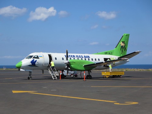
 (by D-Stanley)
| Near by ,,Prince Said Ibrahim International Airport´´ | |
|---|---|
| airport | Prince Said Ibrahim International Airport |
| hill | Mlima Hahaïa, Mirontsi |
| locality | Maziouani Bouani, Mkouloussi, Hadzimou |
| mountain | Irondroni, Bangohozi, Magoudjou, Hamnaradjabou, Hadzimou |
| peak | Tsoussi, Hagnéoi, Mahangani |
| populated place | Hahaïa, Milévani, Bangahani, Dzahadjou, Bouenindi, Dibouani, Bibavou, Mbaléni, Domoni, Oussivo |
| section of populated place | Domoni Ambouani |
| scrubland | Ntsodéhi, Koua |


