Rodez-Marcillac Airport
Rodez–Aveyron Airport is a growing local airport, located on the territory of the commune of Salles-la-Source approximately 10 km outside the centre of Rodez, the departmental capital of Aveyron, France.Photo: Lécuyer-couqueberg, CC BY-SA 4.0.
Notable Places in the Area
Dolmen of Pérignagol
Archaeological site
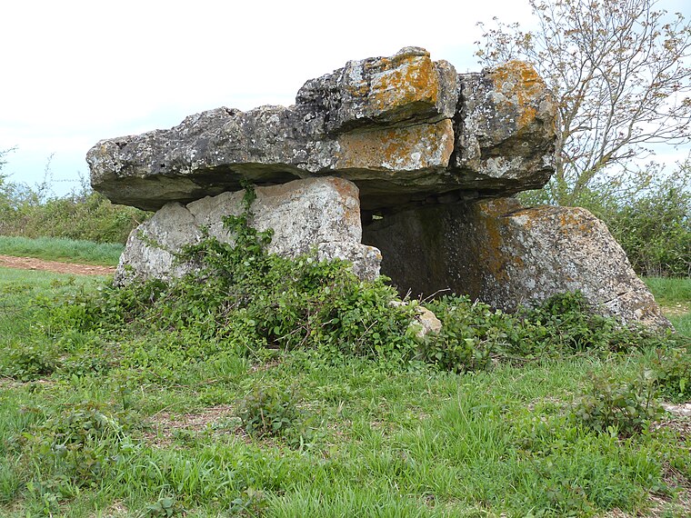
Photo: Thérèse Gaigé, CC BY-SA 4.0.
Dolmen of Pérignagol is an archaeological site.

Église Notre-Dame-de-Vanc
Church
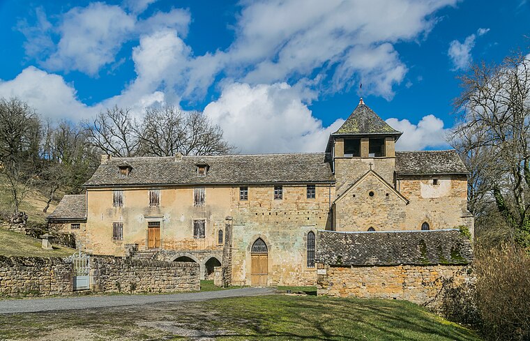
Photo: Tournasol7, CC BY-SA 4.0.
Église Notre-Dame-de-Vanc is a church.
Localities in the Area
Balsac
Village

Photo: Thérèse Gaigé, CC BY-SA 4.0.
Balsac is a village in the Aveyron department in the Occitanie region of southern France.
Salles-la-Source
Village

Photo: Xulin, CC BY-SA 3.0.
Salles-la-Source, historically Salles-Comtaux, is a commune in the Aveyron department in the Occitania region in Southern France. Rodez–Aveyron Airport is largely located in Salles-la-Source.
Druelle
Village
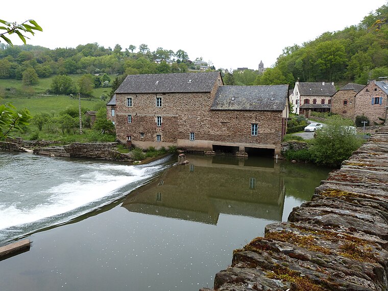
Photo: Thérèse Gaigé, CC BY-SA 4.0.
Druelle is a former commune in the Aveyron department in southern France.
Rodez-Marcillac Airport
- Type: Aerodrome
- Description: airport in Rodez, France
- Categories: airport, commercial traffic aerodrome and transportation
- Location: Salles-la-Source, Arrondissement of Rodez, Aveyron, Occitanie, France, Europe
- View on OpenStreetMap
Latitude
44.40771° or 44° 24' 28" northLongitude
2.48195° or 2° 28' 55" eastElevation
582 metres (1,909 feet)Operator
Chambre du Commerce et d'Industrie de RodezIATA airport code
RDZICAO airport code
LFCROpen Location Code
8FP4CF5J+3QOpenStreetMap ID
way 42019234OpenStreetMap Feature
aeroway=aerodromeGeoNames ID
6299385Wikidata ID
Q1432617Rodez-Marcillac Airport Satellite Map
© OpenStreetMap, Mapbox and Maxar
Also Known As
- Arabic: روديز - مطار أفيرون
- Asturian: Aeropuertu de Rodez-Marcillac
- Cebuano: Rodez-Marcillac Airport
- Chinese: 罗德兹-阿韦龙机场
- Chinese: 罗德兹阿韦龙机场
- Chinese: 羅德茲-阿韋龍機場
- Dutch: Rodez-Aveyron Airport
- English: LFCR
- English: Marcillac, Perancis, LFCR Airport
- English: RDZ
- English: RODEZ-AVEYRON
- English: RODEZ-AVEYRON airport
- English: Rodez-Aveyron Airport
- English: Rodez–Aveyron Airport
- French: Aeroport de Rodez-Marcillac
- French: Aéroport De Rodez-Marcillac
- French: Aéroport Rodez
- French: Aéroport de Rodez-Aveyron
- French: Aéroport de Rodez-Marcillac
- French: Aéroport de Rodez Marcillac
- French: Aéroport de rodez
- French: Aéroport de rodez-marcillac
- French: LFCR
- French: RDZ
- French: RODEZ-AVEYRON
- French: aérodrome de France
- French: aéroport de Rodez-Aveyron
- German: Flughafen Rodez-Aveyron
- German: LFCR
- Hungarian: Rodez-Aveyron repülőtér
- Hungarian: Rodez–Marcillac repülőtér
- Indonesian: Bandar Udara Rodez-Marcillac
- Indonesian: Bandar udara rodez-marcillac
- Indonesian: LFCR
- Indonesian: RDZ
- Italian: Aeroporto di Rodez-Marcillac
- Japanese: ロデーズ・アヴェロン空港
- Japanese: ロデーズ・マルシャック空港
- Japanese: ロデーズ=アヴェロン空港
- Malay: Lapangan Terbang Marcillac, Perancis, LFCR
- Persian: فرودگاه رودز-مارسیلاس
- Polish: Port lotniczy Rodez-Marcillac
- Romanian: Aeroportul Rodez-Aveyron
- Spanish: Aeropuerto de Rodez-Marcillac
- Spanish: Aeropuerto de Rodez - Marcillac
- Spanish: Aeropuerto de Rodez-Monsservin
- Spanish: Aeropuerto de Rodez Marcillac
- Spanish: Aeropuerto de Rodez Monsservin
- Spanish: LFCR
- Spanish: RDZ
- Tajik: Фурудгоҳи рудз-морсилос
- Turkish: Rodez - Marcillac Havalimanı
- Welsh: Maes Awyr Rodez-Aveyron
- Aéroport Rodez Marcillac
- Flughafen Rodez-Marcillac
- Rodez-Marcillac
Localities in the Area
- La TeouineLocality
- Les TieulettesLocality
- La PeyreLocality
- CabassoLocality
- Les PlosLocality
Landmarks in the Area
- Les Ailes RuthénoisesSocial club
- Av'airon clubSocial club
- Carrière de 'La Cordenade'Quarry
- Carrière de La Cau (SEDEMD)Quarry
- Dolmen de SeveyracArchaeological site
Escape to a Random Place
Discover other destinations in the world.
About Mapcarta. Thanks to Mapbox for providing amazing maps. Data © OpenStreetMap contributors and available under the Open Database License. Text is available under the CC BY-SA 4.0 license, excluding photos, directions and the map. Description text is based on the Wikipdia page Rodez-Marcillac Airport. Photo: Lécuyer-couqueberg, CC BY-SA 4.0.