Tokol Airport
Tokol Airport is an aerodrome in Pest County, Central Hungary. Tokol Airport is situated close to the suburb Pesti úti lakótelep and the town Halásztelek.Notable Places in the Area
Árpád-házi Szent Erzsébet templom
Church

Photo: Wikimedia, CC BY-SA 4.0.
Árpád-házi Szent Erzsébet templom is a church.
Lakihegy Tower
Historic site

Photo: Moja, CC BY-SA 3.0.
The Lakihegy Tower is a 314-metre-high radio mast at Szigetszentmiklós-Lakihegy in Hungary.
Érd minaret
Mosque

Photo: Dominik.Tefert, Public domain.
The Érd minaret is an Ottoman era minaret tower situated in Érd near capital Budapest in Hungary.
Localities in the Area
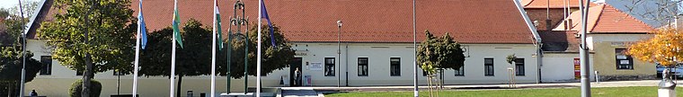
Szigethalom
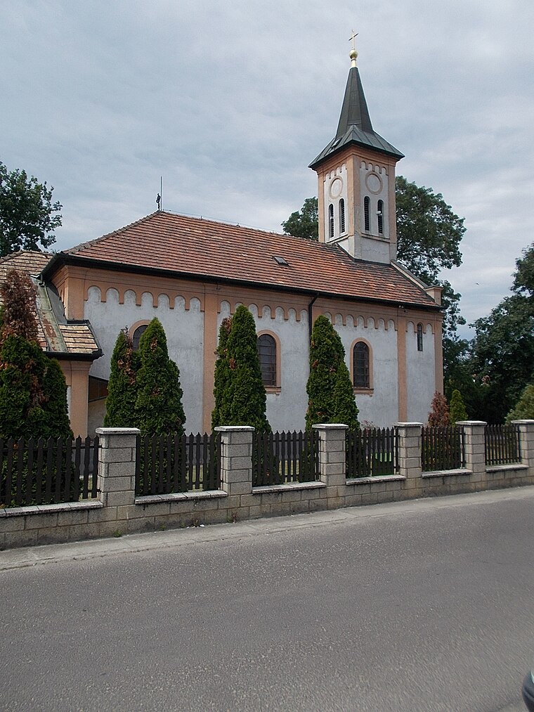
Photo: Globetrotter19, CC BY-SA 3.0.
Szigethalom is a town of 18,000 people in Pest County. It is the northern part of Csepel Island.
Szigetszentmiklós

Photo: Moja, CC BY-SA 3.0.
Szigetszentmiklós is a city of 36,000 people in Pest County on the southern border of Budapest, on Csepel Island.
Tokol Airport
- Type: Aerodrome
- Description: airport in Tököl, Hungary
- Categories: airport and transportation
- Location: Pest County, Central Hungary, Hungary, Central Europe, Europe
- View on OpenStreetMap
Latitude
47.34606° or 47° 20' 46" northLongitude
18.97835° or 18° 58' 42" eastElevation
101 metres (331 feet)Operator
Master Sky Kft.ICAO airport code
LHTLOpen Location Code
8FVW8XWH+C8OpenStreetMap ID
node 1042046970OpenStreetMap Feature
aeroway=aerodromeGeoNames ID
6299531Wikidata ID
Q1327599Tokol Airport Satellite Map
© OpenStreetMap, Mapbox and Maxar
Also Known As
- Cebuano: Tokol Airport
- English: LHTL
- Hungarian: Tököl Airport
- Hungarian: Tököli repülőtér
- Indonesian: LHTL
- Japanese: テケル空港
- Malay: Lapangan Terbang Tokol
- Romanian: Aeroportul Tokol
- Swedish: Tokol Airport
Localities in the Area
- Pesti úti lakótelepSuburb
- HalásztelekTown
- Vasúton túli részSuburb
- RagáddűlőNeighborhood
- GyártelepSuburb
Landmarks in the Area
- Tököli Pálya - Paintball játékokRecreation area
- Tököl Városi UszodaSports venue
- MisézőhelyChurch
- Petőfi parkPark
- Halásztelki focipályaAthletics track
Escape to a Random Place
Discover other destinations in the world.
About Mapcarta. Thanks to Mapbox for providing amazing maps. Data © OpenStreetMap contributors and available under the Open Database License. Text is available under the CC BY-SA 4.0 license, excluding photos, directions and the map. Photo: Civertan, CC BY 3.0.