El Bolsón Airport
El Bolsón Airport is an airport serving El Bolsón, Río Negro, Argentina.Photo: Jmmuguerza, CC BY-SA 4.0.
Localities in the Area
El Bolsón

Photo: Valenroselli, CC BY-SA 3.0.
El Bolsón is a town in the southwest of Río Negro Province, Argentina, at the foot of the Piltriquitron Mountain.
Paraje Entre Ríos
Suburb
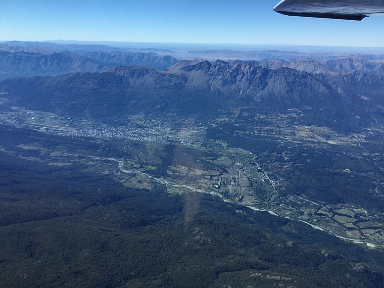
Photo: Jmmuguerza, CC BY-SA 4.0.
Paraje Entre Ríos is a suburb situated 8 km south of El Bolsón Airport.
Las Golondrinas, Chubut
Village

Photo: Jmmuguerza, CC BY-SA 4.0.
Las Golondrinas, Chubut is a village situated 8 km south of El Bolsón Airport.
El Bolsón Airport
- Type: Aerodrome
- Description: airport in Argentina
- Categories: airport, commercial traffic aerodrome and transportation
- Location: Departamento de Bariloche, Río Negro Province, Argentina, South America
- View on OpenStreetMap
Latitude
-41.94504° or 41° 56' 42" southLongitude
-71.53274° or 71° 31' 58" westElevation
344 metres (1,129 feet)Operator
Fuerza Aérea ArgentinaIATA airport code
EHLICAO airport code
SAVBOpen Location Code
47CC3F38+XWOpenStreetMap ID
way 824639204OpenStreetMap Feature
aeroway=aerodromeGeoNames ID
6301850Wikidata ID
Q5350832El Bolsón Airport Satellite Map
© OpenStreetMap, Mapbox and Maxar
Also Known As
- Cebuano: El Bolsón Airport
- Chinese: 埃爾博爾松機場
- Chinese: 埃爾博爾鬆機場
- English: EHL
- English: El Bolson Airport
- English: SAVB
- Indonesian: EHL
- Indonesian: SAVB
- Japanese: エル・ボルソン空港
- Malay: Lapangan Terbang El Bolson
- Romanian: Aeroportul El Bolsón
- Spanish: Aeropuerto de El Bolsón
- Spanish: Aeródromo El Bolsón
- Swedish: El Bolsón Airport
- Aeropuerto El Bolsón
Localities in the Area
- Los ArrayanesSuburb
- San JoséSuburb
- Los CipresesSuburb
- La UsinaSuburb
- ObreroSuburb
Landmarks in the Area
- Caminata de SaludPark
- Juzgado Multifuero N°11Courthouse
- Los Maitenes 5181Playground
- ArrayanesPark
Popular Destinations in Argentina
Discover Buenos Aires, Misiones, Aconcagua and Rosario.
Escape to a Random Place
Discover other destinations in the world.
About Mapcarta. Thanks to Mapbox for providing amazing maps. Data © OpenStreetMap contributors and available under the Open Database License. Text is available under the CC BY-SA 4.0 license, excluding photos, directions and the map. Description text is based on the Wikipdia page El Bolsón Airport. Photo: Jmmuguerza, CC BY-SA 4.0.