Kandla Airport
Kandla Airport is a domestic airport serving the cities of Kandla and Gandhidham in Gujarat, India. It is located in Anjar, 20 km northwest of Kandla and 7.5 km northwest of Gandhidham.Photo: Prad2609, CC BY-SA 4.0.
Localities in the Area
Adipur
Village
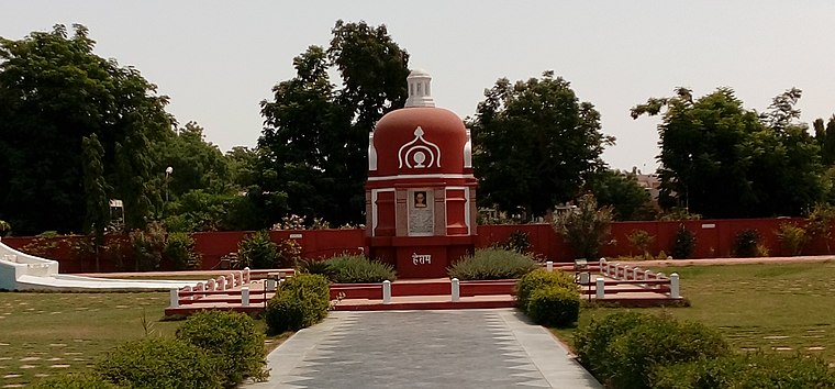
Photo: Nizil Shah, CC BY-SA 3.0.
Adipur is a town in Gandhidham Municipal Corporation of Kutch District in the state of Gujarat, India.
Gandhidham

Photo: Superfast1111, CC BY-SA 3.0.
Gandhidham, initially known as Sardarganj, located in the eastern part of Kutch district in the state of Gujarat and it is the largest and most populous city in Kutch District, Gujarat, India.
Anjar
Town
Anjar is a town, township and municipality of the Kachchh district in the state of Gujarat, India. Anjar is situated 7 km west of Kandla Airport.
Kandla Airport
- Type: Aerodrome
- Description: airport
- Categories: airport, commercial traffic aerodrome and transportation
- Location: Anjar, Kutch, Gujarat, Western India, India, South Asia, Asia
- View on OpenStreetMap
Latitude
23.11258° or 23° 6' 45" northLongitude
70.10073° or 70° 6' 3" eastElevation
30 metres (98 feet)Operator
Airports Authority of IndiaIATA airport code
IXYICAO airport code
VAKEOpen Location Code
7JMG4472+27OpenStreetMap ID
way 91561459OpenStreetMap Feature
aeroway=aerodromeGeoNames ID
7668573Wikidata ID
Q1595074Kandla Airport Satellite Map
© OpenStreetMap, Mapbox and Maxar
Also Known As
- Asturian: Aeropuertu de Kandla
- Asturian: IXY
- Asturian: VAKE
- Cebuano: Kandla Airport
- English: IXY
- English: KANDLA
- English: VAKE
- French: IXY
- French: KANDLA
- French: VAKE
- French: aéroport de Kandla
- French: करंडलर KANDLA
- French: कांडला KANDLA
- French: काॊडरा KANDLA
- French: ङ E33
- French: चF28
- French: चF31
- German: Flughafen Kandla
- Gujarati: કંડલા હવાઈમથક
- Hindi: कांदला विमानक्षेत्र
- Indonesian: IXY
- Indonesian: VAKE
- Malay: Lapangan Terbang Kandla
- Marathi: कंडला विमानतळ
- Persian: فرودگاه کاندلا
- Romanian: Aeroportul Kandla
- Spanish: Aeropuerto de Kandla
- Swedish: Kandla Airport
- Tajik: Фурудгоҳи кондло
- Vietnamese: Sân bay Kandla
- Gandhidham Airport
- Kandla
Localities in the Area
- Bageshree township 4Locality
- Bageshree township 5Locality
- Bageshree township 1Locality
- Bageshree township 3Locality
- Bageshree township 2Locality
Landmarks in the Area
- Ambaji TempleHindu temple
- Jumapir RamapirPlace of worship
- Gandhidham Jain Seva Samiti Kusumben Kantilal Dedhia HospitalHospital
- Gurukul GandhidhamPlace of worship
- We Care HospitalHospital
Popular Destinations in Kutch
Discover Bhuj, Dholavira, Gandhidham and Mandvi.
Escape to a Random Place
Discover other destinations in the world.
About Mapcarta. Thanks to Mapbox for providing amazing maps. Data © OpenStreetMap contributors and available under the Open Database License. Text is available under the CC BY-SA 4.0 license, excluding photos, directions and the map. Description text is based on the Wikipdia page Kandla Airport. Photo: Prad2609, CC BY-SA 4.0.