Goya Airport
Goya Airport is an airport serving Goya, a town on the Paraná River in Corrientes Province, Argentina. The airport is 4 kilometres northeast of the town.Localities in the Area
Goya
Town
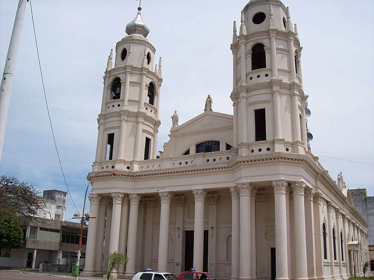
Photo: Alpertron, CC BY-SA 3.0.
Goya is a city in the south-west of the province of Corrientes in the Argentine Mesopotamia.
Lavalle
Village

Photo: Suomi 1973, Public domain.
Lavalle is a town in Corrientes Province, Argentina. It is the capital of Lavalle Department. Lavalle is situated 9 km north of Goya Airport.
Goya Airport
- Type: Aerodrome
- Description: airport in Argentina
- Categories: airport and transportation
- Location: Goya Department, Corrientes, Mesopotamia, Argentina, South America
- View on OpenStreetMap
Latitude
-29.10563° or 29° 6' 20" southLongitude
-59.21935° or 59° 13' 10" westElevation
42 metres (138 feet)IATA airport code
OYAICAO airport code
SATGOpen Location Code
5822VQVJ+P7OpenStreetMap ID
way 954875306OpenStreetMap Feature
aeroway=aerodromeGeoNames ID
7730149Wikidata ID
Q3913503Goya Airport Satellite Map
© OpenStreetMap, Mapbox and Maxar
Also Known As
- Cebuano: Goya Airport
- Chinese: 戈亞機場
- English: OYA
- English: SATG
- French: Goya
- French: OYA
- French: aéroport Dr. Diego Nicolás Díaz Colodrero
- Indonesian: OYA
- Indonesian: SATG
- Japanese: ゴヤ空港
- Malay: Lapangan Terbang Goya
- Persian: OYA
- Persian: SATG
- Persian: فرودگاه فرانسیسکو گویا
- Romanian: Aeroportul Goya
- Spanish: Aeropuerto Dr. Diego Nicolas Diaz Colodrero
- Spanish: Aeropuerto Dr. Diego Nicolás Díaz Colodrero
- Spanish: Aeropuerto de Goya
- Spanish: GOYA
- Swedish: Goya Airport
- Tajik: Фурудгоҳи фиронсеску гӯё
Localities in the Area
- Barrio Santa ClaraNeighborhood
- RemansoHamlet
- Barrio 102 viviendas del BicentenarioNeighborhood
- Barrio Leandro N. AlemNeighborhood
- Barrio 100 viviendas CGTNeighborhood
Landmarks in the Area
- Aeropuerto de GoyaAerodrome
- plaza de lamujerPark
- plaza barrio santa anaPark
- Mz.1101Park
- barrio virgen del rosario estePark
Popular Destinations in Corrientes
Discover Corrientes, Paso de los Libres, Mercedes and Esquina.
Escape to a Random Place
Discover other destinations in the world.
About Mapcarta. Thanks to Mapbox for providing amazing maps. Data © OpenStreetMap contributors and available under the Open Database License. Text is available under the CC BY-SA 4.0 license, excluding photos, directions and the map. Description text is based on the Wikipdia page Goya Airport. Photo: Wikimedia, CC0.