Jabiru Airport
Jabiru Airport is an airport located 1.5 nautical miles northwest of Ranger Uranium Mine and east of Jabiru in the Northern Territory of Australia. Situated within the Kakadu National Park it consists of one runway and five parking spaces for light aircraft such as Cessna 152s.Notable Places in the Area
Ranger Uranium Mine
Quarry
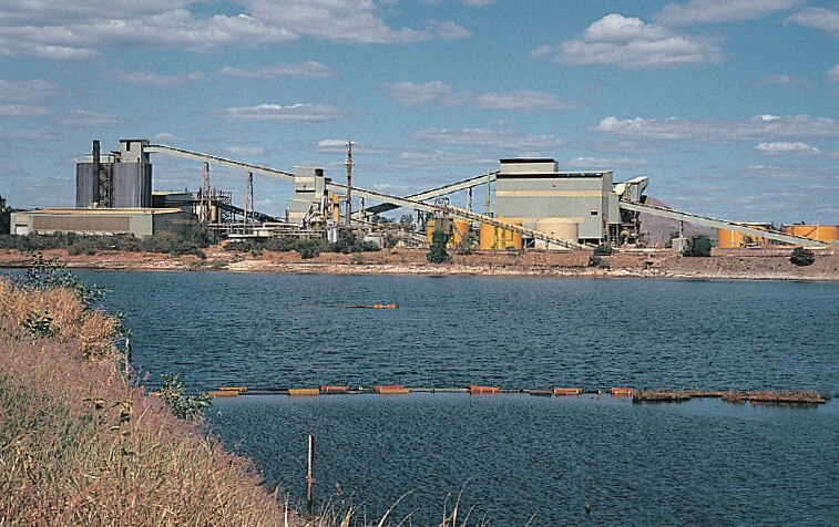 The Ranger Uranium Mine was a uranium mine in the Northern Territory of Australia.
Localities in the Area
Jabiru
Town
A trip to the north of Australia is never complete without visiting Kakadu National Park.
Jabiru Airport
- Type: Aerodrome
- Description: airport in Australia
- Categories: airport and transportation
- Location: West Arnhem Region, Northern Territory, Australia, Oceania
- View on OpenStreetMap
Latitude
-12.6583° or 12° 39' 30" southLongitude
132.89301° or 132° 53' 35" eastElevation
25 metres (82 feet)IATA airport code
JABICAO airport code
YJABOpen Location Code
5QVJ8VRV+M6OpenStreetMap ID
node 1042094052OpenStreetMap Feature
aeroway=aerodromeJabiru Airport Satellite Map
© OpenStreetMap, Mapbox and Maxar
Also Known As
- Cebuano: Jabiru Airport
- English: JAB
- English: YJAB
- French: YJAB
- Indonesian: JAB
- Indonesian: YJAB
- Malay: Lapangan Terbang Jabiru
- Romanian: Aeroportul Jabiru
- Swedish: Jabiru Airport
Localities in the Area
- MudginberriTown
- DjirrbiyakVillage, 16 km southwest
- GubaraLocality, 20 km south
- Mamukala 1Locality, 25 km west
- NourlangieHamlet, 28 km southwest
Landmarks in the Area
- Jabiru Hybrid Renewable Power StationPower station
- Jabiru Kart Track
- Lake Jabiru ParkPark
- Jabiru CemeteryCemetery
- Arnhem OvalPitch
Popular Destinations in Northern Territory
Discover Darwin, Top End, Alice Springs and Red Centre.
Escape to a Random Place
Discover other destinations in the world.
About Mapcarta. Thanks to Mapbox for providing amazing maps. Data © OpenStreetMap contributors and available under the Open Database License. Text is available under the CC BY-SA 4.0 license, excluding photos, directions and the map. Description text is based on the Wikipdia page Jabiru Airport. Photo: Wikimedia, CC0.