Volos Army Airport
Volos/Nea Ionia Airport was a joint public and military airport, situated at Nea Ionia, Volos. It was established in 1948 with a runway of 970m./3,190 ft.Notable Places in the Area
Archaeological Site of Dimini
Park
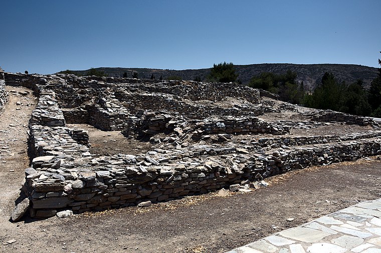
Photo: Kritheus, CC BY-SA 4.0.
Archaeological Site of Dimini is a park situated 3 km southwest of Volos Army Airport.

Courthouse of Volos
Courthouse

Photo: C messier, CC BY-SA 4.0.
Courthouse of Volos is situated 3½ km southeast of Volos Army Airport.
Localities in the Area
Volos

Photo: Wikimedia, CC BY-SA 1.0.
Volos is a city of 86,000 people in Thessaly, almost midway between Athens and Thessaloniki.
Dimini
Town
Dimini is a village near the city of Volos, in Thessaly, in Magnesia. Dimini is situated 3½ km southwest of Volos Army Airport.
Volos Army Airport
- Type: Airport
- Description: airport in Greece
- Categories: air base and transportation
- Location: Volos, Magnesia, Thessaly, Greece, Balkans, Europe
- View on OpenStreetMap
Latitude
39.38339° or 39° 23' 0" northLongitude
22.91776° or 22° 55' 4" eastElevation
38 metres (125 feet)ICAO airport code
LGVOOpen Location Code
8GF49WM9+94GeoNames ID
8555675Wikidata ID
Q7940661Volos Army Airport Satellite Map
© OpenStreetMap, Mapbox and Maxar
Also Known As
- Cebuano: Volos Army Airport
- English: LGVO
- English: VOL
- Greek: Κρατικός Αερολιμένας Βόλου/Νέας Ιωνίας
- Indonesian: LGVO
- Indonesian: VOL
- Malay: Lapangan Terbang Volos Army
- Persian: فرودگاه ولوس آرمی
- Persian: فرودگاه ولوس ارمی
- Russian: Волос
- Swedish: Volos Army Airport
- Tajik: Фурудгоҳи влус орм
Localities in the Area
- MelissatikaVillage
- KakkavosHamlet, 2½ km west
- KlimaHamlet, 3 km northeast
- FytokoHamlet, 3 km northeast
- IolkosVillage, 5 km east
Landmarks in the Area
- Volos PalaceHotel, 3 km southeast
- Neapoli StadiumStadium, 3 km south
- Volos Ferry PortPort, 3½ km southeast
- Limáni VólouHarbor, 4 km southeast
- DemetriasArchaeological site, 4½ km south
Popular Destinations in Magnesia
Discover Volos, Almyros, Chorefto and Nea Anchialos.
Escape to a Random Place
Discover other destinations in the world.
About Mapcarta. Thanks to Mapbox for providing amazing maps. Text is available under the CC BY-SA 4.0 license, excluding photos, directions and the map. Description text is based on the Wikipdia page Volos Army Airport. Photo: Giuliagi, CC BY-SA 3.0.