Marie Louise Island Airport
Marie Louise Island Airport is an airstrip serving Marie Louise Island in the Seychelles. The runway is along the eastern shore of the island. Marie Louise Island is 308 kilometres southwest of Victoria, the capital of the Seychelles.Notable Places in the Area
Marie Louise Island
Island
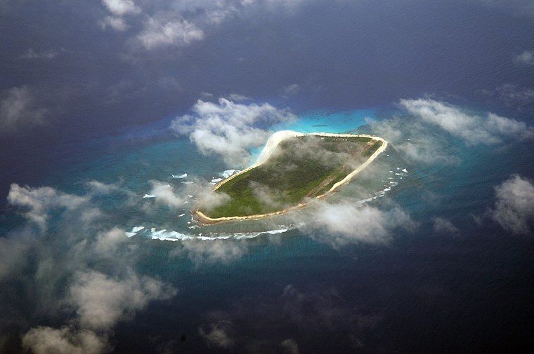
Photo: Acp, CC BY-SA 3.0.
Marie Louise Island is a low-lying coral island in the Amirantes group of the Outer Islands of the Republic of Seychelles, in the western Indian Ocean, with a distance of 308 km south-west of Victoria, Seychelles.
Marie Louise Island Airport
- Type: Airport
- Description: airport
- Categories: airport and transportation
- Location: Seychelles, East African Islands, Africa
- View on OpenStreetMap
Latitude
-6.1781° or 6° 10' 41" southLongitude
53.14568° or 53° 8' 44" eastElevation
5 metres (16 feet)ICAO airport code
FSMAOpen Location Code
6H5MR4CW+Q7GeoNames ID
8555777Wikidata ID
Q1030536Marie Louise Island Airport Satellite Map
© OpenStreetMap, Mapbox and Maxar
Also Known As
- Cebuano: Marie Louise Island Airport
- English: FSMA
- English: Marie-Louise Airport
- Indonesian: FSMA
- Japanese: マリー=ルイーズ島空港
- Malay: Lapangan Terbang Marie-Louise
- Persian: فرودگاه جزیده مری لویز
- Polish: Port lotniczy Marie Louise
- Romanian: Aeroportul Marie Louise Island
Landmarks in the Area
- Desnoeufs IslandIsland, 13 km southwest
Popular Destinations in Seychelles
Discover Victoria, Aldabra, Outer Seychelles and Morne Seychellois National Park.
Escape to a Random Place
Discover other aerodromes in the world.
About Mapcarta. Thanks to Mapbox for providing amazing maps. Text is available under the CC BY-SA 4.0 license, excluding photos, directions and the map. Description text is based on the Wikipdia page Marie Louise Island Airport. Photo: Wikimedia, CC BY-SA 3.0.