Mildura Airport (YMIA)
Australia /
Victoria /
Mildura /
World
/ Australia
/ Victoria
/ Mildura
World / Australia / Victoria
airport
Add category
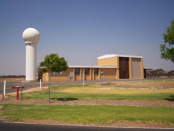
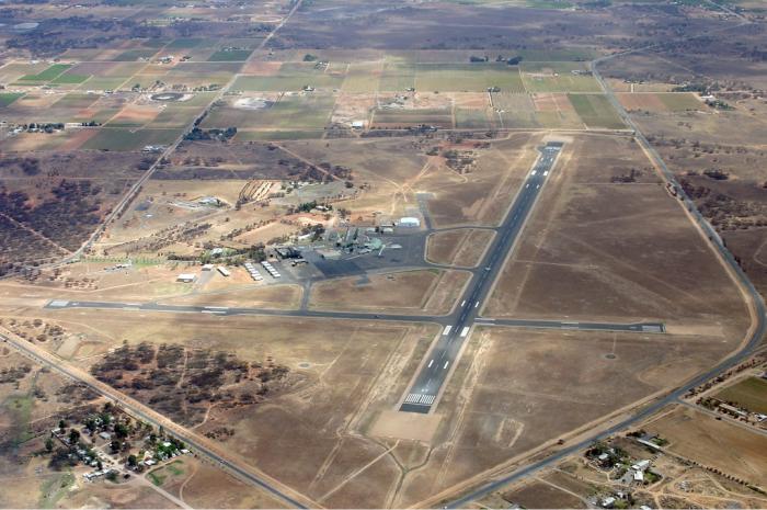
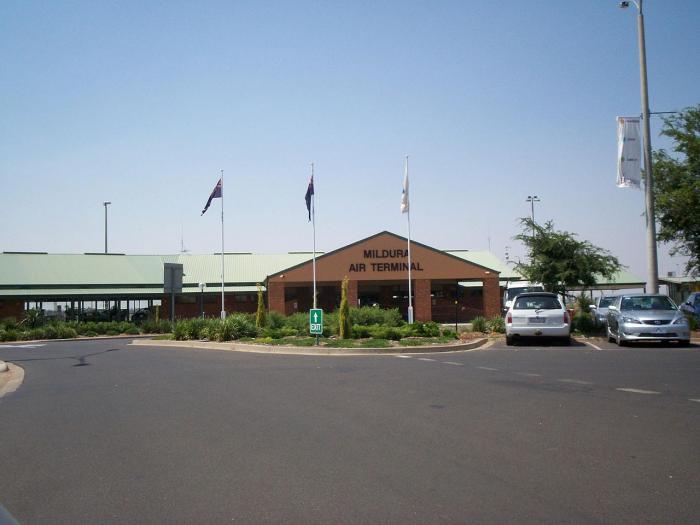
Mildura Airport (IATA: MQL, ICAO: YMIA) is located 5 nautical miles (9.3 km; 5.8 mi) southwest of Mildura, Victoria, Australia. It is the busiest regional airport in Victoria, the 33rd busiest Australian airport[4] and has twice been named Australia's Rural Airport of the Year.
www.murrayriver.com.au/regions/mildura/airport.htm
Details
Type: Airport (Aerodrome, Airfield)
Use: Public/Civil
Latitude: 34°13'45"S (-34.229167)
Longitude: 142°05'08"E (142.085556)
Elevation: 167 ft (51 m)
Runways: 2
Longest: 6004 × 148 ft (1830 × 45 m)
Farthest: FLW: 11916 mi / 19177 km
Flores Island [Santa Cruz], Azores, PT
ourairports.com/airports/YMIA/
Wikipedia article: http://en.wikipedia.org/wiki/Mildura_Airport
Nearby cities:
Coordinates: 34°13'50"S 142°5'3"E
- Broken Hill Airport IATA: BHQ, ICAO: YBHI 256 km
- RAAF Base Edinburgh 323 km
- Parafield Airport 324 km
- Adelaide International Airport 336 km
- Griffith Airport 364 km
- Whyalla Airport 445 km
- Melbourne Airport (Tullamarine) 453 km
- former RAAF Base Laverton 468 km
- Avalon Airport 473 km
- Koo-wee-rup airfield (former WW2 RAAF airfield) 540 km
- Bottle Bend Forest Reserve 23 km
- Travellers Lake 104 km
- Lake Mungo 106 km
- Lunette 107 km
- Mungo National Park 111 km
- Lake Leaghur 115 km
- Willandra Lakes Region 123 km
- Lake Mindona 125 km
- Garnpung Lake 131 km
- Lake Mulurulu 162 km