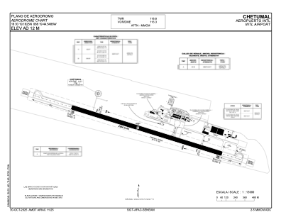


MMCM - Chetumal Aeropuerto Internacional
Located in Chetumal, Mexico
ICAO - MMCM, IATA - CTM
Data provided by AirmateGeneral information
Coordinates: N18°30'19" W88°19'45"
Elevation is 39 feet MSL.
View others Airports in Quintana Roo
Operational data
Special qualification required
Current time UTC:
Current local time:
Weather
METAR: MMCM 061741Z 12009KT 7SM SCT020 32/24 A2987 RMK SLP116 5//// 900 6//// 8/500
TAF: TAF MMCM 061716Z 0618/0718 14015KT P6SM SCT020 FM070300 14008KT P6SM SCT015 FM071200 13010KT P6SM SCT015
Communications frequencies: [VIEW]
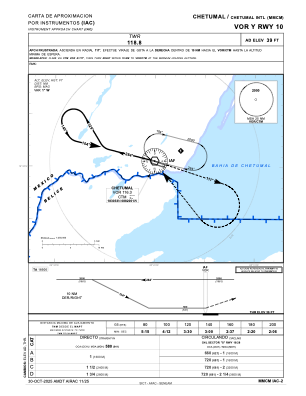
Runways:
| RWY identifier | QFU | Length (ft) | Width (ft) | Surface | LDA (ft) |
| 10 | 108° | 8839 | 148 | ASP | |
| 28 | 288° | 8839 | 148 | ASP |
Airport contact information
Address: Chetumal Mexico