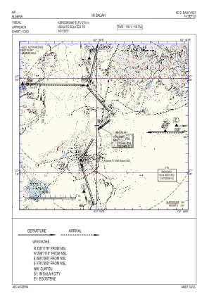


DAUI - In Salah
Located in In Salah, Algeria
ICAO - DAUI, IATA - INZ
Data provided by AirmateGeneral information
Coordinates: N27°15'13" E2°30'39"
Elevation is 895 feet MSL.
View others Airports in Tamanghasset Province
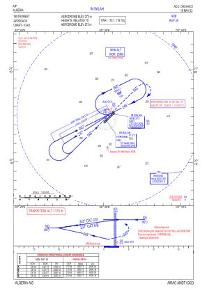
Operational data
Special qualification required
Current time UTC:
Current local time:
Weather
METAR: DAUI 281400Z 24012KT 7000 NSC 34/M02 Q1008
TAF: TAF DAUI 281100Z 2812/2912 24012KT 6000 NSC BECMG 2812/2814 24022KT 3000 DRSA PROB40 TEMPO 2812/2816 24022G32KT 1500 BLSA BECMG 2819/2821 24010KT 6000 NSW PROB30 TEMPO 2908/2912 22015G25KT 4000 -TSRA FEW040CB
Communications frequencies: [VIEW]
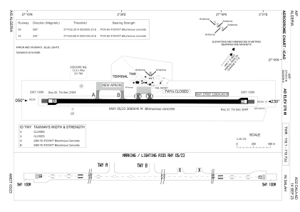
Runways:
| RWY identifier | QFU | Length (ft) | Width (ft) | Surface | LDA (ft) |
| 05 | 51° | 9843 | 148 | ASP | |
| 23 | 231° | 9843 | 148 | ASP |
Airport contact information
Address: In Salah Algeria