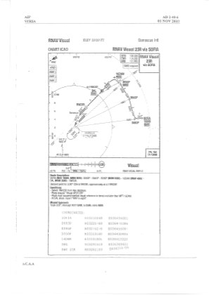
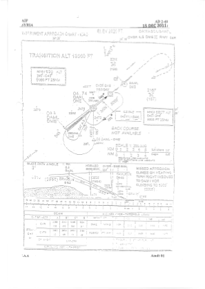
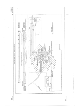


OSDI - Damascus / International
Located in Damascus, Syrian Arab Republic
ICAO - OSDI, IATA - DAM
Data provided by AirmateGeneral information
Coordinates: N33°24'39" E36°30'48"
Elevation is 2020 feet MSL.
View others Airports in Damascus Governorate
Operational data
Special qualification required
Current time UTC:
Current local time:
Weather
METAR: OSDI 032100Z 20013KT 9999 FEW030 16/11 Q1010
TAF: TAF OSDI 031600Z 0318/0424 22010KT 8000 FEW030 SCT090 PROB30 TEMPO 0318/0418 14015G25KT 6000 RA FEW026 CB SCT030 BKN090
Communications frequencies: [VIEW]
Runways:
| RWY identifier | QFU | Length (ft) | Width (ft) | Surface | LDA (ft) |
| 05R | 48° | 11811 | 148 | ASP | |
| 23L | 228° | 11811 | 148 | ASP | |
| 05L | 48° | 11811 | 148 | ASP | |
| 23R | 228° | 11811 | 148 | ASP |
Airport contact information
Address: Damascus Syrian Arab Republic