


RJDA - Amakusa
Located in Amakusa, Japan
ICAO - RJDA, IATA - AXJ
Data provided by AirmateGeneral information
Coordinates: N32°28'56" E130°9'32"
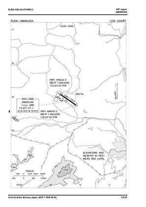
Elevation is 340 feet MSL.
View others Airports in Kumamoto Prefecture
Operational data
Special qualification required
Current time UTC:
Current local time:
Weather at : RJFU - Nagasaki ( 53 km )
TAF: TAF RJFU 061108Z 0612/0718 29007KT 9999 FEW010 BKN015 BECMG 0703/0706 29017KT BECMG 0715/0718 28006KT
Communications frequencies: [VIEW]
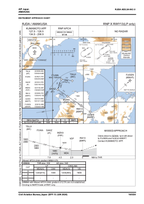
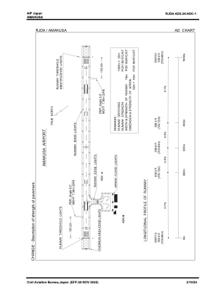
Runways:
| RWY identifier | QFU | Length (ft) | Width (ft) | Surface | LDA (ft) |
| 13 | 125° | 3281 | 98 | ASP | |
| 31 | 305° | 3281 | 98 | ASP |
Airport contact information
Address: Amakusa Japan