
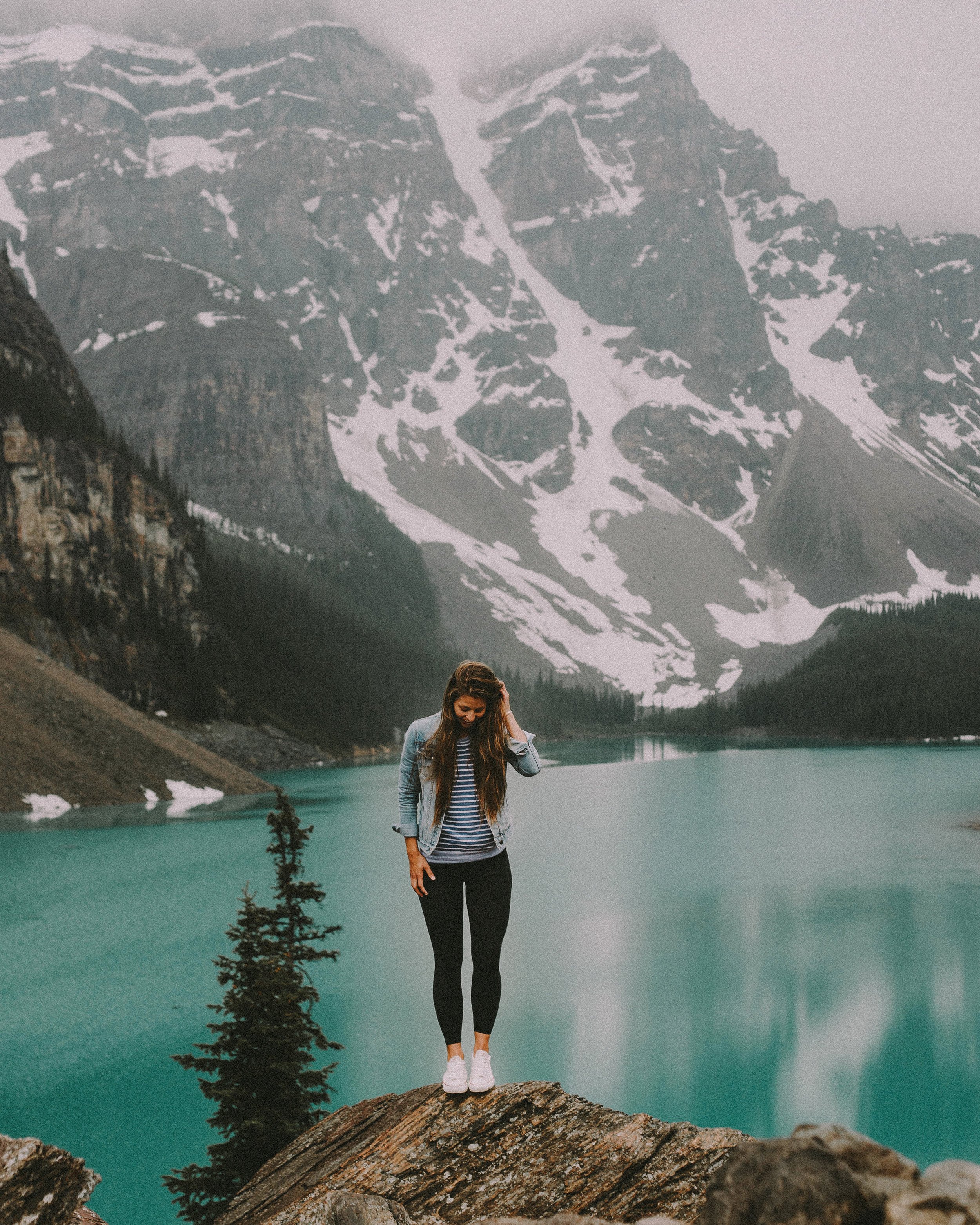
Moraine Lake : a dozen views

The view of Moraine Lake (R) from over 11,000ft at the summit of Mount Temple.
One of the most photographed lakes in the world, I am grateful to be able to call Moraine Lake my backyard. Over recent years its popularity has grown and for good reason. So for anyone asking what they should do that is "away from the tourists" - I don't know because even though I have called this place home for the entirety of my life this is still one of the parking lots that I find myself departing from on a frequent basis throughout the Summer and early fall seasons. The road to Moraine Lake is closed from Thanksgiving Monday (early October) until late spring due to avalanche risk on the roadway. The opening date varies by year and is dependant upon the annual snowmelt - my favourite insider tip is that typically the road is clear of all snow a few weeks before it opens and not only is the bike ride it's self beautiful but it's one of the few times where you can have the entirety of the lake to yourself.
The biggest piece of advise that I can give anyone when visiting Moraine Lake is to get there as early as you possibly can. The road closes to cars when the parking lot fills up (this year I have seen it close before 7am) and you will be required to take a shuttle from the Lake Louise overflow parking lot to Moraine Lake. I can guarantee that the early rise will be worth it when you get to experience the alpenglow cascading across the ten peaks with the only sound, a few shutter clicks echoing across the lake.
Once you've gotten over the biggest hurdle of waking up early and finding a parking spot I have compiled a list of a dozen ways to enjoy this little piece of paradise.
1. moraine lake shoreline
elevation: 1884 meters (6181 feet)
difficulty: easy
roundtrip distance: 2.9 kilometers (1.8 miles)
elevation gain: 0 meters (0 feet)
roundtrip average time: 40-60 minutes
notes: this is the most accessible vantage of Moraine Lake but do not let that deter you from soaking in the sights.
best time to go: anytime that the Moraine Lake Road is open this pathway is open and wheelchair accessible
Starting near the canoe dock, trail weaves through the forested shore of the lake. It is a flat, easy walk that allows for beautiful views of the famous alpine lake. At the far end of the lake there is a boardwalk next to the stream rushing in from the Wenkchemna Glacier.


2. the Rock Pile
elevation: 1914 meters (6279 feet)
difficulty: easy hike
roundtrip distance: 0.8 kilometers (0.5 miles)
elevation gain: 30 meters (98 feet)
roundtrip average time: 25 minutes
notes: please be careful to stay on the trail as navigating off trail and over the rocks and logs can be quite dangerous
best time to go: from road open until close this is the most popular vantage point of moraine lake, and for good reason.
Located adjacent to the Lodge, the short interpretive trail up the Rock Pile provides an introduction to the environment and the history of the Valley of the Ten Peaks along with unparallel views. From the lower parking lot, cross the bridge over the stream, and follow the trail as it climbs a set of rock stairs to the top of the knoll. Along the path there are plaques showing examples of various species and rock formations that comprise the area. From the top the “Twenty Dollar View” can be seen as it is the exact location pictured on the old Canadian Twenty Dollar Bill.

From an early season bike ride out before the road was open - photo / Mitch Henderson

A foggy morning on the lake - photo/ Marisa Anderson
3. Consolation Lakes
elevation: 1944 meters (6377 feet)
difficulty: easy hike
roundtrip distance: 6 kilometers (3.7 miles)
elevation gain: 60 meters (197 feet)
roundtrip average time: 2 hours
notes: seasonal group size restrictions may be in effect due to bear activity in the area (either recommended or required minimum group size of 4, each carrying bear spray)
best time to go: late June until the closing of Moraine Lake road for the season in early October these lakes are the perfect place for a lakeside picnic.
This hike leads into the heart of the mountains with a rewarding destination of beautiful surroundings. From the lower parking lot, cross the bridge over the stream and follow the pathway past the Rock Pile and through a quartzite boulder field. The trail to Consolation Lake trail takes you through the lush forest, eventually opening up to a meadow just prior to reaching the lower of the two lakes. A large rock slide separates the lower and upper lakes. The impressive glacier-covered cliffs tower above the lakes, contributing to the impressive view.

The final section of the trail to consolation lakes with Mount Temple in the background hiding in the clouds - photo / Ryan Clennett

Mid morning at Consolation Lakes - photo / Ryan Clennett

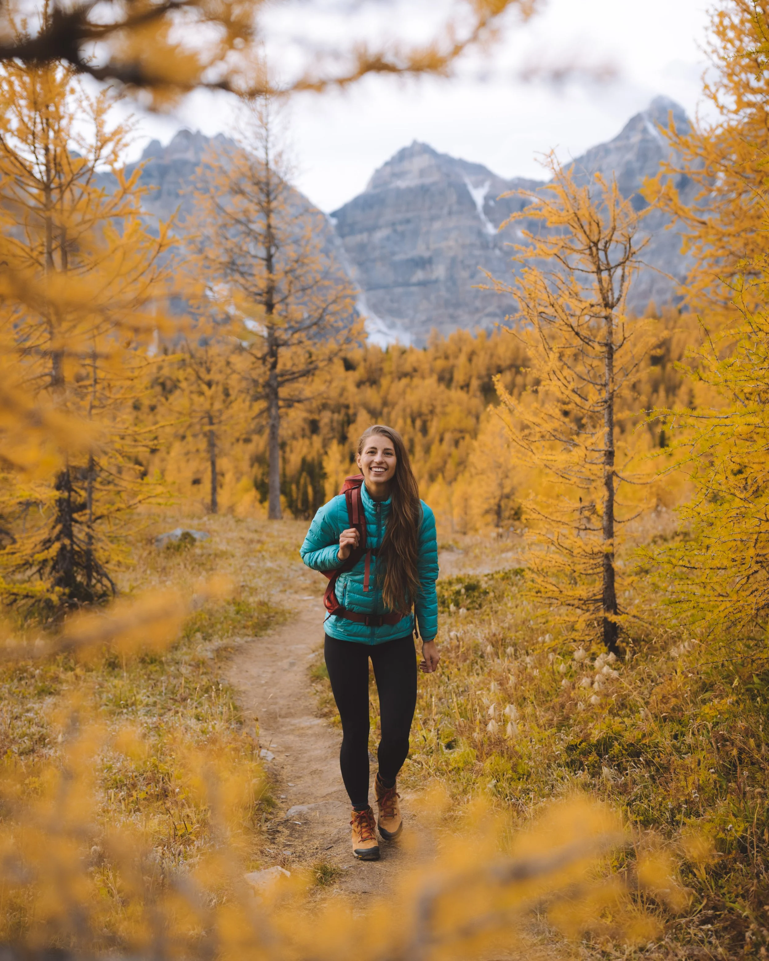
4. hike to Valley of the Larches
elevation: 2404 meters (7887 feet)
difficulty: moderate hike
roundtrip distance: 8.6 kilometers (5.4 miles)
elevation gain: 520 meters (1706 feet)
roundtrip average time: 3-4 hours
notes: seasonal group size restrictions may be in effect due to bear activity in the area (minimum group size of 4, each carrying bear spray)
best time to go: although beautiful at any point in the season when the valley is snow-free this valley is most spectacular in early autumn when the larch trees turn golden yellow. This route does get extremely busy and an early morning departure is highly recommended.
Located right outside your doorstep, Larch Valley, also known as Valley of the Ten Peaks is for the slightly more ambitious hiker. For the first two kilometers, the trail takes you up a series of steady uphill switchbacks. As you gain elevation, you are treated to intermittent views of the beautiful blue-green Moraine Lake. At the top of the switchbacks, the trail branches right to Larch Valley. The trail winds through a grove of larch trees before opening up to an alpine meadow with the Ten Peaks towering above, making for an impressive backdrop. This is an especially popular hike in the Fall as the subalpine meadow turns into a golden valley as the Larch Tree needles turn from soft green to a bright yellow.

Larch season in it's full expression with a friend visiting from out of town. We arrived very early to ensure that we would have parking, on our way down the trail it was a consistent stream of people. During larch season especially arrive early!

An early season visit to The Valley of the Ten Peaks/Larch Valley
5. watch the sunrise at Minnestimma Lake
elevation: 2444 meters (8018 feet)
difficulty: moderate hike
roundtrip distance: 9.2 kilometers (5.7 miles)
elevation gain: 560 meters (1837 feet)
round trip average time: as soon as the ice melts from the lake this lake is an ideal shoreline to watch the alpenglow cascade across the ten peaks.
notes: seasonal group size restrictions may be in effect due to bear activity in the area (minimum group size of 4, each carrying bear spray)
best time to go: late June onward when snow free the shoreline of these lakes provide a beautiful vantage of the ten peaks.
In recent years this lake has received a lot of attention via social media. The trail follows the same course as the Larch Valley trail for the first 2.4km (1.5mi), however you continue up towards Sentinel Pass and just before the switchbacks begin you will see an open body of water offering reflections of the ten peaks. I recommend stopping here for sunrise before heading up to other objectives such as Sentinel Pass or Mount Temple.

Lower MinnestimmaLake - photo / Ryan Clennett


Sunrise at Lower Minnestimma Lake - photo / Ryan Clennett
6. hike to Eiffel Lake
elevation: 2254 meters (7395 feet)
difficulty: moderate hike
roundtrip distance: 11.2 kilometers (7 miles)
elevation gain: 370 meters (1214 feet)
roundtrip average time: 4-5 hours
notes: seasonal group size restrictions may be in effect due to bear activity in the area (minimum group size of 4, each carrying bear spray)
best time to go: a great spot to watch sunrise, and possibly the only lake int he valley that you can have to yourself for sunrise, this spot is beautiful as soon as it melts in the early summer months.
Yet another awe-inspiring lake that tends to see notably fewer hikers than most areas in the valley. The trail follows the same course as the Larch Valley trail for the first 2.4km (1.5mi). At the junction, take the trail to the left (there is a sign, don't worry). The path soon opens up to an open area surrounded by boulders and mountain peaks. From the Larch Valley junction, the next 3km(1.9mi) is relatively flat as the trail winds around the mountain side. Stunning panoramic views are offered as the trail crosses the scree slope above Eiffel Lake. From here you can drop down to the lakeshore of Eiffel lake and on a nice morning have calm water that offers reflections of the ten peaks.

A smoky sunrise at Eiffel Lake.

Lakeside views. photo / Ryan Clennett
7. hike to Wenkchemna Pass
elevation: 2604 meters (8543 feet)
difficulty: difficult hike
roundtrip distance: 19.4 kilometers (12 miles)
elevation gain: 720 meters (2362 feet)
roundtrip average time: 7-8 hours
notes: seasonal group size restrictions may be in effect due to bear activity in the area (minimum group size of 4, each carrying bear spray)
best time to go: my favourite time to visit this pass is early July onward when the snow melts and the temperatures rise. This route to the continental divide is a beautiful secluded hike.
After hiking to Eiffel Lake, you can hike further on to Wenkchemna Pass. To reach the pass you must first cross rolling alpine tundra, glacial moraine and rockslides. At the top, this summit pass provides an excellent viewpoint down the length of the Valley of the Ten Peaks and the Wenkchemna Glacier which is concealed beneath the glacial till (rocks). I ended up here years ago by accident and the entire valley floor on both the Alberta and BC sides were engulfed in fog.

8. hike to Sentinel Pass
elevation: 2611 meters (8566 feet)
difficulty: difficult hike
roundtrip distance: 11.6 kilometers (7.2 miles)
elevation gain: 727 meters (2385 feet)
roundtrip average time: 5-6 hours
notes: seasonal group size restrictions may be in effect due to bear activity in the area (minimum group size of 4, each carrying bear spray)
best time to go: although beautiful at any point in the season when the route is snow free (general mid-late June onward) this extension of Valley of the Larches is a must-do hike.
After hiking up to Larch Valley, you can climb further up to Sentinel Pass. Continuing further through the subalpine, you will pass by Minnestimma lakes. The trail then cuts across the mountain with a few steep shale switchbacks up to the pass. From the pass, you are treated to an expansive view of the Ten Peaks and Larch Valley as well as Paradise Valley on the other side.

Looking down on the Valley of Ten Peaks from Sentinel Pass.

A late-season trail run from Moraine Lake to Lake Louise. Photo / Russell Kennedy

Early season conditions from Sentinel Pass.
9. scramble up Tower of Babel
elevation: 2360 meters (7742 feet)
difficulty: easy scramble
roundtrip distance: 3.2 kilometers (2 miles)
elevation gain: 450 meters (1476 fet)
roundtrip average time: 2.5-4 hours
notes: climbing helmet required due to falling rock on steep pitch sections of this scramble
best time to go: scramblers being ascending this peak as soon as the road to Moraine Lake opens and although extremely steep it has, in recent years, become extremely popular until the end of the season when the road to Moraine Lake closes.
I consider this to be my favourite short and sweet scramble in the area. The biggest crux with Tower of Babel is getting a parking spot, in 2017 I ended up atop Tower of Babel at least a half dozen times and I cannot imagine that I will not be back a time or two this year. Follow the Consolations Lakes trail to a gigantic bolder field and start moving up. The bulk of this hike is a large, steep chimney that was just made for rocks to fall so I could not imagine doing this without a helmet on. You aren't worried about yourself but about rocks falling from hikers and animals above you on your ascent/descent. I use the Scrambles in the Canadian Rockies - 3rd Edition by Alan Kane as my bible for Rockies Scrambles and recommend picking up a copy if you plan on getting atop mountains on your trip up here (this isn't sponsored, I wholeheartedly believe it is the best resource available).

Sunrise from Tower of Babel, on the right of the image you can see the canoe docks and the rock pile. Fortunately we had this summit to ourselves for a Sunday sunrise.

An early season ascent of Tower of Babel looking over Moraine Lake.
10. scramble up Wasatch peak
elevation: 2849 meters (9347 feet)
difficulty: easy-moderate scramble
roundtrip distance: 14.3 kilometers (8.9 miles)
elevation gain: 965 meters (3166 feet)
roundtrip average time: 7- hours
notes: climbing helmet strongly recommended as rock fall can occur from hikers and animals above, seasonal group size restrictions may be in effect due to bear activity in the area (minimum group size of 4, each carrying bear spray)
best time to go: The route Wasatch mountain is much less visited than it's neighbouring mountains Eiffel Peak and Mount Temple. This route is safe as long as it is snow free which depends on the year, a quick stop at the Lake Louise wardens office will resolve any questions.
My trail running partner Darren and I mistakenly summited Wasatch Mountain in 2016 when we took a wrong turn on our way to Eiffel Peak. Instead we ended up atop Wenkchemna Pass before realizing our mistake, trying to turn around we made another wrong turn and with the very spotty cell phone service at the summit go Wasatch we realized where we were... and also where we were not but wanted to be. I fell in love with this summit, the approach is longer but the scramble is shorter. Before us it has been nearly a decade since the previous name in the summit log. I have since returned a few times and will be keeping it in my back pocket as a secluded summit among the chaos that can be Moraine Lake.

From my first ascent of Wasatch Mountain. Looking down on Paradise Valley.

This was when Darren and I realized we were on the wrong mountain, Eiffel Peak (far right) and Mount Temple (right, snow capped)

Smoke from the August Forest fires in BC obscuring views of Paradise Valley.

A smoky Eiffel Peak.
11. scramble up Eiffel Peak
elevation: 3084 meters (10118 feet)
difficulty: moderate scramble
roundtrip distance: 10.9 kilometers (6.8 miles)
elevation gain: 1230 meters (4035 feet)
roundtrip average time: 4.5-9 hours
notes: climbing helmet strongly recommended as rock fall can occur from hikers and animals above, seasonal group size restrictions may be in effect due to bear activity in the area (minimum group size of 4, each carrying bear spray)
best time to go: Autumn when the larch trees are in their golden glory. The route is safe as long as it is snow free which depends on the year, a quick stop at the Lake Louise wardens office will resolve any questions.
Although it's not a challenging scramble, the views on Eiffel Peak are absolutely breathtaking. Fall is the best time to go but expect to find the trails crowded with tourists who come to see the larches changing colours. The route follows the Larch Valley Trail and do not make the mistake I did by turning left at the junction to Eiffel Lake. Continue along the Larch Valley trail to the creek and look for Carins that will keep you left along the north shore of the creek. After reaching Larch Valley, it leaves the trail and starts up the east ridge to a gully leading to the summit. The trail is easy to find and well defined, there is some hands on scrambling and a few spots where rockfall would be a concerning factor - remember your climbing helmet. I use the Scrambles in the Canadian Rockies - 3rd Edition by Alan Kane as my bible for Rockies Scrambles and recommend picking up a copy if you plan on getting atop mountains on your trip up here (this isn't sponsored, I wholeheartedly believe it is the best resource available).

Looking out over Moraine Lake from Eiffel Peak - Photo / Darren Lund

Horseshoe Lakes and Paradise Valley from the summit of Eiffel Peak.

Down-climbing the summit block of Eiffel Peak.
12. scramble up Mount Temple
elevation: 3543 meters (11624 feet)
difficulty: moderate scramble with several exposed climbing sections
roundtrip distance: 16.5 kilometers (10.3 miles)
elevation gain: 1690 meters (5544 feet)
roundtrip average time: 7-12 hours
equipment required: climbing helmet, a fall on the crux would (and has) severely injure or kill so take necessary precautions. Due to its size, weather and conditions are the most likely hazards. Seasonal group size restrictions may be in effect due to bear activity in the area (minimum group size of 4, each carrying bear spray)
best time to go: Mount Temple has a very narrow window in which it is safe to summit this mountain generally beginning in early July. It is advised to visit the Lake Louise wardens office to inquire about conditions. Main concerns are summit ice, falling rock from hikers above, bad weather or whiteout conditions on the descent. It's a long way down with several cliff bands along the way.
Mount Temple is the most accessible peak greater than 11,000 ft in the Canadian Rockies and dominates the skyline in the Lake Louise region. Summiting Mount Temple is not a hike, it's considered a moderate to difficult scramble depending on which reference material you are looking at. The southwest scramble route leading up to Mount Temple's summit is often referred to as the "Tourist Route", don't let this name fool you into a sense of security though. More mountaineering accidents have occurred on Mount Temple than any other mountain located in Banff National Park. This scramble requires good route finding skills and basic mountaineering knowledge. The second grey rock band (the crux) requires some exposed climbing. The photos below were on my first summit of Mount Temple, but my third attempt after being turned around twice due to unfavourable weather unexpectedly rolling in. This mountain has taught me a lot of humility over the years.
References I have used in summiting Mount Temple previously:

Looking out over Paradise Valley and Horseshoe Lakes from 11,624 feet - I was wearing a helmet for the climb but took it off once on the summit. Photo / Erik Read

Looking directly at Eiffel Peak and Wasatch Peak with the Valley of the Ten Peaks(Moraine Lake) on the left and Paradise Valley on the right.

Looking over Consolation Lakes (left) and Moraine Lakes (centre) - I was wearing a helmet for the climb but took it off once on the summit. Photo / Erik Read

A stream of scramblers approaching the first rock band as we descended from the summit. Although we were alone on the mountain during our ascent this was the reason we wore climbing helmets.
map

Moraine Lake Shoreline
Rock Pile Lookout
Consolation Lakes
Valley of the Larches/ Vally of the Ten Peaks
Minnestimma Lakes
Eiffel Lake
Wenkchemna Pass
Sentinel Pass
Tower of Babel
Wasatch Mountain
Eifel Peak
Mount Temple


For adventure enthusiasts I can’t imagine a better year-round Canadian destination, with world class surfing (wave dependant), mountain biking, hiking, trail running, sea kayaking… and more passive activities such as whale and bird watching as well as walks with coffee on a seemingly endless maze of trails that are extremely well maintained there isn’t too terribly much that you can not do in Tofino. With just shy of 2,000 permanent residents, Tofino is located on the tip of the Esowista Peninsula at the southern edge of Clayoquot Sound. It is situated in the traditional territory of the Tla-o-qui-aht First Nations.