
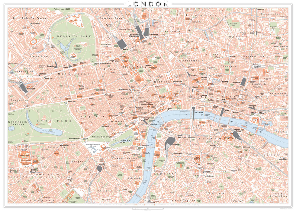
The whole map design, which is finished with a simple border design and a title in outlined Gill Sans at the top centre.
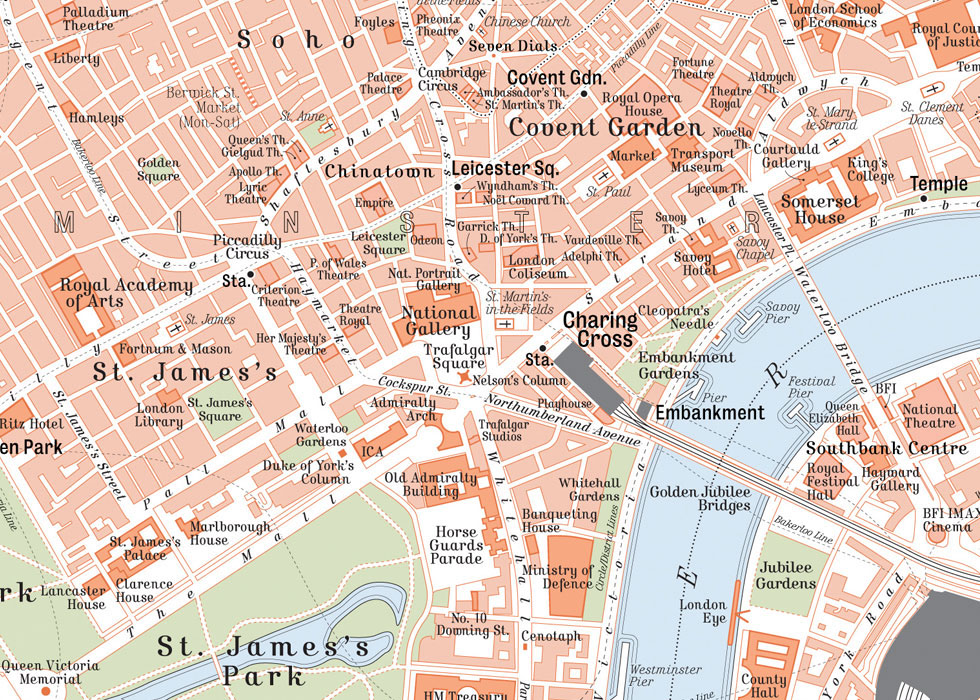
Detail of the West End, Covent Garden and Whitehall.
I chose to employ a limited colour palette for the design, in keeping with the style of those city maps from the turn of the 20th century; various shades of orange are used for built-up areas and different categories of buildings, whilst green spaces and parks are coloured a complimentary green, and water a pale blue.

Detail of the City of London, including St. Paul's Cathedral and the Bank of England.
Also in keeping with early 20th-century map designs (and earlier), I carefully chose two period-style typefaces for the labelling; Bureau for station labels, and Kursivschrift in regular, bold and italics for all other labels.

Detail of Knightsbridge and South Kensington, including the Natural History, V&A and Science Museums. Dashed lines show the courses of underground railway lines, whilst dotted lines show the boundaries between the different boroughs.

Detail of Bloomsbury, including University College and the British Museum.

Detail of Shoreditch and the East End.

Detail of the Angel and south Islington.

Detail of London Bridge and Southwark, including Tate Modern.

Detail of Westminster and Lambeth, including the Houses of Parliament.

Detail of Marylebone and Regent's Park.

Detail of Elephant And Castle.

A mock-up of the map printed and framed.


