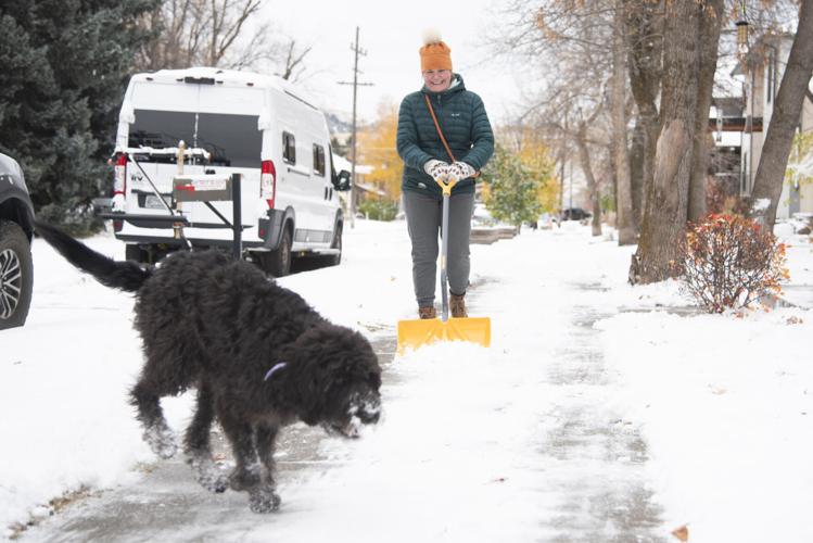
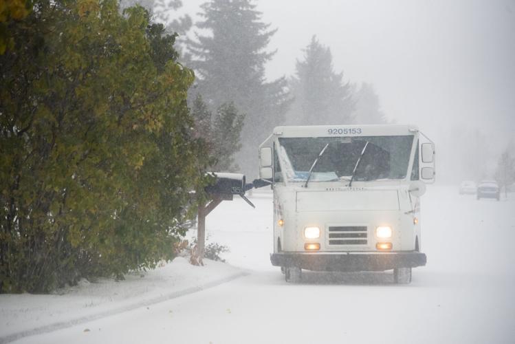
The Bozeman area saw its first snow storm of the season on Wednesday, causing hazardous conditions for drivers and prompting officials to remind people to be careful on the roads.
The snow started falling late Tuesday evening and continued to fall through early afternoon Wednesday. It is expected to pick back up Wednesday evening and snow through midnight Thursday, said Patrick Pierce, a meteorologist for the National Weather Service.
A weather station at the Bozeman airport recorded a snow depth of 3 inches as of 6 a.m. Wednesday, Pierce said. In total, about 5 to 5.5 inches is expected to accumulate through Thursday, he said.
Over the weekend, temperatures will start to increase and no precipitation is forecasted as of Wednesday. There could be some lingering showers but they’d be minimal, Pierce said. It’s likely the snow will start to melt as temperatures rise, and only rain is expected early next week, Pierce said.
The timing of the first snow is pretty typical compared to past years, Pierce said — Montana normally gets snow storms by late October and early November.
Last year, the first snow in Bozeman came two weeks earlier on Oct. 11.
The first snow always brings hazardous conditions to roads for drivers who are adjusting to driving in winter, said Sergeant Ryan Jern with the Gallatin County Sheriff’s Office.
Jern said Wednesday afternoon at least 20 different crashes had been reported to the county sheriff’s office since the snow started.
Jern said he expected that number to continue rising, as the roads are slicker than people are used to. The crashes typically involve people sliding off the road and/or hitting somebody or something, and are happening on both busy roads and side streets, he said.
The Montana Highway Patrol District 7 — which encompasses Gallatin, Park, Madison, Stillwater, Broadwater and Meagher counties — said Wednesday afternoon they had responded to at least 64 crashes.
No fatalities had been reported in the district, though there have been a handful of minor injuries, said Sergeant Derek Stoner with the District 7 Highway Patrol office.
The crashes have been widespread throughout the district, but Interstate 90 from Three Forks to Big Timber has been particularly bad, Stoner said. There have been a few multi-car crashes with cars sliding into each other and a few crashes involving semi-trucks, Stoner said.
Still, there were no reported road closures today around Bozeman.
Yellowstone National Park sent an advisory out Wednesday afternoon warning of hazardous conditions driving to and through the park and asked people to stay off the roads.
Officials asked those who do have to drive to follow winter driving safety tips.
That includes traveling at slower speeds and making sure there is plenty of braking distance in between you and the cars ahead, said Pierce, the meteorologist.
Pierce also recommended people carry ice scrapers and shovels in their vehicles and also prepare an emergency kit, which can include water, blankets and anything else people would want if they get stranded in the snow.
The long-term outlook for winter in Montana is generally forecasting warmer than average temperatures and lower than average precipitation, Pierce said. That’s because this year is an El Niño year, meaning a climate pattern in the Pacific Ocean leads to weather that trends warmer with less precipitation.
Last year, and the two years prior, the climate pattern was in La Niña, which trends cooler weather with more precipitation.
The 2022-2023 winter’s total snowfall, recorded at the Montana State University weather station, was 135.7 inches — or 11.3 feet — with the most snow falling in December.
Let the news come to you
Get any of our free daily email newsletters — news headlines, opinion, e-edition, obituaries and more.
Send us your thoughts and feedback as a letter to the editor. Submit by email, by post to 2820 W. College St., Bozeman, MT 59718 or use our online form.
Support quality local journalism. Become a subscriber.
Subscribers get full, survey-free access to the Bozeman Daily Chronicle's award-winning coverage both on our website and in our e-edition, a digital replica of the print edition.