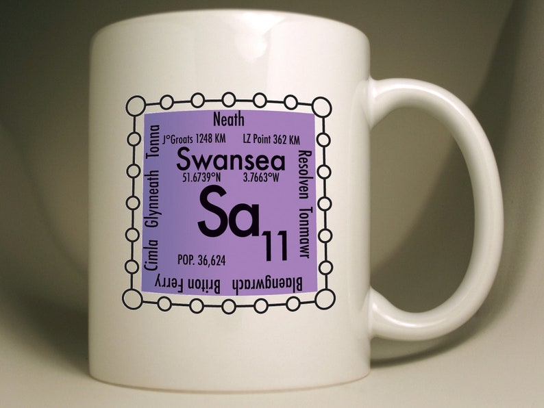
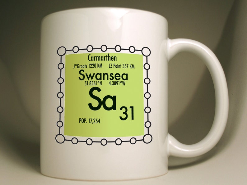
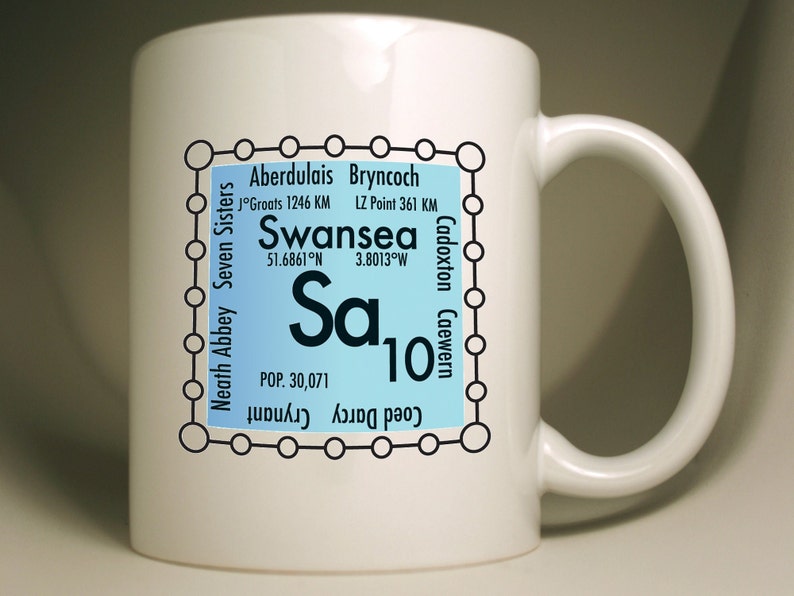
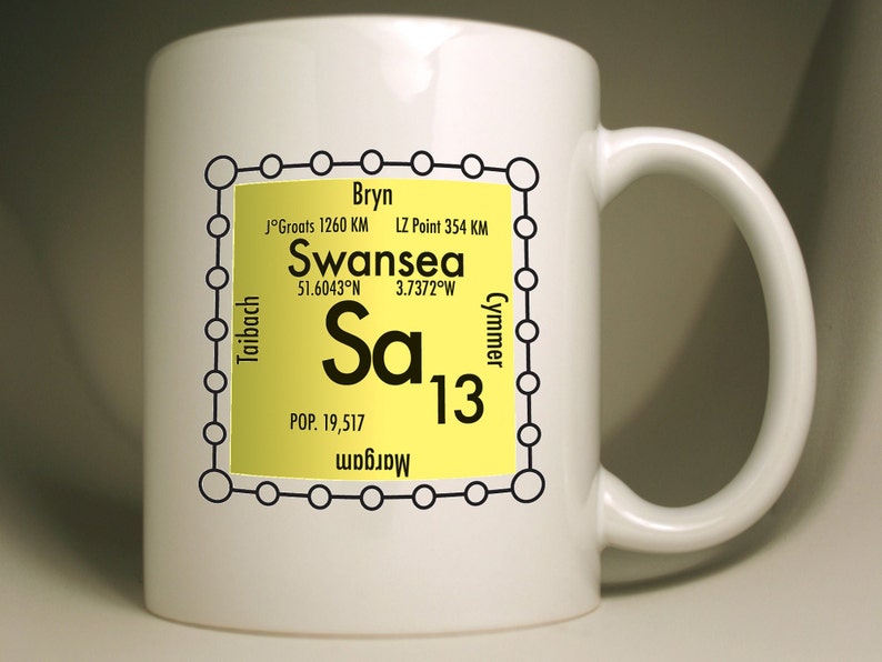
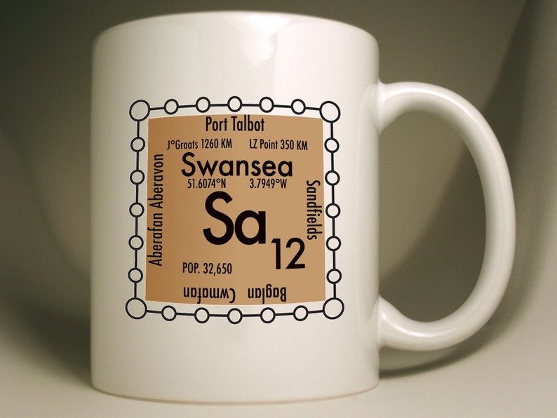
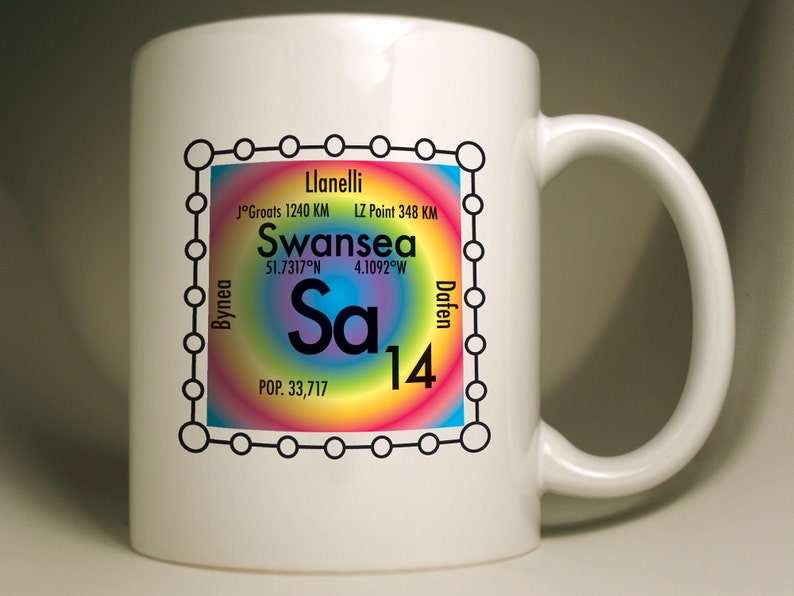
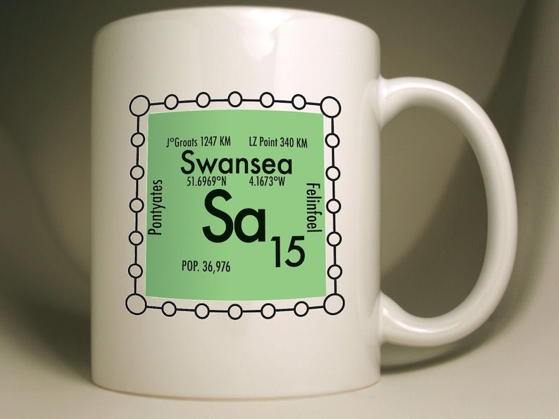
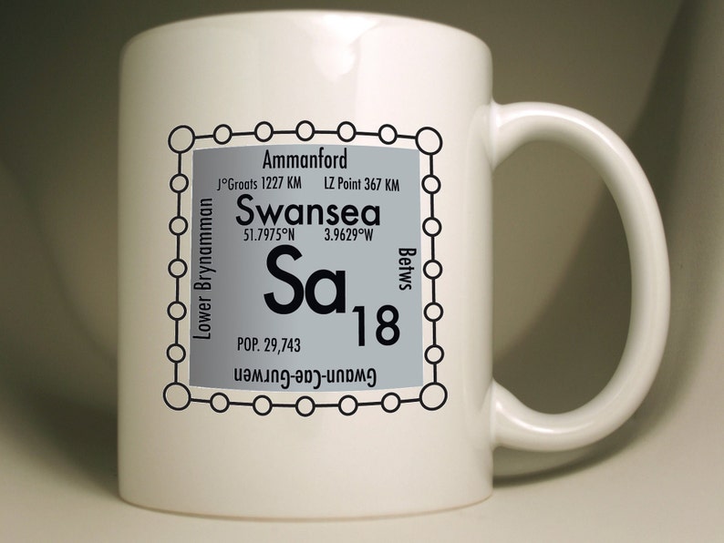
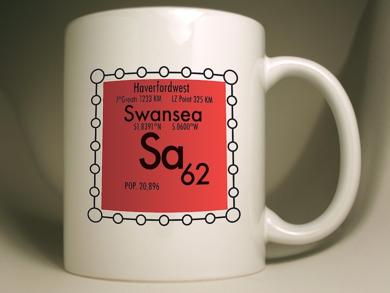
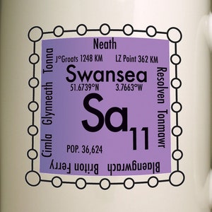
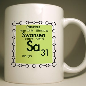
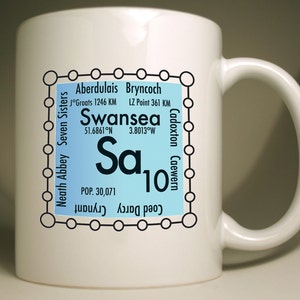
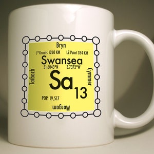
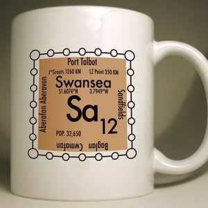
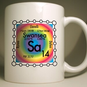
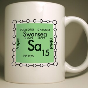
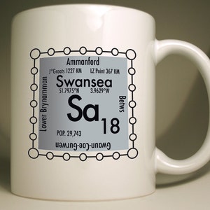
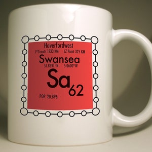
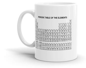
A novel, white, large 11oz personalised mug celebrating the UK postcode system in the style of the periodic table, based on SA Swansea postcodes. I can produce every postcode in the UK on request.
Browse postcodes at https://www.etsy.com/shop/pepopoco
Also available as a sturdy tote bag
https://etsy.com/uk/listing/1434784698
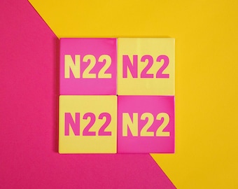
Also available as a colourful coaster
https://etsy.com/uk/listing/
Also available as a coaster and mug set
https://etsy.com/uk/listing/1331999296
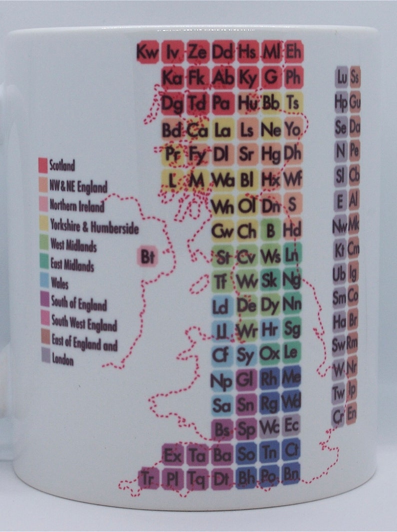
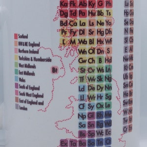
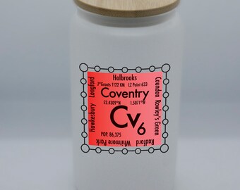
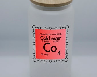
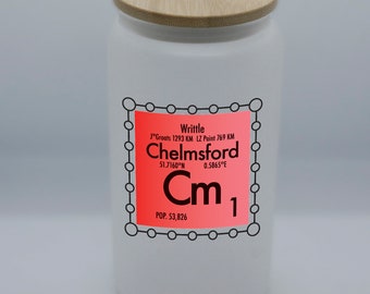
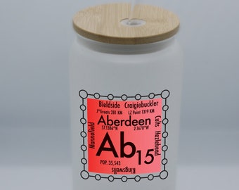
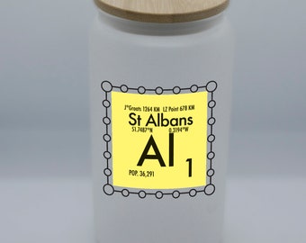
Fun Fact! Did you know: there are the same number of chemical elements as there are postcode areas in the mainland UK? So... 1st side shows the local area, the other displays the UK postcode areas in the form of the periodic table. Interesting and fun information is shown alongside the postcode, showing its GPS coordinates, population and both the distance to John O' Groats and Lands End.
with areas
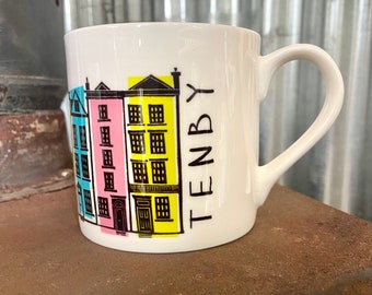
SA1: Bonymaen, Copper Quarter, Crymlyn Burrows, Danygraig, Greenhill, Hafod, Jersey Marine, Landore,, SA2: Brynmill, Cockett, Derwen Fawr, Dunvant, Fairwood, Glanmor, Hendrefoilan, Hendrefoilan Student Village,, SA3: Bishopston, Blackpill, Caswell, Clyne, Langland, Mumbles, Oystermouth, Southgate,, SA4: Blue Anchor, Gorseinon, Gowerton, Hendy (Carmarthenshire), Loughor, North Gower, Penllergaer, Penclawdd,, SA5: Blaenymaes, Cwmdu, Cwmdu Industrial Estate, Felindre, Fforestfach, Gendros, Llangyfelach, Llewitha,, SA6: Clase, Cwmrhydyceirw, Clydach, Morriston, Plasmarl, Plasmarl Industrial Estate, Swansea Enterprise Park, Ynystawe,, SA7: Birchgrove, Glais, Llansamlet, Swansea Enterprise Park, Talycoppa, Trallwn, SA8: Alltwen, Cwmtawe, Pontardawe, Rhos, Rhyd-y-fro, Trebanos, Ynysmeudwy, SA9: Abercraf, Cwmllynfell, Cwmtwrch, Lower Cwmtwrch, Rhiwfawr, Upper Cwmtwrch, Ystalyfera, Ystradgynlais, SA10: Aberdulais, Bryncoch, Cadoxton, Caewern, Coed Darcy, Crynant, Jersey Marine, Llandarcy,, SA11: Blaengwrach, Briton Ferry, Cimla, Glynneath, Neath town centre, Resolven, Tonmawr, Tonna, SA12: Aberafan, Aberavon, Baglan, Cwmafan, Port Talbot town centre, Sandfields, SA13: Bryn, Cymmer, Margam, Taibach, SA14: Bynea, Dafen, Llanelli town centre, SA15: Felinfoel, Pontyates, SA16: Burry Port, Pembrey, SA17: Ferryside, Kidwelly, Llansaint, Mynyddygarreg, Carway, SA18: Ammanford town centre, Betws, Gwaun-Cae-Gurwen, Lower Brynamman, SA19: Llandeilo, Llangadog, Llanwrda, SA20: Llandovery, SA31: Carmarthen town centre, SA32: Nantgaredig, Dryslwyn, SA33: Bancyfelin, Pendine, Blaenycoed, SA34: Whitland, SA35: Llanfyrnach, SA36: Glogue, Hermon, SA37: Boncath, SA38: Newcastle Emlyn, SA39: Pencader, SA40: Llanybydder, SA41: Crymych, SA42: Newport, SA43: Cardigan, New Quay, SA44: Llandysul, SA45: New Quay, SA46: Aberaeron, SA47: Llanarth, SA48: Lampeter, SA48: Lampeter, SA61: Haverfordwest town centre, Merlin's Bridge, SA62: Haverfordwest, SA63: Clarbeston Road, SA64: Goodwick, SA65: Fishguard, SA66: Clynderwen, SA67: Narberth, SA68: Kilgetty, SA69: Saundersfoot, SA70: Tenby, SA71: Pembroke, SA72: Pembroke Dock, SA73: Milford Haven, SA80: Swansea
I developed the idea after practicing memory techniques. As I tried to memorise the elements and postcodes, I wanted a visual image to help me. The answer was just one step away.