
Congo Basin, as one of the largest tropical wetlands in the world, carries special significance for not just Africa, but the whole world. From its tropical climate and expansive rainforests to the crucial Congo River and vast peatlands, its myriad geographical features make this region unique. This article of NEXT IAS aims to explain various aspects of this region.
Location of Congo Basin
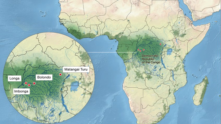
- The Congo basin refers to the basin of the Congo River lying across the equator in west-central Africa.
- It is the world’s second-largest river basin (after the Amazon River basin), covering over 1.3 million square miles.
- It is a geographic depression, bordered by the Sahara in the north, the Atlantic Ocean in the south and west, and the region of the East African Lakes in the east.
Bordering Countries
The Congo Basin is a vast tropical rainforest region that spans across several Central African countries. The Congo Basin countries include:
- The Democratic Republic of the Congo (DRC),
- The Republic of the Congo,
- The Central African Republic,
- Cameroon,
- Equatorial Guinea, and
- Gabon
Geographical Features
- Tropical Climate: The Congo Basin experiences a tropical climate with high temperatures, abundant rainfall, and high humidity throughout the year.
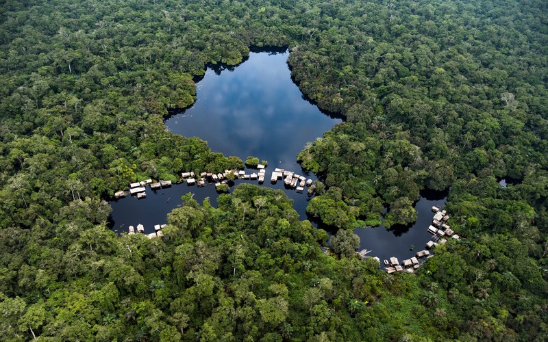
- Congo Rainforests: The Congo Basin is home to the second-largest rainforest in the world, after the Amazon Rainforest in South America. Ituri rainforest is another name for the Congo Rainforests.
- Central African Highlands: The eastern part of the Congo Basin includes the Central African Highlands, which are mountainous areas with significant elevation.
- Peatlands: The Congo Basin Peatlands constitute one of the world’s largest tropical peatlands and are among the world’s largest carbon sinks.
- Rivers: The Congo Basin is dominated by the Congo River, which is the second largest river in Africa after the Nile River.
- The vast drainage area of the Congo River includes almost the whole of the Republic of the Congo, the Democratic Republic of the Congo, the Central African Republic, western Zambia, northern Angola, and parts of Cameroon and Tanzania.
- Lakes: The Congo Basin includes several lakes, with Lake Tanganyika being the second-deepest lake in the world and one of the African Great Lakes. Other notable lakes include Lake Albert, Lake Edward, Lake Kivu, Lake Tumba, Lake Mai-Ndombe, etc.
- Mineral Resources: The basin is rich in mineral resources, including oil, diamonds, gold, and timber, which contribute to economic activities in the region.
- Biodiversity Hotspot: The Congo Basin is considered a biodiversity hotspot. This region is home to iconic species such as gorillas, chimpanzees, elephants, and various bird species.
Congo Basin Peatlands
- The Congo Basin, also known as the “Lungs of Africa,” is the largest carbon sink in the world, absorbing more carbon than the Amazon rainforest.
- Together with Brazil and Indonesia, it is home to one of the largest tropical peatlands in the world.
- About 29 billion tons of carbon are stored in the peat swamp forest of the Congo Basin, which is about equal to three years’ worth of greenhouse gas emissions worldwide.
- The Congo Basin Peatlands are also home to diverse flora, including various species of mosses and plants, and support wildlife such as birds, insects, and amphibians.
Threats to Congo Basin Peatlands
- Peatlands and other carbon sinks are already under threat of collapse due to pollution, biodiversity loss, and climate change.
- They are highly susceptible to wildfires, which can be exacerbated by human activities such as land clearing, agricultural conversion, or accidental ignition.
- Peatlands face threats from hydrocarbon exploration, hydroelectric dams, petroleum drilling, logging, palm oil plantations, etc.
Conservation Measures
Several countries have acknowledged the value of peatlands and pledged to safeguard the threatened ecosystems through these initiatives:
- Brazzaville Declaration on Peatlands: This declaration is signed by the Democratic Republic of Congo (DRC), the Republic of Congo, and Indonesia, whose main objective is to protect the Cuvette Centrale region in the Congo Basin, one of the world’s largest tropical peatlands, from unauthorized land use and stop its drainage and degradation.
- Global Peatlands Initiative: This is a UNEP initiative to save peatlands, the world’s largest terrestrial organic carbon stock, and to prevent it from being emitted into the atmosphere.
- There are several international conventions, such as the Ramsar Convention and the United Nations Environmental Assembly Resolution, with provisions for sustainable management of peatlands and their protection.
- Many regional initiatives, such as the Blue Fund for the Congo Basin, and partners such as the Central African Forest Initiative, Forest Carbon Partnership Facility, Forest Investment Program, Global Environment Facility, PROGREEN, and REDD+, are committed to supporting forest-smart development in the Congo Basin.
Related Prelims PYQs
UPSC Prelims 2023
Which one of the following is a part of the Congo Basin?
(a) Cameroon
(b) Nigeria
(c) South Sudan
(d) Uganda
Correct Answer: Option (c)


