

The Stewart-Cassiar Highway: Cycling from Watson Lake, Yukon to Kitwanga, British Columbia
6 - 16 August 2022
6 August - Watson Lake to Wild Camp at Good Hope Lake (74.0 mi, 119.1 km)
7 August - Wild Camp at Good Hope Lake to Jade City (15.3 mi, 24.6 km)
8 August - Jade City to Dease Lake (71.2 mi, 114.6 km)
9 August - Layover in Dease Lake
10 August - Dease Lake to Morchuea Lake Recreation Site (41.5 mi, 66.8 km)
11 August - Morchuea Lake Recreation Site to Iskut (14.0 mi, 22.5 km)
12 August - Iskut to Wild Camp near Bob Quinn Lake (66.3 mi, 106.7 km)
13 August - Wild Camp near Bob Quinn Lake to Wild Camp near Bell-Irving River (68.0 mi, 109.4 km)
14 August - Wild Camp near Bell-Irving River to Meziadin Junction (22.4 mi, 36.0 km)
15 August - Meziadin Junction to Wild Camp on Stewart-Cassiar Hwy (66.4 mi, 106.9 km)
16 August - Wild Camp on Stewart-Cassiar Hwy to Kitwanga (29.1 mi, 46.8 km)
Which Way from Watson Lake?
When we reached the town of Watson Lake in the Yukon, we had a decision to make: Should we stay on the Alaska Highway towards Dawson Creek, or head southward on the lightly-traveled Stewart-Cassiar Highway?
Several factors drew us to the Stewart-Cassiar Highway. First, the promise of less vehicle traffic and more wildlife sightings was definitely a plus. Second, we had heard wonderful reports about the scenic quality of the road. And third, it’s famous for its salmon runs - which attract and support a large population of bears (mostly black bears, but there are grizzly bears, too). With luck, we hoped to see both bears and salmon along the way.
Our decision to head south on the Stewart-Cassiar Highway meant we would end up putting in some long cycling days. There are very few towns and services along this road.
In keeping with a strategy we adopted earlier in our journey, we figured we would cycle farther on days when we planned to camp, and shorter distances when ending in a town with services. An early arrival in town allows for better lodging options (i.e., checking in before the best rooms or campsites are taken), more time to shop for supplies, and the possibility of resting in a climate-controlled space (especially welcome in hot, rainy, or very cold weather).
The first town south of Watson Lake with a population of more than 35 people is Dease Lake. Our plan was to cover the 160 miles (257 km) to Dease Lake in three days, with two long rides followed by a short sprint into town.
Into British Columbia
All went according to plan our first day out. We were still on the Alaska Highway when we saw our first bear for this leg of the trip - a black bear feeding among the shrubs on the side of the road. It was extremely wary of people and ran off as soon as we approached, so there was no chance to get a photo. But the encounter was a reminder that we were still very much in bear country.
Not long after turning onto the Stewart-Cassiar Highway (BC-37), we arrived at the Yukon/British Columbia border. There’s a big welcome sign and rest stop by the side of the road, so of course we stopped for a photo.
Our happy arrival in British Columbia, under a beautiful blue sky. Who wouldn’t be pleased to arrive at “the Best Place on Earth?” Stewart-Cassiar Highway, Yukon-British Columbia Border, Canada. Copyright © 2019-2022 Pedals and Puffins.
Upon entering British Columbia, we discovered the true nature of the Watson Highlands. The Alaska Highway had traversed this ecoregion, but it generally stayed within gentle river valleys or followed the shorelines of long lakes. This highway was very different. It marched directly across the rugged plateau. And the land itself was unbelievably lumpy.
To be fair, the engineers that built the Stewart-Cassiar Highway did a lot of work to smooth out the route. There were many places where the road blasted through a hillside to dampen a climb. At other times we cycled across gravel ridges constructed to keep the road from diving down into a steep-sided valley. But there was only so much the road-builders could do, because the true Watson Highlands are riven with deep trenches that duck and weave among pyramid-shaped hills. We cycled over a seemingly endless series of steep hills that were just high enough to drive us down into our lowest gears before cresting into short, fast descents.
The forested hills turned out to be fantastic habitat for spruce grouse. Over the next 200 mi of cycling (322 km) we would see at least one covey of spruce grouse each day, sometimes more.
When we startled a covey of spruce grouse along the highway, this female stayed out on the side of the road to distract us while her brood sheltered in the forest nearby. We would see many grouse along the Stewart-Cassiar Highway. British Columbia, Canada. Copyright © 2019-2022 Pedals and Puffins.
One indication that we were still in the boreal Watson Highlands was the continued presence of cottongrass. Stewart-Cassiar Highway, British Columbia, Canada. Copyright © 2019-2022 Pedals and Puffins.
A strong headwind arose in the afternoon, slowing our progress. Moreover, dark clouds gathered over the surrounding mountains, causing us to pedal harder in hopes of setting up camp before the storm arrived. By the time we reached Good Hope Lake we were bushed. Fortunately, we finished setting up camp just minutes before the clouds burst. We fell asleep to the sound of the raindrops on our tent, and the wild, eerie calls of a loon out on the lake.
Good Hope Lake was a lovely place for a wild camp, but stormy weather and tired legs sent us into our tent early. Stewart-Cassiar Highway, British Columbia, Canada. Copyright © 2019-2022 Pedals and Puffins.
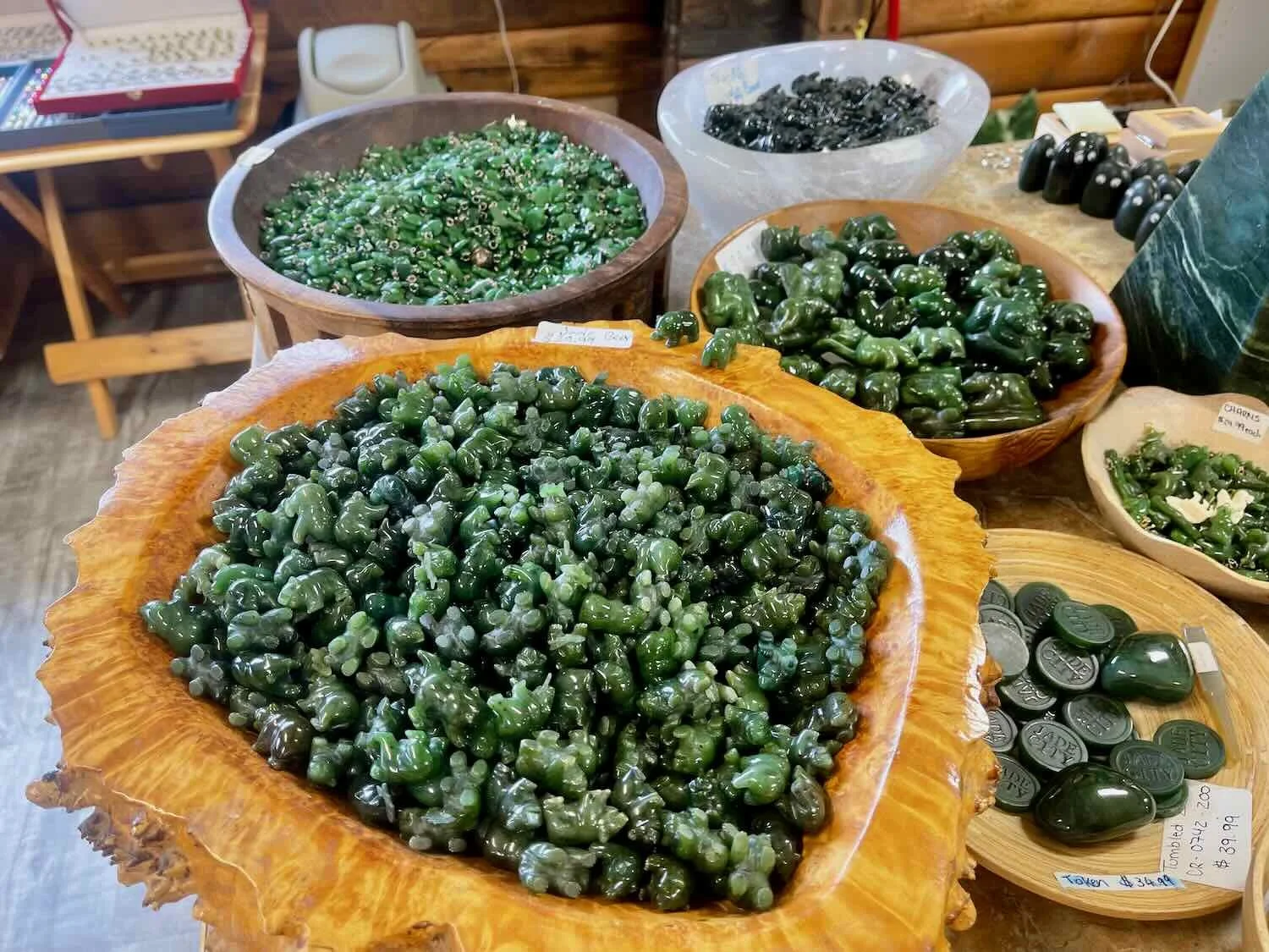
Jade Fever
Our second day out from Watson Lake did not go according to plan. We awoke to the sound of rain on our tent, which kept us inside until almost 9am.
After packing up our wild camp in a light rain, we took one last moment to appreciate the beauty of the location. Good Hope Lake is set against the backdrop of the Cassiar Mountains. Stewart-Cassiar Highway, British Columbia, Canada. Copyright © 2019-2022 Pedals and Puffins.
Once we got down to the business of pedaling, it became clear that our legs were feeling weak, in spite of the extended rest imposed by the morning’s rain.
Part of the problem was that we were gaining elevation. Immediately upon leaving Good Hope Lake, we started the climb out of the Watson Highlands and into the Northern Cordillera Forest ecoregion. This mountainous zone is an area of transition between the boreal forests of the Yukon and more temperate forests to the south. For the next 200 miles, we would remain generally above 2,500 ft (762 m) in elevation, while cycling over numerous mountain passes.
Now we were pedaling relentlessly uphill into the Cassiar Mountain range. We had hoped to get something substantial to eat for breakfast in the town of Good Hope Lake - just a short distance down the highway from where we had camped. But the town’s mini mart was permanently closed. Tough luck for us, and for a motorbiker who had also stopped there looking for supplies. Our light breakfast of energy bars didn’t quite hit the mark.
Then, about two hours into our ride, a cold rain started to fall. When we reached Jade City 40 minutes later, we were soaked and chilled. Casting about for somewhere we could hide from the rain, we were very grateful when the manager of the Cassiar Mountain Jade Store invited us to bring our bikes up onto the covered front porch. He then invited us inside to dry out, and offered us a cup of tea or hot cider (they also offer free coffee). As we sipped our hot drinks, the warmth slowly started to return to our tired bodies.
The Cassiar Mountain Jade Store is a warm and dry outpost in the middle of the wilderness. They generously offer free coffee, tea and hot cider, as well as free camping near the store’s parking lot. Stewart-Cassiar Highway, British Columbia, Canada. Copyright © 2019-2022 Pedals and Puffins.
It didn’t matter that we weren’t in the market for anything made of jade. The store manager, a guy originally from Germany, was warm and welcoming. When he wasn’t attending to other customers, he sat with us and chatted about his adventures, our cycling plans, and life in general. We passed the time visiting with him and browsing the huge variety of jade artwork on display.

At 3pm we were still waiting for the rain to end, and a look at the weather forecast showed it was likely to continue raining throughout the night. At 4pm we made the decision to spend the night in Jade City. Our route was about to enter into colder, higher elevation mountains, and it seemed unwise to venture out in the rain as the sun was sinking towards the horizon.
But “Jade City” (pop. 25) is not actually a city. In reality, it is a single store that sells Jade. They also offer camping and maintain a couple of cabins. There are no supplies or food items that can be purchased.
The decision to cut short our ride after only 15 miles (24 km) threw our plans off somewhat. We had originally planned to cycle 65 miles (105 km) for the day. To stay on schedule, we would have to cycle more than 70 miles (113 km) the next day to reach Dease Lake, where we could buy needed supplies at a grocery store. But 70+ miles in dry weather seemed much more appealing than any miles in the bone-chilling rain. We rented a cabin from the Jade Store and spent the rest of the day eating and resting, while the rain continued into the night.
There’s one thing that sets this lodging apart. It turns out that the Cassiar Mountain Jade Store is famous. Their challenges and accomplishments in the business of mining, refining, and marketing jade products was chronicled on seven seasons of a television program called Jade Fever (on the Discovery Channel). Having never seen the show, we entertained ourselves for a couple of hours by watching DVDs of the program’s first season. It was a blast to see the back story behind the Jade Store operations, and it gave us a deeper understanding - albeit through a Hollywood lens - of the work it takes to own and operate a business on the edge of the wilderness.
Our rainy-day cabin in Jade City. Here, we ate, rested, and watched several hours of Jade Fever on DVD. Stewart-Cassiar Highway, British Columbia, Canada. Copyright © 2019-2022 Pedals and Puffins.
The Last Two Northbound Cyclists
After several weeks of mostly rainy days (going all the way back to early July), the weather forecast had finally improved. But in the mountains, clear skies also meant it would be a bit colder. The temperature was around 37 F (2.5 C) when we hit the road in the morning. To fortify ourselves for the cold, we improvised breakfast from among the leftovers of the day before: vegetable soup with quinoa added, plus peanut butter-and-jelly sandwiches. Not exactly a combination you would plan for, but it worked.
We had a lot more energy this morning to tackle a long day of cycling. With our newfound vigor, we cycled strongly up into the Cassiar Mountains. The scenery was splendid as we crested the passes through the mountains then dropped down to skirt the eastern shore of Dease Lake.
Approaching another ridge of the Cassiar Mountains. After resting in Jade City, we tackled the high passes with new-found energy. Stewart-Cassiar Highway, British Columbia, Canada. Copyright © 2019-2022 Pedals and Puffins.
Along the way we crossed paths with the last two northbound cyclists we would see in Canada. Their window of good weather would be closing soon, especially if they wanted to go much farther north.
Our first encounter was with Mark. He was riding a DIY, one-of-a-kind vehicle: a recumbent e-bike with two large solar panels (one over his head and the other on a third wheel in the back). The panels generate power for his e-bike battery. He departed San Diego earlier this year, with a plan to cycle around the world. He said that he hoped to get at least as far as the Arctic Circle heading north, so we shared a few insights about cycling the Dalton Highway. Then he will fly to Australia for some outback cycling, and from there he will fly to Ushuaia, Argentina, and cycle back northward to San Diego. Who knows? Maybe we’ll cross paths with him again as we head south towards Ushuaia.
Our roadside visit with Mark, the solar e-bike guy. Check out that rig. He looked quite comfortable. Stewart-Cassiar Highway, British Columbia, Canada. Copyright © 2019-2022 Pedals and Puffins.
Later in the day we saw another cyclist approaching. We stopped to get acquainted, and learned that he was from New Zealand. But it sounded like he hadn’t been back to his homeland for a while. He traveled and worked in places like Norway and the UK before getting a job in British Columbia. Now that the work in Canada was finished, he was cycling up to Whitehorse, Yukon. There, he planned to meet a couple family members who were traveling to the Yukon for a horse packing trip. It’s always fun to hear the plans of our fellow cyclists. They’re a source of inspiration for us, and a reminder that there is still so much more of the world to see.
We were thrilled to have two moose sightings for the day. It seemed like ages since we’d seen our last moose (it had been nearly a month). The first one was a distant sighting. That moose was ankle deep in a patch of swamp grasses, vacuuming up the vegetation as fast as it could chew. Later we stumbled upon a mother moose with a calf. The mama had clambered up onto the road ahead of us, and looked like she was about to walk across. But when she saw us, she turned around and headed back into the bush with her little one following.
This mother moose considered crossing the road in front of us, then changed her mind. The little guy (lower left) never came up onto the road. Stewart-Cassiar Highway, British Columbia, Canada. Copyright © 2019-2022 Pedals and Puffins.
Large patches of Canadian bunchberry brightened the roadsides. And we startled another covey of spruce grouse feeding in the highway margin. This time, the young ones retreated to some tree branches where we could plainly see them from the road. We caught three of them on camera, eyeing us suspiciously.
The bright red and green of Canadian bunchberry decorated the roadsides. Stewart-Cassiar Highway, British Columbia, Canada. Copyright © 2019-2022 Pedals and Puffins.
After dashing into the forest, these three young spruce grouse eyed us suspiciously as we cycled by. Stewart-Cassiar Highway, British Columbia, Canada.
We arrived in the town of Dease Lake reasonably early, tired but happy.
Unfortunately the wifi in the town’s motel was abysmal. So to take care of some rest-day business, we headed over to the provincial Service Office. They handle stuff like driver’s license renewals and public assistance applications. This office lets the public use their wifi for free. It was not fast by “high speed internet” standards, but it was way better than the motel. We appreciated being able to get our work done there.
A Few Bumps In the Road
The next day our route threw a few “bumps” at us.
At the edge of town as we departed Dease Lake, we encountered our first bump. This one was actually pretty modest in height. We passed a sign saying that we were crossing back over the Arctic-Pacific Divide (which we’d first traversed along the way into Watson Lake). This time, there was barely even a hill to climb. But at 2,690 ft (820 m), it still separates the water flowing into the Pacific from the water that flows northward into the Arctic Ocean. So, as bumps in the road go, it was pretty significant.
Just outside of the town of Dease Lake, we crossed back over the Arctic-Pacific Divide. Once again, we were back in the Pacific Ocean watershed. Stewart-Cassiar Highway, British Columbia, Canada. Copyright © 2019-2022 Pedals and Puffins.
The next bump was a bit bigger. At 4,071 ft (1,241 m), Gnat Pass is the highest point on the Stewart-Cassiar Highway. It ascends over a distance of 11+ miles (18+ km), so it’s a long crawl. But although there were a couple of steep sections, it was less taxing than expected. Of course, we posed for a victory photo at the top.
Made it to the top of Gnat Pass, highest point on the Stewart-Cassiar Highway. British Columbia, Canada. Copyright © 2019-2022 Pedals and Puffins.
Unfortunately, near the top of Gnat Pass we encountered a construction zone - the most serious bump in the road. To our great delight, they allowed us to bike through (instead of having to ride in the pilot car). We cycled on the freshly-laid chip-and-seal while the pilot car shuttled traffic back-and-forth in the other lane. We really appreciated their accommodation of cyclists.
After a few miles, the construction zone officially ended. But for many additional miles we rode on the loose gravel left behind after a chip-and-seal paving job. And that meant we had to deal with all of the slippery, bumpy, and dusty conditions that go along with loose gravel.
As a result, the ride down the far side of Gnat Pass didn’t offer a lot of rest. We had to manage our descent on the gravel, plus there were lots of small hills that kept us pedaling hard. But the final three miles down to the banks of the Stikine River were a treat. With a downhill gradient averaging 7%, those miles flew by. It was over too quickly.
The Stikine River was impressive. The wide channel looked deep and full. Plus, the water was flowing fast. Considered one of the last truly wild rivers in British Columbia, it drains an area more than twice the size of Vermont. Yet it is home to less than 1,500 permanent residents. Just six miles (10 km) downstream from the bridge where we stood, the river enters a steep-walled canyon that’s nearly 1,000 ft (300m) deep, called the Grand Canyon of the Stikine. The rapids through the canyon are Class 5, and are considered very dangerous. We’ll stick to the roads.
View of the Stikine River from the bridge on the Stewart-Cassiar Highway. It’s one of British Columbia’s last great wilderness rivers. British Columbia, Canada. Copyright © 2019-2022 Pedals and Puffins.
The fabulous descent into the Stikine River Valley was, of course, followed by a less fabulous climb back out. Unfortunately for us, the southern escarpment was longer (4.5 mi) and steeper (8%) than the descent had been. Eager to get it behind us, we ground our way to the top. Two road signs indicating that the surface would be gravel, and that the climb would be long and steep, didn’t give us much comfort.


But as we crested the edge of the valley we were greeted with a magnificent site. Mount Edziza was suddenly there, right in front of us. Even though it was more than 25 miles away as the raven flies, it appeared huge. Icefields and glaciers draped its higher peaks. Awestruck, we stopped to admire the beautiful mountain.
The giant massifs of Mt Edziza Provincial Park, loomed over us as we cycled southward. Stewart-Cassiar Highway, British Columbia, Canada. Copyright © 2019-2022 Pedals and Puffins.
Less than a half hour later we reached our destination, Morchuea Lake Recreation Site. The campground, like many Canadian recreation sites, is pretty basic - comprised of a dirt road leading down to the lake with a couple of pull-outs that have picnic tables.
We cycled the full length of the road to the edge of the lake, where we met Lyn and Addie. They’re a Canadian couple from Kimberly, BC, traveling in a camper, fishing and kayaking. We talked for a long time, hearing about their travels throughout Alaska, western Canada, and the USA. Around 7pm the local mosquitos sent us scrambling for our tent.
The Last Town for Five Days
We had a short day planned, cycling from Morchuea Lake Recreation Site to the town of Iskut (pop. 295) - the last real town we would pass through for the next five days. With that in mind, we took the opportunity to wait for the air to warm up a bit before rousing ourselves out of our sleeping bags. Clear skies mean that the days are now warm, but the nights are quite cold. When we finally emerged, it was still cold enough to make us don our puffy coats.
The cold didn’t dampen the enthusiasm of the red squirrels that lived near our campsite, though. It was their loud chattering that woke us up. As we broke camp, two of them chased and tussled with each other, in apparent courtship. It wasn’t always easy to tell whether they were flirting or fighting.
A couple of red squirrels chased and wrestled with each other right next door to our campsite. Morchuea Lake Recreation Site, Stewart-Cassiar Highway, British Columbia Canada. Copyright © 2019-2022 Pedals and Puffins.
Before heading out, we struck up a conversation with another couple in the campground. Robin and Maury were from Terrace, BC, and traveling by motorbike. They were on their way home from a trip up the Dempster Highway to the Arctic Ocean. We enjoyed talking with them because they were very familiar with our route, and made some helpful recommendations about where to camp.
Our ride to Iskut went quickly. The highlight was the day’s sighting of another spruce grouse - this time a handsome male.
Another spruce grouse. This one was a handsome male. Stewart-Cassiar Highway, British Columbia, Canada. Copyright © 2019-2022 Pedals and Puffins.
We arrived at the very modest grocery store in Iskut a little before noon. This store was even more basic than others we’ve visited in remote towns. It wasn’t easy to find any food we wanted to eat. We ended up eating microwave-heated frozen dinners for breakfast. We hoped that the Red Goat Lodge would have something more appealing that we could buy for dinner (fortunately, they did).
The Red Goat Lodge in Iskut was the last indoor lodging available for more than 260 miles (420 km). That’s just as long as the stretches of wilderness we had cycled on the Dalton Highway. We decided it was worth it to rest up at the lodge before tackling the 5-day run from Iskut to Kitwanga, the next town on our route.
We’re glad we did. The Lodge has a beautiful location on the shore of a pristine lake. As we took an afternoon walk along the cobble-stone strewn beach, the mountains on the far side of the lake were reflected in its calm clear waters.
The lake next to Red Goat Lodge captured the reflections of surrounding mountains on its mirror-like surface. Stewart-Cassiar Highway, British Columbia, Canada. Copyright © 2019-2022 Pedals and Puffins.
Southern Flowers and Coastal Mountains
Over the next two days we cycled through a changing landscape. Under clear, cloudless skies with crisp mountain air, we passed through a corridor where three ecoregions come together.
Gradually we left the boreal forests of the Northern Cordillera behind and entered the Northern Transitional Alpine Forest. This is a more temperate region, sandwiched between the high coastal ranges to the west, and more subdued mountains to the east. Before long the great, snow-covered peaks of the Pacific Coastal Mountains became a constant presence on our righthand side.
The most noticeable evidence of our arrival in the Northern Transitional Alpine Forest was a dramatic increase in the variety of plants. The forests now have a striking diversity of broadleaf trees and shrubs mixed in with the conifers. The pines grow much taller. And there has been an explosion of species along the highway margins. Flowers familiar to us from the lower 48 states included birdsfoot trefoil, butter-and-eggs, pearly everlasting, oxeye daisies, yarrow, thimbleberry, and big mats of white clover.


The sunny skies ensured that we had stunning views of the very high, dramatic peaks of the Pacific Coastal Mountains. Our proximity to the icefields blanketing these mountains probably accounted for the brisk headwinds that were once again a feature of our rides. But the wind never became overbearing, and we appreciated the fact that it kept the mosquitoes at bay.
Big Mountain (yes, that’s really its name) is part of the Pacific Coastal Mountain range. Even this far south, the coastal mountains are covered with snow and ice in August. Stewart-Cassiar Highway, British Columbia, Canada. Copyright © 2019-2022 Pedals and Puffins.
Yet there were still places where the last few pockets of boreal forest lingered. One of our best wildlife sightings on the first day out of Red Goad Lodge was an encounter with a flock of boreal chickadees - a characteristic species of the taiga. We had occasionally heard these diminutive birds while cycling, but had not been able to spot any of them during our entire trip through Alaska and the Yukon. This time, we were pedaling slowly up a hill when we heard them calling close to the road. We stopped, and were able to watch the flock as it darted in and out of the poplars growing alongside the highway. They were very elusive, so we didn’t get any photos. But it felt like a wonderful farewell from the boreal forest.
Finding a good campsite took a bit of effort once we got near Bob Quinn Lake. We had heard that you could camp down by the water, but we had to cycle through an active logging camp to reach the lake. It felt a bit odd to cycle among the occupied camp buildings. Then the dirt road plunged down a 10% grade to the water’s edge. But when we arrived, four campers who were probably part of the logging operations were already there, occupying all the level spots.
We huffed and puffed back up the 10% grade gravel road, wondering where we might find a quiet spot to spend the night. At the top of the embankment there was a lightly-used, 2-track road that headed off into the woods. We decided to give it a try. About 100m down that road we found an open area, beyond which the road became overgrown. There were a couple of abandoned, torn-apart trucks sinking into the mud, which gave the clearing a spooky feel. But ultimately it was ideal, because it was much quieter and more private than being down with the crowd by the lake. We enjoyed a peaceful night among the rusting old trucks.
We camped in a clearing with a couple of old, abandoned trucks. Fortunately, the trucks didn’t party all night. So we slept more soundly than if we’d chosen a more crowded spot closer to Bob Quinn Lake. Stewart-Cassiar Highway, British Columbia, Canada. Copyright © 2019-2022 Pedals and Puffins.
The next day our route dropped rapidly downhill into a river valley that cuts right up against the foothills of the Pacific Coast Mountains. We rode through the shadowy valley with steep slopes rising directly from the river below. It wasn’t long before the “falling rock” signs began to appear, and we started noticing treeless avalanche chutes cutting through the forest. Apparently British Columbia’s road system has some of the most challenging avalanche management areas in North America, and the mountain pass that we were cycling through is one of the worst avalanche areas in the province. Moments later, a sign proclaiming that “avalanche control using explosives may begin without warning” confirmed that this area can be hazardous in wet or snowy weather.
A stream cascades down towards the Stewart-Cassiar Highway through a treeless avalanche chute on the mountainside. Ningunsaw Pass, British Columbia, Canada. Copyright © 2019-2022 Pedals and Puffins.
This sign confirmed that the valley we were cycling through can be hazardous to travel in bad weather. Stewart-Cassiar Highway, British Columbia, Canada. Copyright © 2019-2022 Pedals and Puffins.
After making our way over the mountain pass we arrived at the Bell 2 Lodge, an upscale, off-the-grid outpost whose main business is hosting heli-skiers in the winter. But even though it was the middle of August, multiple helicopters were still whirring through the sky, landing on the Lodge’s helipad.
It immediately became apparent why we hadn’t been able to get a reservation at the Bell 2 campground (which we were told was fully booked through October). The Lodge had been transformed into a staging area for “contractors.” They were transporting heavy equipment and supplies into the backcountry for the development of a copper and gold mine. A succession of helicopters would arrive at the Lodge, get hooked up to pallets loaded with supplies, and take off over the mountains.
A helicopter carries a load of gear away from Bell 2 Lodge. A mining company had fully booked the lodge through October 2022. Stewart-Cassiar Highway, British Columbia, Canada. Copyright © 2019-2022 Pedals and Puffins.
Although we couldn’t sleep there, we were delighted that the lodge had a small deli where we could get some food. We had a luxurious lunch of roasted turkey on whole-grain rolls, with chocolate milk and berry-crunch cakes for dessert. It was heavenly. When we were done, we were stuffed.
Back in Bear Country
We had heard in advance that the area between Bob Quinn Lake and Kitwanga is home to a lot of bears. It’s one of the most productive salmon spawning areas in the province. And the abundance of salmon supports a sizable population of both grizzly and black bears.
So it didn’t come as a surprise that we saw three more bears as we headed south from Bob Quinn Lake. Two were black bears (one of which had a cinnamon coat), and the third was a grizzly. All of them were seen from a comfortable distance, as they wandered across the road in front of us. In each case, we simply waited until they had gone on their way before we proceeded down the road.


After a roadside dinner, we started scouting for a place to camp for the night. One promising spot was overrun by an encampment of construction workers for a bridge project up ahead. It seems like every available bed is occupied by seasonal contractors (roads, forestry, mining) in this part of the world. There are way more contractors here than actual residents.
We finally found a campsite after turning down a gravel road, right across from an ominous sign about the bears in the area. At this point we were not being too picky, because our options were limited. A disused 2-track road that led away from our campsite had lots of old moose droppings, and one unnervingly fresh bear scat. Given the number of bears in the area, it was not completely unexpected. But just in case, we were especially careful with our food storage that night.
This sign was located literally across the highway from the dirt road where we camped one night. Luckily, no bears came by to pay us a visit. Stewart-Cassiar Highway, British Columbia, Canada. Copyright © 2019-2022 Pedals and Puffins.
Bad Luck / Good Luck
In the morning we immediately descended into the Bell-Irving River Valley, where the highway bridge was under construction. Once again, the workers allowed us to cycle through, and the 1-lane section was pretty short. We’re really grateful that the construction crews in British Columbia have been relaxed about having cyclists ride through the work zones. It’s 180 degrees the opposite of the crews in Yukon, who always insisted that we load our bikes into a pilot car.
But we did have a stroke of bad luck. On the descent toward the bridge, PedalingGuy realized that his front tire was going flat - our first puncture of the trip. So as soon as we exited the construction zone, we pulled over for some roadside maintenance.
When we tried adding air back into the tire, sealant started bubbling out of the puncture. The hole looked big enough that the sealant seemed unlikely to hold it shut. So we inserted a Dynaplug, and that seemed to fix it. Inserting plugs in tubeless tires really beats having to change a tire by the side of the road (in tires that have tubes). After topping up the pressure in the rest of our tires, we resumed our short ride to Meziadin Junction.
As we cycled southward, road conditions finally began to improve. The road surfaces were smoother, and there was often a rideable shoulder. But on the flip side, vehicle traffic was much heavier. Plus, the cars, trucks and RVs were now going much faster than when the road had been narrower and strewn with gravel.
On the final approach to Meziadin Junction, our good luck kicked in. The weather forecast had predicted rain. But although it clouded over, the precipitation didn’t start to fall until our final descent. We zoomed into a parking lot and quickly found a spot for our bikes under the eaves of the convenience store that sits at the junction, just in time to stay mostly dry. As if to emphasize our good luck, we spotted a four-leaf clover in the grass where we secured our bikes. We relaxed on the covered porch of the store with a few drinks and a bag of potato chips, while we waited for the rain to pass.
We saw this four-leaf clover at the Meziadin Junction convenience store. We were lucky to reach the store before much rain fell. Stewart-Cassiar Highway, British Columbia, Canada. Copyright © 2019-2022 Pedals and Puffins.
When the weather cleared, we cycled the final mile to the Meziadin Lake Campground, and saw another black bear cross the road along the way. After setting up our tent, we headed back to the junction work camp for dinner and a shower. The showers are mostly used by construction workers and loggers who rent bunks at the junction, but they were still a treat for two grubby cyclists. And the cafeteria-style dinner supplied us with a big plate full of hearty meat and veggies. We had no trouble finishing everything that was served.
Then it was back to the campground for a walk by the lake. There is a dock with a boat launch, and quite a few of the campers had fishing boats or kayaks with them. The water in the lake was exquisitely clear.
Checking out the birds at Meziadin Lake. We spotted a bald eagle and an osprey. Stewart-Cassiar Highway, British Columbia, Canada. Copyright © 2019-2022 Pedals and Puffins.
Finally, Some Salmon
Early the next day as we crossed the bridge over Hanna Creek, PedalingGuy spotted something in the water. We pulled over to have a look, and were thrilled to see about a dozen, gleaming red, sockeye salmon spawning right beneath the bridge. They were so brightly colored that PedalingGal momentarily thought they were koi (which may seem silly, but that’s what they looked like).
Sockeye salmon spawning in Hanna Creek. They were so brightly colored, they looked like giant goldfish (koi). Stewart-Cassiar Highway, British Columbia, Canada. Copyright © 2019-2022 Pedals and Puffins.
We watched from the bridge as the males harassed each other in an attempt to be selected as a mate by the lone female. After swimming closely and brushing each others’ sides, the female and her chosen mate shook vigorously as they laid and fertilized the eggs. It was a privilege to see those big, beautiful fish complete the act for which they swam thousands of miles upstream. And it was especially gratifying because we have looked for salmon unsuccessfully in dozens of rivers and creeks over the years. Finally, we have seen these magical fish in action.
About an hour later we crossed over the Nass River, near where a fish ladder was installed to help migrating salmon through some rapids. We had hoped to see salmon leaping over the fish ladder, but there was no signage to help us locate the right spot. So, this time we had to be satisfied with just reading some information about the fish ladders at a rest stop along the highway next to the river.
View of the Nass River from the Stewart-Cassiar Highway. About a mile downstream there are fish ladders to assist migrating salmon. But we weren’t able to figure out how to get there for a look. British Columbia, Canada. Copyright © 2019-2022 Pedals and Puffins.
In addition to the salmon, we enjoyed sightings of several other species that are typical of the region. In one photo, PedalingGuy got a particularly good shot of the oddly-shaped beak on a Red Crossbill. The very sharp tips of this bird’s bill cross over each other, looking like they’ve grown unnaturally long. But that’s how they’re supposed to be. Crossbills are highly adapted to cracking the seeds out of un-opened pine cones. And since their diet is comprised of very-hard seeds, they also spend a fair amount of time ingesting sand and gravel that help break down the seeds they have eaten. They are odd and interesting birds.


This was our first sighting of a spotted tussock moth on this trip, but not the last. These fuzzy critters turned out to be quite common all the way along the remainder of our route in Canada. Stewart-Cassiar Highway, British Columbia, Canada. Copyright © 2019-2022 Pedals and Puffins.
It was another day for playing dodgeball with the rain. We cycled through several light showers, but we were fortunate to find shelter during the hardest downpour of the day. In a case of amazing coincidence, we came upon the only shelter available along a 100+ mile stretch of road, just when the rain started to really come down. We clambered up onto the platform of an abandoned logging structure, and waited for the rain to end before continuing up the road.
In a stroke of exceptional luck, we arrived at this old logging structure just as a heavy rain started to fall. It was the only shelter for more than 100 miles, but it was right there when we needed it. Stewart-Cassiar Highway, British Columbia, Canada. Copyright © 2019-2022 Pedals and Puffins.
Haunted by a Wolf
Towards the end of the day we had one of our more frustrating “near misses” with an animal sighting. A car that had passed us stopped up ahead, and then turned around and came back to talk with us. We assumed they were just being friendly.
But when they pulled up next to us they explained that they had just seen “a big, white wolf” on the side of the road - just up ahead. Believing that we were in danger, they scared the wolf away. It was hard to be too mad at them, because they wanted to help us. But, truthfully, we would much rather have seen the wolf. The probability that the wolf would have posed any risk to us was pretty small.
Our campsite that night, tucked away on a side road, was littered with evidence of the wildlife in the area. Moose, bears, and what appeared to be wolves had all left calling cards along the road. Fortunately, none of them chose to visit us that night. Our biggest headache arose from the fact that the campsite was near a swamp, so there were lots of mosquitoes. But we’re getting used to that.
Clouds of Butterflies
Our final day on the Stewart-Cassiar Highway dawned with a gorgeous, blue sky.
The highlight of the ride was the swarms of butterflies along the sides of the road. For long stretches of highway we cycled through clouds of Green Commas - beautiful little butterflies decked out in the colors of fall. They seemed to be courting, but many of them were also preoccupied with licking up salts from the road, as well as from our skin and clothing. It was magical to have so many butterflies flitting around our bikes, and landing on us as we rode by.
We cycled through clouds of these lovely Green Comma butterflies. Often, they would land on our clothing or skin to lap up some of our salts. Stewart-Cassiar Highway, British Columbia, Canada. Copyright © 2019-2022 Pedals and Puffins.
We also were treated to a final glimpse of a black bear strolling across the road, and a young moose walking along the shoulder ahead of us. As we entered the more populous, southern region of the province, these sightings would become much more rare.
In a preview of what was to come, we were passed by a ton of logging trucks as we approached the town of Kitwanga. Along this stretch of highway, the road was narrow with a very poor, degraded shoulder. That was a bad combination. The cycling actually started to feel dangerous over the last 60 miles. We were happy to arrive in Kitwanga, and to leave the final stretch of the Stewart-Cassiar Highway behind.
The town of Kitwanga is in a lovely location, set against the backdrop of the Seven Sisters mountains. Kitwanga, British Columbia, Canada. Copyright © 2019-2022 Pedals and Puffins.
The town of Kitwanga offers free camping at the municipal park, which is right across the street from a small supermarket. That’s a great combination for hungry, tired cyclists. We sat at a park bench, enjoying an over-sized supper, with the constant buzzing of a nearby sawmill in the background. Afterwards, we strolled around the park, checking out some old logging, mining and farming equipment that was on display. We had fun guessing the purpose of each piece of equipment before reading the signs.
An old road grader on display at Kitwanga Centennial Park. British Columbia, Canada. Copyright © 2019-2022 Pedals and Puffins.
The heartbeat of Kitwanga seems to come from this large sawmill not far from the center of town. The hum of logs being shaped into boards kept up throughout the night. Kitwanga, British Columbia, Canada. Copyright © 2019-2022 Pedals and Puffins.
On the next leg of our journey we would cut eastward across central British Columbia, heading for the rugged beauty of the Rocky Mountains. As we entered more populated areas, we looked forward to having more frequent access to towns. But we would surely miss the wild beauty and frequent wildlife encounters offered by the Stewart-Cassiar Highway. It had been a fantastic ride.


