AIP for Armenia (section )
AIP for Armenia (section )
AIP for Armenia (section )
Create successful ePaper yourself
Turn your PDF publications into a flip-book with our unique Google optimized e-Paper software.
<strong>AIP</strong> <strong>Armenia</strong> GEN 3.2-1<br />
~~~eaip-amdt~~~AIRAC-2007-0427/09/2007<br />
GEN 3.2 Aeronautical charts<br />
1 Responsible services<br />
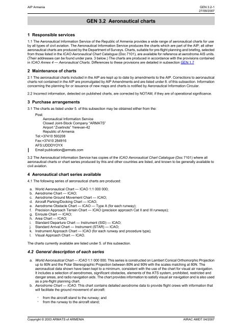
1.1 The Aeronautical In<strong>for</strong>mation Service of the Republic of <strong>Armenia</strong> provides a wide range of aeronautical charts <strong>for</strong> use<br />
by all types of civil aviation. The Aeronautical In<strong>for</strong>mation Service produces the charts which are part of the <strong>AIP</strong>; all other<br />
aeronautical charts are produced by the Department of Surveys. Charts, suitable <strong>for</strong> pre-flight planning and briefing, selected<br />
from those listed in the ICAO Aeronautical Chart Catalogue (Doc 7101), are available <strong>for</strong> reference at aerodrome AIS units.<br />
(Their addresses can be found under para. 3 below.) The charts are produced in accordance with the provisions contained<br />
in ICAO Annex 4 — Aeronautical Charts. Differences to these provisions are detailed in sub<strong>section</strong> GEN 1.7<br />
2 Maintenance of charts<br />
2.1 The aeronautical charts included in the <strong>AIP</strong> are kept up to date by amendments to the <strong>AIP</strong>. Corrections to aeronautical<br />
charts not contained in the <strong>AIP</strong> are promulgated by <strong>AIP</strong> Amendments and are listed under 8. of this sub<strong>section</strong>. In<strong>for</strong>mation<br />
concerning the planning <strong>for</strong> or issuance of new maps and charts is notified by Aeronautical In<strong>for</strong>mation Circular.<br />
2.2 Incorrect in<strong>for</strong>mation, detected on published charts, are corrected by NOTAM, if they are of operational significance.<br />
3 Purchase arrangements<br />
3.1 The charts as listed under 5. of this sub<strong>section</strong> may be obtained either from the:<br />
Post:<br />
Aeronautical In<strong>for</strong>mation Service<br />
Closed Joint-Stock Company “ARMATS”<br />
Airport “Zvartnots” Yerevan-42<br />
Republic of <strong>Armenia</strong><br />
Tel:+37410 593208<br />
Fax:+37410 284916<br />
AFS:UDDDYOYX<br />
Email:publication@armats.com<br />
3.2 The Aeronautical In<strong>for</strong>mation Service has copies of the ICAO Aeronautical Chart Catalogue (Doc 7101) where all<br />
aeronautical charts or chart series produced by this and other countries are listed, and known to be generally available to<br />
civil aviation.<br />
4 Aeronautical chart series available<br />
4.1 The following series of aeronautical charts are produced:<br />
a. World Aeronautical Chart — ICAO 1:1 000 000;<br />
b. Aerodrome Chart — ICAO;<br />
c. Aerodrome Ground Movement Chart — ICAO;<br />
d. Aircraft Parking/Docking Chart — ICAO;<br />
e. Aerodrome Obstacle Chart — ICAO — Type A (<strong>for</strong> each runway);<br />
f. Precision Approach Terrain Chart — ICAO (precision approach Cat II and III runways);<br />
g. Enroute Chart — ICAO;<br />
h. Area Chart — ICAO;<br />
i. Standard Departure Chart — Instrument (SID) — ICAO;<br />
j. Standard Arrival Chart — Instrument (STAR) — ICAO;<br />
k. Instrument Approach Chart — ICAO (<strong>for</strong> each runway and procedure type);<br />
l. Visual Approach Chart — ICAO.<br />
The charts currently available are listed under 5. of this sub<strong>section</strong>.<br />
4.2 General description of each series<br />
a. World Aeronautical Chart — ICAO 1:1 000 000. This series is constructed on Lambert Conical Orthomorphic Projection<br />
up to 80N and the Polar Stereographic Projection between 80N and 90N with the scales matching at 80N. The<br />
aeronautical data shown have been kept to a minimum, consistent with the use of the chart <strong>for</strong> visual air navigation.<br />
It includes a selection of aerodromes, significant obstacles, elements of the ATS system, prohibited, restricted and<br />
danger areas, and radio navigation aids. The chart provides in<strong>for</strong>mation to satisfy visual air navigation and is also used<br />
as a pre-flight planning chart.<br />
b. Aerodrome Chart — ICAO. This chart contains detailed aerodrome data to provide flight crews with in<strong>for</strong>mation that<br />
will facilitate the ground movement of aircraft:<br />
∗<br />
∗<br />
from the aircraft stand to the runway; and<br />
from the runway to the aircraft stand;<br />
Copyright © 2003 ARMATS of ARMENIA<br />
AIRAC AMDT 04/2007
20/01/2005~~~eaip-amdt~~~AIRAC-2005-01<br />
GEN 3.2-2<br />
<strong>AIP</strong> <strong>Armenia</strong><br />
and helicopter movement:<br />
∗<br />
∗<br />
∗<br />
∗<br />
from the helicopter stand to the touchdown and lift-off area and to the final approach and take-off area;<br />
from the final approach and take-off area to the touchdown and lift-off area and to the helicopter stand;<br />
along helicopter ground and air taxiways; and<br />
along air transit routes.<br />
It also provides essential operational in<strong>for</strong>mation at the aerodrome.<br />
c. Aerodrome Ground Movement Chart — ICAO. This chart is produced <strong>for</strong> those aerodromes where, due to congestion<br />
of in<strong>for</strong>mation, details necessary <strong>for</strong> the ground movement of aircraft along the taxiways to and from the aircraft stands<br />
and <strong>for</strong> the parking/docking of aircraft cannot be shown with sufficient clarity on the Aerodrome Chart — ICAO.<br />
d. Aircraft Parking/Docking Chart — ICAO. This chart is produced <strong>for</strong> those aerodromes where, due to the complexity of<br />
the terminal facilities, the in<strong>for</strong>mation to facilitate the ground movement of aircraft between the taxiways and the aircraft<br />
stands and the parking/docking of aircraft cannot be shown with sufficient clarity on the Aerodrome Chart — ICAO or<br />
on the Aerodrome Ground Movement Chart — ICAO.<br />
e. Aerodrome Obstacle Chart — ICAO — Type A (operating limitations). This chart contains detailed in<strong>for</strong>mation on<br />
obstacles in the take-off flight path areas of aerodromes. It is shown in plan and profile view. This obstacle in<strong>for</strong>mation,<br />
in combination with an Obstacle Chart — ICAO — Type C, provides the data necessary to enable an operator to<br />
comply with the operating limitations of ICAO Annex 6, Parts I and II, Chapter 5.<br />
f. Precision Approach Terrain Chart — ICAO. This chart provides detailed terrain profile in<strong>for</strong>mation within a defined<br />
portion of the final approach so as to enable aircraft operating agencies to assess the effect of the terrain on decision<br />
height determination by the use of radio altimeters. This chart is produced <strong>for</strong> all precision approach Cat II and III<br />
runways.<br />
g. En-route Chart — ICAO. This chart is produced <strong>for</strong> the entire YEREVAN FIR. The aeronautical data include all<br />
aerodromes, prohibited, restricted and danger areas and the air traffic services system in detail. The chart provides<br />
the flight crew with in<strong>for</strong>mation that will facilitate navigation along ATS routes in compliance with air traffic services<br />
procedures.<br />
h. Area Chart — ICAO. This chart is produced when the air traffic services routes or position reporting requirements are<br />
complex and cannot be shown on an En-route Chart — ICAO.<br />
It shows, in more detail, those aerodromes that affect terminal routings, prohibited, restricted and danger areas and<br />
the air traffic services system. This chart provides the flight crew with in<strong>for</strong>mation that will facilitate the following phases<br />
of instrument flight:<br />
∗<br />
∗<br />
∗<br />
the transition between the en-route phase and the approach to an aerodrome;<br />
the transition between the take-off/missed approach and the en-route phase of flight; and<br />
flights through areas of complex ATS routes or airspace structure.<br />
i. Standard Departure Chart — Instrument (SID) — ICAO. This chart is produced whenever a standard departure route<br />
— instrument has been established and cannot be shown with sufficient clarity on the Area Chart — ICAO.<br />
The aeronautical data shown include the aerodrome of departure, aerodrome(s) which affect the designated standard<br />
departure route — instrument, prohibited, restricted and danger areas and the air traffic services system. This chart<br />
provides the flight crew with in<strong>for</strong>mation that will enable them to comply with the designated standard departure route<br />
—instrument from the take-off phase to the en-route phase.<br />
j. Standard Arrival Chart — Instrument (STAR) — ICAO. This chart is produced whenever a standard arrival route<br />
—instrument has been established and cannot be shown with sufficient clarity on the Area Chart — ICAO.<br />
The aeronautical data shown include the aerodrome of landing, aerodrome(s) which affect the designated standard<br />
arrival route — instrument, prohibited, restricted and danger areas and the air traffic services system. This chart<br />
provides the flight crew with in<strong>for</strong>mation that will enable them to comply with the designated standard arrival route —<br />
instrument from the en-route phase to the approach phase.<br />
k. Instrument Approach Chart — ICAO. This chart is produced <strong>for</strong> all aerodromes used by civil aviation where instrument<br />
approach procedures have been established. A separate Instrument Approach Chart — ICAO has been provided <strong>for</strong><br />
each approach procedure.<br />
The aeronautical data shown include in<strong>for</strong>mation on aerodromes, prohibited, restricted and danger areas, radio<br />
communication facilities and navigation aids, minimum sector altitude, procedure track portrayed in plan and profile<br />
view, aerodrome operating minima, etc.<br />
This chart provides the flight crew with in<strong>for</strong>mation that will enable them to per<strong>for</strong>m an approved instrument approach<br />
procedure to the runway of intended landing including the missed approach procedure and where applicable, associated<br />
holding patterns.<br />
l. Visual Approach Chart — ICAO. This chart is produced <strong>for</strong> aerodromes used by civil aviation where:<br />
∗<br />
∗<br />
∗<br />
only limited navigation facilities are available; or<br />
radio communication facilities are not available; or<br />
no adequate aeronautical charts of the aerodrome and its surroundings at 1:500 000 or greater scale are available;<br />
or<br />
AIRAC AMDT 01/2005<br />
Copyright © 2004 ARMATS of ARMENIA
<strong>AIP</strong> <strong>Armenia</strong> GEN 3.2-3<br />
~~~eaip-amdt~~~AIRAC-2008-0208/05/2008<br />
∗<br />
visual approach procedures have been established.<br />
The aeronautical data shown include in<strong>for</strong>mation on aerodromes, obstacles, designated airspace, visual approach<br />
in<strong>for</strong>mation, radio navigation aids and communication facilities, as appropriate.<br />
5 List of aeronautical charts available<br />
Title of series<br />
Scale<br />
Name and/or number<br />
Aerodrome Chart – ICAO (AC) 1: 30 000 Yerevan/Zvartnots<br />
1: 25 000 Gyumri/Shirak<br />
1: 30 000 Yerevan/Erebuni<br />
Aerodrome Ground Movement Not to scale Yerevan/Zvartnots<br />
And parking Chart-ICAO<br />
Instrument Approach Chart – 1:300 000<br />
Gyumri/Shirak<br />
Yerevan/Erebuni<br />
Yerevan/Zvartnots<br />
ICAO (IAC)<br />
1:200 000<br />
UDYZ ILSDME 09<br />
UDYZ VOR/DME 09<br />
UDYZ NDB DME 09<br />
UDYZ VOR/DME+NDB 27<br />
Gyumri/Shirak<br />
UDSG ILS 02<br />
UDSG DVOR DME NDB DME 02<br />
Yerevan/Erebuni<br />
Aerodrome Obstacle Chart – 1: 20 000<br />
UDYE NDB 03<br />
Yerevan/Zvartnots<br />
ICAO TYPE A (AOC) 1: 50 000 Gyumri/Shirak<br />
Precision Approach Terrain 1: 5000 Yerevan/Zvartnots<br />
Chart - ICAO (PATC) UDYZ PATC 09<br />
AREA CHART-ICAO 1:1 000 000 Yerevan TMA<br />
1:1 000 000 Gyumri/Shirak TMA<br />
Radar Vectoring Area Chart 1: 100 000<br />
UDSG ARRIVAL 02<br />
UDSG DEPARTURE 20/02<br />
Yerevan/Erebuni TMA<br />
Yerevan TMA (UDYZ)<br />
Visual Approach Chart - ICAO 1: 200 000<br />
Yerevan TMA (UDYE)<br />
Yerevan/Zvartnots UDYZ 09/27<br />
Standard Departure Chart - 1: 500 000<br />
Yerevan/Erebuni UDYE 03/21<br />
Yerevan/Zvartnots<br />
Instrument – ICAO (SID)<br />
Standard Arrival Chart - 1:500 000<br />
UDYZ SID 09<br />
UDYZ SID 27<br />
Yerevan/Erebuni<br />
UDYE SID 03<br />
UDYE SID 21<br />
UDYZ STAR 09<br />
Instrument – ICAO(STAR)<br />
Circle-To-Land<br />
1: 200 000<br />
UDYZ STAR 27<br />
UDYE STAR 03/21<br />
UDYZ RWY 27<br />
En-route Chart – ICAO 1:1 000 000<br />
UDSG RWY 20<br />
Lower<br />
Upper<br />
Price ($)<br />
Date<br />
6 Index to the World Aeronautical Chart (WAC) — ICAO 1:1 000 000<br />
To be developed.<br />
7 Topographical charts<br />
To supplement the aeronautical charts, a wide range of topographical charts is available from:<br />
Copyright © 2003 ARMATS of ARMENIA<br />
AIRAC AMDT 02/2008
08/05/2008~~~eaip-amdt~~~AIRAC-2008-02<br />
GEN 3.2-4<br />
<strong>AIP</strong> <strong>Armenia</strong><br />
Post:<br />
“Geodetic and Charting center”<br />
Closed Joint-Stock Company<br />
Yerevan-51 Republic of <strong>Armenia</strong><br />
Tel:+37410 255449<br />
8 Corrections to charts not contained in the <strong>AIP</strong><br />
NIL<br />
AIRAC AMDT 02/2008<br />
Copyright © 2003 ARMATS of ARMENIA


![KYIV/Boryspil' / ÐÐÐÐ/ÐоÑиÑÐ¿Ð¾Ð»Ñ UKBB AD 2 [] State Aviation ...](https://img.yumpu.com/40921659/1/184x260/kyiv-boryspil-3-4-nn-3-4-n-ukbb-ad-2-state-aviation-.jpg?quality=85)