Base Pack Version 0.9 - Vietnam War project - Free
Base Pack Version 0.9 - Vietnam War project - Free
Base Pack Version 0.9 - Vietnam War project - Free

You also want an ePaper? Increase the reach of your titles
YUMPU automatically turns print PDFs into web optimized ePapers that Google loves.
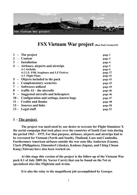
FSX <strong>Vietnam</strong> <strong>War</strong> <strong>project</strong> (<strong>Base</strong> <strong>Pack</strong> <strong>Version</strong> <strong>0.9</strong>)<br />
1 – The <strong>project</strong> page 1<br />
2 – Content page 3<br />
3 – Installation page 4<br />
4 – Airbases, airports and airstrips page 5<br />
4-1 Airfields page 6<br />
4-2 LZ- FSB, Seaplanes and LZ Fictives page 37<br />
4-3 Flight Plans page 41<br />
5 – Objects included in the pack page 43<br />
6 – Complementary sceneries page 43<br />
7 – Softwares utilized page 45<br />
8 – traffic AI – the aircrafts page 46<br />
9 – Suggested aircrafts and helicopters page 46<br />
10 – Configuration and settings, known bugs page 47<br />
11 – Credits and thanks page 48<br />
12 – Sources and links page 50<br />
13 – Legal stuff page 51<br />
1 – The <strong>project</strong><br />
The <strong>project</strong> was motivated by our desire to recreate for Flight Simulator X<br />
the aerial campaign that took place over the countries of South East Asia during<br />
the period 1963 – 1975. For that purpose, airbases, airports and airstrips had to<br />
be recreated for <strong>Vietnam</strong> (North and South), Thailand, Laos and Cambodia.<br />
Furthermore American airbases outside the war zone like Andersen (Guam),<br />
Clark (Philippines), Elmendorf (Alaska), Kadena (Japan), and Ching Chuan<br />
Kang (Taiwan) have also been worked on.<br />
At this stage this version of the <strong>project</strong> is the follow-up of the <strong>Vietnam</strong> <strong>War</strong><br />
pack 0.1 of July 2009 (by Xavier Carré) that can be found on the Net at<br />
specialized sites like Flightsim and Avsim.<br />
It is also the relay to the magnificent job accomplished by Georges<br />
1
Kwowles who, under Flight Simulator 2002, provided the community of flight<br />
simmers with a virtual reproduction of most of the military airports located in<br />
South <strong>Vietnam</strong>. We would have liked to bring him under the <strong>project</strong>.<br />
Unfortunately we have not been able to contact him.<br />
Throughout our work we have been<br />
faced with changing pictures of<br />
airports and airstrips being modified<br />
over the whole period of the war. The<br />
same can be said about the aircrafts.<br />
What you will see in the <strong>Vietnam</strong> <strong>War</strong><br />
pack is therefore the result of an<br />
arbitrary choice we made to represent<br />
airstrips and airports (like Ben Het) at<br />
the time when major military<br />
operations or significant ground battles<br />
took place (invasion of Cambodia by 1 st<br />
Cavalry and the role of Kontum is an<br />
example).<br />
Column of M113 at Dak To ( M113 from Al<br />
Simms)<br />
The same can be said about aircrafts that will be found together with aircrafts,<br />
which were only for a short time on the aerial theatre.<br />
AI traffic found in this pack in still rudimentary. It will evolve with time, and the<br />
development of more powerful machines. The AI traffic will be linked with<br />
major military operations.<br />
This version is <strong>0.9</strong> base pack. It will be improved, others airfields will be added<br />
later.<br />
AI packs, Operations packs and Mission packs will be added later.<br />
Take a look at the <strong>project</strong> website for news : FSX <strong>Vietnam</strong> <strong>War</strong> <strong>project</strong><br />
You will find some airplanes textures, downloads links to airplanes and other<br />
objects libraries, and more...<br />
This <strong>project</strong> is open, AI airplanes, objects, sceneries, missions authors are<br />
welcome, you can contact us at : vietnamwar.<strong>project</strong>@free.fr<br />
We are looking for Navy operations , AI carrier (USS Enterprise, USS Intrepid),<br />
and Navy AI airplanes.<br />
Also AI helicopters are welcome.<br />
2
2 – The content<br />
5 folders :<br />
The sceneries folders :<br />
• <strong>Vietnam</strong> <strong>War</strong> <strong>project</strong> containing the airbases, airports and airstrips as well as<br />
the complementary sceneries ; (scenery and texture folders)<br />
• <strong>Vietnam</strong> <strong>War</strong> fictive LZ (optional) ; small fictious airstrips wich purpose is<br />
the challenge of approach, and landing (scenery and texture folders)<br />
• <strong>Vietnam</strong> <strong>War</strong> <strong>project</strong> Under Fire (optional): some of the <strong>project</strong> airfields in<br />
war conditions (scenery and texture folders)<br />
AI airplanes folder :<br />
• VnW AI airplanes containing appropriate files ; (Model and textures<br />
folders) and author readme.<br />
Documentation folders<br />
• VnW Documentation containing<br />
the related documentation<br />
• The technical leaflets of the<br />
airports and airstrips (TAD<br />
Technical Airport<br />
Documentation) : a small pdf file<br />
(Adobe reader – freeware, needed,<br />
you can find it here : Adobe )<br />
containing geographical and<br />
airfields data (length, comms,<br />
navaids...) and an airfield map.<br />
• Flight plans VFR VnW : These<br />
flight plans suggested to discover<br />
the various airfields of area.<br />
xxxx.PLN must be copied in file<br />
« My documents /files Flight<br />
Simulator X<br />
3
3 - Installation<br />
VERY IMPORTANT – BEFORE INSTALLATION:<br />
If the sceneries of <strong>Vietnam</strong> <strong>War</strong> <strong>Pack</strong> 0.1 (Pleiku, Cam Ranh, Dak To et LZ<br />
Alpha July 2009) have been installed, they must be now removed from FSX.<br />
1 - Start FSX. In FSX main page, go to Settings > Addon Scenery, and browse to<br />
locate to the location of the sceneries folders called: Dak To, Cam Ranh, Pleiku<br />
and LZ Alpha.<br />
2 - Select one by one, then click delete a zone, and confirm.<br />
3 - Re-start FSX, and check that they no longer appear in the folder C: \<br />
Program Files \ Microsoft Games \ Microsoft Flight Simulator X \ Addon<br />
Scenery (default path for FSX in XP environment), otherwise delete .<br />
For beta testers the same procedure to remove <strong>Vietnam</strong> <strong>War</strong> <strong>project</strong> test.<br />
Crashed A-1 Skyraider (A-1 from Tim Piglet Conrad)<br />
INSTALLATION:<br />
To install the new pack, theses procedures must be followed :<br />
1 - Extract the archive file into a temporary folder.<br />
Then, launch the FSX <strong>Vietnam</strong> <strong>War</strong> <strong>project</strong>.exe file<br />
AUTOMATIC INSTALLATION (for any default installation of FSX)<br />
check FSX path during installation , you can choose another install path if<br />
necessary (if used another drive than C:)<br />
OR<br />
4
MANUAL INSTALLATION: when selecting during installation, you can choose<br />
another folder temporarily, then<br />
1 - copy the <strong>Vietnam</strong> <strong>War</strong> <strong>project</strong> folders (which contain scenery and texture<br />
sub-folders) and paste in the Microsoft Flight Simulator X folder / addon<br />
scenery<br />
2 - copy the contents of the folder: / simObjects / airplanes (VNW AI airplanes)<br />
and paste in Microsoft Flight Simulator X / simObjects / airplanes<br />
3 - Copy the file VNW Document Library folder and paste in Microsoft Flight<br />
Simulator X folder<br />
Then:<br />
- Start FSX, go to Settings > Addon Scenery, and browse to the location of the<br />
<strong>Vietnam</strong> <strong>War</strong> <strong>project</strong> folders that you want to install : <strong>Vietnam</strong> <strong>War</strong> <strong>project</strong>,<br />
<strong>Vietnam</strong> <strong>War</strong> <strong>project</strong> Under Fire, <strong>Vietnam</strong> <strong>War</strong> <strong>project</strong> Fictive LZ (normally in<br />
FSX / addon scenery) , they should then appear at the top of your Addon<br />
Scenery list.<br />
VERY IMPORTANT:<br />
The <strong>Vietnam</strong> <strong>War</strong> Project Under Fire scenery must be above the 2 others<br />
<strong>Vietnam</strong> <strong>War</strong> <strong>project</strong> sceneries to take advantage of its additional scenes.<br />
- Restart FSX, choose free flight and select airfields from <strong>Vietnam</strong>, or load a<br />
flight plan provided<br />
IMPORTANT: Do not forget to disable the <strong>Vietnam</strong> <strong>War</strong> <strong>project</strong> sceneries to go<br />
fly in 2009.<br />
4 - Airports and airstrips<br />
The technical leaflets (TAD for each airfield, PDF file) may be consulted to<br />
obtain more information about airbases, airports and airstrips listed hereunder.<br />
Most of the airports and airstrips are built with heli-starts so that software<br />
Helitrafic from Flight1 may be utilized to increase the realism of the <strong>project</strong>.<br />
NOTA : most of the airports are not lighted. Only the airbases located in<br />
Thailand and those in <strong>Vietnam</strong>, Cambodia and Laos likely to take night traffic<br />
5
are illuminated<br />
Ben Het airstrip and SF camp<br />
Republic of South <strong>Vietnam</strong><br />
A Shau Valley SF camp VVAS<br />
• N 16.08 E 107.19 Alt 591 m / 1939ft<br />
• Runway 14/32 Tôle/Steel-mats. Longueur/Length:<br />
646m/2120ft Largeur/Width: 25m/821ft<br />
• Tower : 128.500<br />
• Fuel : No Eclairage des pistes/ runway lights : None<br />
An Thoi VVAT<br />
• N 10.01 E 104.01 Alt 6 m / 20ft<br />
• Runway 13/31 Steel-mats Longueur/Length:<br />
1200m/3940ft Largeur/Width: 20m/65ft<br />
• Tower : 136.075<br />
• Fuel : No Runway lights : No<br />
Bac Lieu VVBL<br />
• N 09.18 E 105.43 Alt. 3 ft<br />
• Runway 16/34 Steel mats. Longueur/Length:<br />
6
700m/2300ft Largeur/Width: 16m/50ft<br />
• Tower : 136.400<br />
• Fuel : Yes Runway lights : No<br />
Ban Me Thuot (Buon Me Thuot) VVBM (VVSB)<br />
• N 12.39.96 E 108.06.86 Alt 1600 ft<br />
• Runway 09/27 Asphalt /ASP Length 5400ft Width 90ft<br />
• Tower 121.400 – 122.500<br />
• Fuel : Yes Runway lights : no<br />
• Navaids : TACAN (VOR/DME) : BMT 117.950<br />
Ben Het VVB1<br />
• N 14.40 E 107.40 Alt 669m/2195 ft<br />
• Runway 08/26 Tôle/Steel-mat Longueur/length:<br />
600m/1970ft, Largeur/width: 20m/65ft<br />
• No comms, no fuel runway lights : no<br />
Bien Hoa Air Force <strong>Base</strong> VVBH<br />
• N 10.58 E 106.49 Alt 1m/3ft<br />
• Runway 9L/27R Concrete Longueur/Length:<br />
3048m/10000ft Largeur/Width: 50m/165ft<br />
• Runway 9R/27L Concrete Longueur/Length:<br />
3048m/10000ft Largeur/Width: 50m/165ft<br />
• Tower : 121.400 App.: 124.525 Ground : 130.425<br />
• Fuel : yes runway lights : Yes<br />
• Navaids : cf : Tan Son Nhut<br />
• Historical information Bien Hoa AFB at Wikipedia<br />
Binh Thuy – Tra Noc (Can Tho) VVBT (VVCT)<br />
• N 10.05 E 105.43 Alt. 2m / 7ft<br />
• Runway 06/24 Asphalt/ASP Longueur/Length:<br />
7
2450/8038ft Largeur/Width: 37m/121ft<br />
• Tower : 133.025 Fuel : yes Runway lights : yes<br />
• Navaids : NDB : CT (CAN THO) : 420.000 VOR/DME :<br />
BHT ( BINH THUY) : 108.200<br />
• Caution : pylon end runway 06<br />
• Historical information Binh Thuy AFB at Wikipedia<br />
Bu Krak VVBU<br />
• N 12.15 E 107.17 Alt 842m/2762ft<br />
• Runway 01/09 Dirt Longueur/Length: 540m/1770ft<br />
Largeur/Width: 20m/65ft<br />
• Tower : 132.500<br />
• Fuel : no Runway lights : no<br />
Cam Ranh bay AFB VVCR<br />
• N 11.59 E 109.13 Alt : 12 m /40ft<br />
• Runway 02L/20R Concrete Longueur/Length :<br />
3048m/10000ft Largeur/Width: 50m /164ft<br />
• Runway 02R/20L Asphalt Longueur/Length :<br />
3048m/10000ft Largeur/Width: 35m/114ft<br />
• Tower : 120.725 Ground : 130.400<br />
• Fuel : all. fuel truck available 14th aerial port<br />
parking Runway lights : Yes<br />
• Navaids : NDB : NDBA (Cam Ranh) : 240.000<br />
TACAN ( VOR/DME) : VORA (Cam Ranh AFB) :<br />
108.200 at field<br />
• ILS runway : 02L/20R<br />
• Historical information Cam Ranh AFB at Wikipedia<br />
8
P-3 Orion, and RAF Avro Shackleton at Cam Ranh AFB, 1971 (P-3 by the KBT Team,<br />
Shakleton by Paul Foster)<br />
Cam Ranh army airfield VVCA<br />
• N 11.54 E 109.12 Alt 1m/3ft<br />
• Runway 36/18 Tôle /Steel-mats Longueur/Length:<br />
830m/2723ft Largeur/Width: 40m/130ft<br />
• Tower : 121.850<br />
• Fuel : none Runway lights : no<br />
Can Tho army airfield (Can Tho) VVCO<br />
• N 10.03 E 105.45 Alt 2m/ 6ft<br />
• Runway 08/26 Tôle/Steel-Mats Longueur/Length:<br />
1200m/3937ft Largeur/Width: 30m/100ft<br />
• Tower : 132.725 Fuel : yes Runway lights : No<br />
• Airports in use by Army and Air America<br />
Cao Lanh - Tan Tich Army VVTT<br />
• N 10.25 E 105.38 Alt 7m/23ft<br />
• Runway 07/25 Gravel Longueur/Length:<br />
470m/1542ft Largeur/Width: 15m/50ft<br />
• Tower : 124.3750 Fuel : yes Runway lights : No<br />
9
Chu Laï AFB, Lockheed EC-121 <strong>War</strong>ning Star ramp<br />
Chu Laï Air Force <strong>Base</strong> VVCH<br />
• N 15.24 E 108.42 Alt 9 m / 30ft<br />
• Runway 14/32 Concrete Longueur/Length:<br />
3050m/10000ft Largeur/Width: 46m/150ft<br />
• Runway 14L/32R Asphalt Longueur/Length:<br />
2362m/7750ft Largeur/Width: 35m/115ft<br />
• Runway 03/21 Tôle/Steel-mats. Longueur/Length:<br />
1523m/5000ft Largeur/Width: 30m/100ft<br />
• Tower : 136.425 Ground : 130.475<br />
• Fuel : yes Eclairage des pistes/ runway lights : Yes<br />
• Navaids : NDB : NDCL (CHU LAI) 382.00<br />
VOR-DME : CHULA (CHU LAI ) 108.20<br />
• ILS : R32 (108.35)<br />
Con Son airfield VVCS<br />
• N 08.43 E 106.38 Alt 6m/20 ft<br />
• Runway 11/29 Asphalt/ASP Longueur/Length:<br />
1130m/3700ft Width: 30m/100ft<br />
• Tower : 123.000<br />
• Fuel : none Rrunway lights : No<br />
• Navaids : NDB : CS (CONSON) : 333.000<br />
Da Lat – Camly VVCL<br />
• N 11.56 E 108.24 Alt 1505m/4937 ft<br />
• Runways 28R/10L Asphalt /ASP Longueur/Length:<br />
1390m/4560ft Largeur/Width: 28m/91ft<br />
• 28L/10R Asphalt/ASP Longueur/Length:<br />
10
1390m/4560ft largeur/Width: 40m/131ft<br />
• Tower : Dalat 118.400<br />
• Fuel: Yes Runway lights : Yes<br />
• Navaids : NDB : CL (CAMLY) : 350.000 at airfield<br />
•<br />
Dalat - Lienkhoung VVDL<br />
• N 11.45 E 108.22 Alt 961 m / 3153ft<br />
• Runway 09/27 Asphalt Longueur/Length:<br />
1500m/4921ft Largeur/Width: 37m/121ft<br />
• Tower : 118.400<br />
• Fuel : yes Eclairage des pistes/ runway lights : None<br />
• Navaids : NDB : HYD (DALAT) 312.00<br />
Da Nang Air Force <strong>Base</strong> VVDN<br />
• N 16.02 E 108.12 Alt 32ft<br />
• Runway 17L/35R Asphalt Longueur/Length:<br />
3061m/10043ft Largeur/Width: 45m/147ft<br />
• Runway 17R/35L Asphalt Longueur/Length:<br />
3061m/10043ft Largeur/Width: 45m/147ft<br />
• Tower : 125.000 App.: 119.500, 125.300 Ground :<br />
121.600, 121.900<br />
• Fuel : yes Runway lights : Yes ILS : 35R<br />
• Navaids : NDB : D (DA NANG) 243.00<br />
• VOR-DME : DAN (DANANG) 114.400<br />
• Historical information Da Nang AFB at Wikipedia<br />
Dak Pek Special Forces camp VVKK<br />
• N 15.04 E 107.44 Alt 693m/2273 ft<br />
• Runway 02/20 Clay Longueur/Length: 600m/1970ft<br />
Largeur/Width: 20m/65ft<br />
• Comms. : none<br />
• Fuel : none Runway lights : No<br />
11
Dak To 2 VVDT<br />
• N 14.39 E 107.46 Alt 595m/1952ft<br />
• Runway 10/28 Asphalt Longueur/Length: 1280/4200ft<br />
Width: 30m/98ft<br />
• Tower : 118.925<br />
• Fuel : yes Runway lights : No<br />
• Navaids : NDB : DT (DAK TO) : 198.000 at field<br />
• This airport replaces the old Dak To airfield considered<br />
as badly located and too short.<br />
Dong Ba Thin (Cam Ranh bay) VVD1<br />
• N 12.01 E 109.11 Alt 1 m/ 3ft<br />
• Runway 14/32 Asphalte/ASP Longueur/Length:<br />
750m/2460ft Largeur/Width: 20 m/65ft<br />
• Tower : 128.800<br />
• Fuel : yes Eclairage des pistes/ runway lights : No<br />
Dong Ha VVDH<br />
• N 16.48 E 107.06 Alt 2 m / 6ft<br />
• Runway 07/25 Tôle/Steel-mats. Longueur/Length:<br />
1150m/3773ft Largeur/Width: 25m/82ft<br />
• Tower : 119.375<br />
• Fuel : Yes Eclairage des pistes/ runway lights : No<br />
Duong Dong (Phu Quoc) VVPQ<br />
• N 10.13 E 103.57 Alt 7 m / 23ft<br />
• Runway 08/26 Asphalt Longueur/Length:<br />
1100m/3600ft Largeur/Width: 30m/100ft<br />
• Tower : 118.100 118.600<br />
• Fuel : No Eclairage des pistes/ runway lights : No<br />
• Navaids.: NDB : PQ (PHUQUOC) : 278.00<br />
Gia Nghia VVGN<br />
• N 12.01 E 107.41 Alt 622m/2040ft<br />
• Runway 18/36 Terre/Dirt Length: 650m/2132ft<br />
12
Width: 25m/82ft<br />
• Tower : 126.750 Fuel : yes<br />
Ha Tien VVHT<br />
Ha Tien harbour helipad<br />
• N 10.24 E 104.27 Alt 1 m / 3ft<br />
• Runway 07/25 Terre/Dirt Longueur/Length:<br />
650m/2132ft Largeur/Width: 18m/60ft<br />
• No comms.<br />
• Fuel : No Runway lights : No<br />
Ha Tien South VVHA<br />
• N 10.21 E 104.29 Alt. 6m/20 ft<br />
• Runway 06/24 Oil treated Longueur/Length:<br />
460m/1500ft Largeur/Width: 12m/40ft<br />
• Tower : No comms.<br />
• Fuel : None Runway lights : None<br />
Hué Citadel VVHU<br />
• N 16.28 E 107.34 Alt. 2m/6 ft<br />
• Runway 12/30 Gravel Longueur/Length:<br />
800m/2624ft Largeur/Width: 18m/60ft<br />
13
• Tower : No comms.<br />
• Fuel : None Runway lights : None<br />
• Located in the citadel, considered as very dangerous.<br />
Kham Duc VVKD<br />
• N 15.26 E 107.47 Alt 369m/1210ft<br />
• Runway 04/22 Asphalt/ASP Longueur/Length:<br />
1600m/5250ft Largeur/Width: 40m/131ft<br />
• Tower : 129.775<br />
• Fuel : yes Runway lights : No<br />
• Caution : airport may be under fire<br />
• About battle of Kham Duc and heroïc intervention of C-<br />
123 pilots : Kham Duc at Wikipedia<br />
Khe Sanh USMC combat base VVKS<br />
• N 16.39 E 106.44 Alt 478 m / 1569ft<br />
• Runway 10/28 Tôle/Steel-mats. Longueur/Length:<br />
1100m/3610ft Largeur/Width: 26m/85ft<br />
• Tower : 131.750<br />
• Fuel : no Eclairage des pistes/ runway lights : no<br />
• Caution ; High risk airsritp, under fire<br />
• About battle of Khe Sanh : Battle of Khe Sanh at<br />
Wikipedia<br />
Kontum VVKT<br />
• N 14.21 E 108.01 Alt 542m/1779ft<br />
• Runway 09/27 Asphalt/ASP Longueur/Length:<br />
1200m/3937ft Largeur/Width: 30m/100ft<br />
• Tower : 134.225<br />
• Fuel : yes Runway lights : No<br />
Long Xuyen VVLX<br />
• N 10.19 E 105.28 Alt 3 m / 10ft<br />
• Runway 08/26 Gravel Longueur/Length:<br />
1036m/3400ft Largeur/Width: 28m/90ft<br />
• Tower : 130.550<br />
14
• Fuel : yes Eclairage des pistes/ runway lights : No<br />
• Caution : gravel mounds each side of the runway – Tas<br />
de graviers des 2 côtés de la piste.<br />
Mang Buk VVMB<br />
• N 14.50 E 108.11 Alt. 1203m/ 3948ft<br />
• Runway 11/29 Terre/Dirt Longueur/Length:<br />
700m/2300ft Largeur/Width: 20m/65ft<br />
• Tower , Fuel : none Runway lights : No<br />
Marble mountain VVMM<br />
• N 16.02 E 108.15 Alt 9m/29ft<br />
• Runway 16/34 Asphalt Longueur/Length:<br />
1500m/4920ft largeur/Width: 20m/65ft<br />
• Tower : 127.600<br />
• Fuel : yes Runway lights : no<br />
• Navaids : NDB : D (DA NANG) 243.00 VOR-DME :<br />
DAN (DANANG) 114.400<br />
Nam Can VVNC<br />
• N 08.44 E 104.58 Alt 1 m / 3ft<br />
• Runway 9/27 Gravier/Gravel Longueur/Length:<br />
950m/3116ft Largeur/Width: 30m/100ft<br />
• Tower : No comms.<br />
• Fuel : None Eclairage des pistes/ runway lights : None<br />
•<br />
Nha Trang VVNT<br />
• N 12.13 E 109.11 Alt 5 m / 16ft<br />
• Runway 12/30 Asphalte/ASP Longueur/Length:<br />
1980m/6490ft Largeur/Width: 50m/164ft<br />
• Tower : 123.300 Sol/Ground : 129.925<br />
• Fuel : yes Eclairage des pistes/ runway lights :<br />
Yes<br />
15
• Navaids : VOR/DME : VONA (NHA TRANG) : 108.000<br />
sur l'aéroport/at field<br />
• NDB : NT (NHA TRANG) : 528.000<br />
• ILS on runways 12/30<br />
• Historical information : Nha Trang AFB at Wikipedia<br />
Phan Rang Air Force <strong>Base</strong> VVPA<br />
• N 11.38 E 108.57 Alt 24 m / 80ft<br />
• Runway 04L/22R Concrete Longueur/Length:<br />
3050m/10000ft Largeur/Width: 45m/147ft<br />
• Runway 04R/22L Tôle/Steel mats. Longueur/Length:<br />
3050m/10000ft Largeur/Width: 32m/105ft<br />
• Tower : 121.350 Ground : 120.650<br />
• Fuel : yes Eclairage des pistes/ runway lights : Yes<br />
• Navaids : VOR-DME : PHAR (PHAN RANG) 108.200<br />
• ILS : 22R<br />
• Historical information : Phan Rang AFB at Wikipedia<br />
Phan Thiet VVPT<br />
• N 10.55 E 108.07 Alt 2 m / 6ft<br />
• Runway 07/25 Tôle/Steel-mats Longueur/Length:<br />
1200m/3937ft Largeur/Width: 23m/75ft<br />
• Tower : 126.075 Fuel : yes Eclairage des pistes/ runway<br />
lights : No<br />
Phu Baï VVPB<br />
• N 16.23 E 107.42 Alt 13 m / 43ft<br />
• Runway 9/27 Asphalte/ASP Longueur/Length:<br />
1900m/6240ft Largeur/Width: 35m/115ft<br />
• Tower : 118.000<br />
• Fuel : yes Eclairage des pistes/ runway lights : Yes<br />
16
Phu Cat AFB, C-7 Caribou ramp<br />
Phu Cat AFB VVPC<br />
• N 13.56 E 109.02 Alt 31 m / 101ft<br />
• Runway 15/33 Concrete Longueur/Length:<br />
3064m/10052ft Largeur/Width: 45m/150ft<br />
• Tower : 118.600 Ground : 126.225<br />
• Fuel : yes Eclairage des pistes/ runway lights : yes<br />
• Navaids: NDB : C (PHUCAT) 388.00 VOR-DME : PCA<br />
(PHUCAT) : 116.300<br />
• Historical information : Phu Cat AFB at Wikipedia<br />
Plateau GI Chuong Nghia VVPG<br />
• N 14.35 E 108.17 Alt 1174 m /3851 ft<br />
• Runway 07/25 Terre/Dirt Longueur/Length:<br />
850m/2788ft Largeur/Width: 26m/85ft<br />
• Tower : 126.850<br />
• Fuel : none Eclairage des pistes/ runway lights : No<br />
Pleiku AFB VVPK<br />
• N 14.00 E 108.01 Alt 741 m / 2431 ft<br />
• Runway 09/27 Asphalt Longueur/Length: 1800m/<br />
5905ft Largeur/Width : 38 m/124ft<br />
• Tower : 118.100<br />
• Fuel : yes Eclairage des pistes/ runway lights :<br />
Yes<br />
• Navaids : NDB : PK (PLEIKU) : 282.000 sur<br />
l'aéroport/at field<br />
• Historical information : Pleiku AFB at Wikipedia<br />
17
Pleiku Camp Holloway US Army airfield VVPK<br />
• N 13.58.47 E 108.02.17 Alt 741 m /<br />
2223 ft<br />
• Runway 05/23 Tôle/Steel-mat. Longueur/Length:<br />
1200m/3600ft Largeur/Width : 50 m/150ft<br />
• Tower : 136.525<br />
• Pleiku tower : 118.100<br />
• Fuel : yes Eclairage des pistes/ runway lights : No<br />
• Important:<br />
• pour atterrir/ to land at C. Holloway choisir/choose<br />
runway 05/23 at ATC.<br />
• Pour décoller/to take off depuis/from C. Holloway<br />
choisir/choose runway 05/23 at FSX start choice<br />
Quang Long – Ca Mau VVCM<br />
• N 09.11 E 105.10 Alt. 2 m / 7 ft<br />
• Runway 09/27 Tôle/Steel mats. Longueur/Length:<br />
1080m/3543ft Largeur/Width: 30m/100ft<br />
• Tower : No comms<br />
• Fuel : No Eclairage des pistes/ runway lights : No<br />
Quang Tri VVQT<br />
• N 16.46 E 107.09 Alt 10 m / 32ft<br />
• Runway 14/32 Tôle/Steel-mat. Longueur/Length:<br />
1150m/3773ft Largeur/Width: 30m/100ft<br />
• Tower : 135.050<br />
• Fuel : yes Eclairage des pistes/ runway lights : No<br />
Qui Nhon AFB VVQI<br />
• N 13.45 E 109.13 Alt 8 m / 26ft<br />
• Runway 18/36 Asphalt Longueur/Length:<br />
18
1550m/5085ft Largeur/Width: 30m/100ft<br />
• Tower : 125.325<br />
• Fuel : yes Eclairage des pistes/ runway lights : yes<br />
• Navaids: NDB : QNH (QUI NHON) 455.00<br />
Rach Gia VVRG<br />
• N 09.56 E 105.08 Alt 2 m / 7ft<br />
• Runway 08/26 Asphalt Longueur/Length:<br />
1500m/4920ft Largeur/Width: 30m/100ft<br />
• Tower : 118.300<br />
• Fuel : yes Eclairage des pistes/ runway lights : No<br />
• Navaids.: NDB : RG (RACHGIA) : 335.00<br />
Red Beach VVRB<br />
N 16.05 E 108.08 Alt 6 m / 20ft<br />
• Runway 13/31 Tôle/Steel-mats Longueur/Length:<br />
600m/1970ft Largeur/Width: 20m/66ft<br />
• No comms.<br />
• Fuel : No Eclairage des pistes/ runway lights : No<br />
Soc Trang VVBX<br />
• N 09.34 E 105.57 Alt. 5 m / 16 ft<br />
• Runway 04/22 Asphalte/ASP. Longueur/Length:<br />
1040m/3400ft Largeur/Width: 20m/65ft<br />
• Tower : 124.150<br />
• Fuel : Yes Eclairage des pistes/ runway lights : No<br />
•<br />
Tan Son Nhut (Tansonnhat) Saïgon VVTS<br />
N 10.49 E 106.39 Alt 10 m / 32ft<br />
• Runway 07L/25R Concrete Longueur/Length:<br />
3055m/10000ft Largeur/Width: 50m/164ft<br />
19
• Runway 07R/25L Concrete Longueur/Length:<br />
3042m/10000ft Largeur/Width: 50m/164ft<br />
• Tower : 118.700 130.000 App.: 120.100 125.500 134.100<br />
Atis: 128.000 Ground: 121.600 121.900<br />
• Fuel : yes Eclairage des pistes/ runway lights : Yes<br />
ILS 07L/25R<br />
• Navaids : VOR+DME : SAIGON TAN SON NHUT<br />
VTSN : 108.200 sur l'aéroport/at field<br />
• NDB : SAIGON NTSN : 448.000 sur l'aéroport/at field<br />
• Historical information : Tan Son Nhut AFB at<br />
Wikipedia<br />
Tay Ninh city VVTY<br />
• N 11.18 E 106.06 Alt 16 m / 52ft<br />
• Runway 02/20 Tôle/Steel-mats. Longueur/Length:<br />
640m/2100ft Largeur/Width: 16m/52ft<br />
• No comms.<br />
• Fuel : no Eclairage des pistes/ runway lights : no<br />
Tay Ninh west VVTN<br />
• N 11.29 E 106.03 Alt 12 m / 39ft<br />
• Runway 02/20 Asphalt Longueur/Length:<br />
1260m/4134ft Largeur/Width: 24m/79ft<br />
• Tower : 128.725<br />
• Fuel : no Eclairage des pistes/ runway lights : no<br />
Tuy Hoa Air Force <strong>Base</strong> – Dong Tac VVTH<br />
• N 13.02 E 109.20 Alt 10 m / 32ft<br />
• Runway 03R/21L Tôle/Steel-mats. Longueur/Length:<br />
2745m/9006ft Largeur/Width:45m/147ft<br />
• Runway 03L/21R Concrete Longueur/Length:<br />
2900m/9515ft Largeur/Width: 45m/147ft<br />
• Runway 03A/21B Asphalt Longueur/Length:<br />
1020m/3346ft Largeur/Width: 30m/98ft<br />
• Tower : 118.900<br />
20
• Fuel : yes Eclairage des pistes/ runway lights : 03L/21R<br />
• Navaids : NDB : TH (TUY HOA) 200.00<br />
• Historical information : Tuy Hoa AFB at Wikipedia<br />
Vung Tau VVVT<br />
• N 10.22 E 107.05 Alt 2 m / 6ft<br />
• Runway 18/36 Asphalte/ASP Longueur/Length:<br />
1620m/5315ft Largeur/Width: 30m/100ft<br />
• Runway 12/30 Tôle/steel-mat Longueur/Length:<br />
650m/12132ft Largeur/Width: 20m/65ft<br />
• Tower : 120.175<br />
• Fuel : yes Eclairage des pistes/ runway lights :<br />
Yes<br />
• Navaids : NDB : XVL (VUNG TAU) : 235.000 sur<br />
l'aéroport/at field<br />
• VOR : VTV ( VUNG TAU) : 114.700 sur l'aéroport/at<br />
field<br />
Antonov AN-2, ang Mig-21 (static Mig-21 from Guy Diotte)<br />
North <strong>Vietnam</strong><br />
Bac Mai – Hanoï VVBA<br />
• N 20.59 E 105.49 Alt 10 m / 32ft<br />
• Runway 15/33 Concrete Longueur/Length:<br />
21
1300m/4265ft Largeur/Width: 40m/131ft<br />
• Tower : 134.525<br />
• Fuel : yes Eclairage des pistes/ runway lights : Yes<br />
Dien Bien Phu VVDB<br />
• N 21.23 E 103.00 Alt 460m/1509ft<br />
• Runway 16/34 Planks Longueur/Length:<br />
1830m/6000ft largeur/Width: 30m/98ft<br />
• Tower : 118.700<br />
• Fuel : no Runway lights : no<br />
Haïphong Catbi VVCI<br />
• N 20.49 E 106.43 Alt 4 m / 13ft<br />
• Runway 07/25 Concrete Longueur/Length:<br />
2354m/7725ft Largeur/Width: 50m/165ft<br />
• Tower : 118.500<br />
Fuel : yes Eclairage des pistes/ runway lights : Yes<br />
Navaids : NDB : B (HAIPHONG) 327.00<br />
VOR-DME : CAB (CATBI HAIPHONG) 115.100<br />
Na San VVNS<br />
• N 21.12 E 104.02 Alt 669 m / 2195ft<br />
• Runway 12/30 Planches/Planks Longueur/Length:<br />
2409m/7903ft Largeur/Width: 45m/147ft<br />
• Tower : 118.400<br />
Fuel : yes Eclairage des pistes/ runway lights : No<br />
Noibaï (Hanoï) VVNB<br />
• N 21.13 E 105.48 Alt 12 m / 39ft<br />
• Runway 11/29 Béton/Concrete Longueur/Length:<br />
3200m/10500ft Largeur/Width: 45m/147ft<br />
• Tower: 118.200 118.800 App.Hanoï: 125.900 132.300<br />
22
App Noibaï.:119.600 121.000 Atis:127.000<br />
• Fuel : yes Eclairage des pistes/ runway lights : No<br />
• Navaids : NDB: KW (NOIBAI) : 320.000 – K (NOIBAI<br />
INTL) 230.000sur l'aéroport/at field<br />
• VOR-DME : NOB ( NOIBAI) : 116.100 sur l'aéroport/at<br />
field<br />
Phuc Yen VVPY<br />
• N 21.18 E 105.43 Alt 28 m / 92ft<br />
• Runway 15/33 Concrete Longueur/Length:<br />
1400m/4595ft Largeur/Width: 40m/131ft<br />
• Tower : 130.525<br />
• Fuel : yes Eclairage des pistes/ runway lights : Yes<br />
• Navaids : NDB : NDBA (PHUY) 225.00<br />
VOR-DME : PHUC (PHUC YEN) 108.200<br />
Vinh VVVH<br />
• N 18.44 E 105.40 Alt 5 m / 16ft<br />
• Runway 17/35 Concrete Longueur/Length:<br />
2186m/7172ft Largeur/Width: 45m/147ft<br />
• Tower : 125.425<br />
• Fuel : yes Eclairage des pistes/ runway lights : None<br />
• Navaids : NDB : X (VINH) 448.00<br />
VOR-DME : VINB (VINH) 113.100<br />
Cambodia<br />
Battambang VDBG<br />
• N 13.05 E 103.13 Alt 18 m / 60ft<br />
23
• Runway 07/25 Asphalt Longueur/Length:<br />
1605m/3266ft Largeur/Width: 34m/111ft<br />
• Tower : 122.400<br />
• Fuel : yes Eclairage des pistes/ runway lights : Yes<br />
• Navaids : NDB : BB (BATTAMBANG) 484.00<br />
• VOR-DME : BANT (BATTAMBANG) 108.200<br />
Kratie VDKT<br />
• N 12.29 E 106.03 Alt 30 m / 100ft<br />
• Runway 03/21 Terre/Dirt Longueur/Length:<br />
1100m/3610ft Largeur/Width: 30m/100ft<br />
• No comms.<br />
• Fuel : No Eclairage des pistes/ runway lights : No<br />
• Navaids : None<br />
• Unfriendly, unusable – Hostile, non utilisable<br />
Phnom Penh VDPP<br />
• N 11.32 E 104.50 Alt 12 m / 40ft<br />
• Runway 05/23 Asphalt Longueur/Length:<br />
2133m/7000ft Largeur/Width: 40m/130ft<br />
• Tower : 118.000 App.: 123.800<br />
• Fuel : yes Eclairage des pistes/ runway lights : Yes<br />
• Navaids : NDB : PNP (PHNOM PENH) 365.00<br />
• ILS : R 23 (PNP)<br />
Ratanakiri VDRK<br />
• N 13.43 E 106.59 Alt 324 m / 1063ft<br />
• Runway18/36 Terre/Dirt Longueur/Length:<br />
715m/2345ft Largeur/Width: 30m/100ft<br />
• No Comms<br />
• Fuel : no Eclairage des pistes/ runway lights : no<br />
• Navaids : no<br />
• Unfriendly, unusable – Hostile, non utilisable<br />
24
Sihanoukville VDSV<br />
• N 10.35 E 103.37 Alt 10 m / 32ft<br />
• Runway 03/21 Asphalt Longueur/Length:<br />
1200m/3937ft Largeur/Width: 34m/111ft<br />
• Tower : 125.300<br />
• Fuel : yes Eclairage des pistes/ runway lights : Yes<br />
• Navaids : NDB : SIHAN (SIHANOUKVILLE) 213.00<br />
Stung Treng VDST<br />
• N 13.31 E 106.01 Alt 60 m / 200ft<br />
• Runway 02/20 Oil treated Longueur/Length:<br />
1330m/4365ft Largeur/Width: 29m/95ft<br />
• Tower : 122.800<br />
• Fuel : Yes Eclairage des pistes/ runway lights : No<br />
• Navaids : NDB : ST (STUNG TRENG–STREUNG)<br />
444.00<br />
• Unfriendly, unusable – Hostile, non utilisable<br />
LAOS<br />
The Kingdom of Laos was a covert theater of battle for the other belligerents<br />
during the <strong>Vietnam</strong> <strong>War</strong>. The fighting in Laos involved the North <strong>Vietnam</strong>ese<br />
Army, American, Thai, and South <strong>Vietnam</strong>ese forces directly and through<br />
irregular proxies, like the Hmong tribes, in a battle for control over the Laotian<br />
Panhandle. The North <strong>Vietnam</strong>ese Army occupied the area for use as the Ho Chi<br />
Minh Trail supply corridor and staging area for offensives into South <strong>Vietnam</strong>.<br />
There was a second major theater of action on and near the northern Plaine des<br />
Jarres.<br />
The CIA, with the help of local tribes, operated several airstrips known as<br />
Lima Sites. These airstrips, most of them located in mountainous regions, helped<br />
in providing food, weapons and other stuff to the belligerents. Air America flew<br />
a fleet of various aircrafts piloted by so-called civilians.<br />
25
Ban Na Nio Lima Site 22 LS22<br />
• N 18.57 E 103.15 Alt 913 m / 2995ft<br />
• Runway 05/23 Gravier/Shale Longueur/Length:<br />
360m/1180ft Largeur/Width: 20m/65ft<br />
• No comms<br />
• Fuel : no Eclairage des pistes/ runway lights : no<br />
Ban San Thong Lima Site 20 LS20<br />
• N 19.11 E 102.52 Alt 1306 m / 4284ft<br />
• Runway 18/36 Gravier/Shale Longueur/Length:<br />
580m/1900ft Largeur/Width: 18m/60ft<br />
• No comms<br />
• Danger : Décollage/take off : Rwy 36<br />
Atterrissage/landing Rwy 18<br />
• Fuel : no Eclairage des pistes/ runway lights : no<br />
• Navaids : NDB : NDBJ (BAN SAN) 339.00<br />
Hong Non Lima Site 86 VL86<br />
• N 20.23 E 103.53 Alt 1341 m / 4400ft<br />
• Runway 17/35 Gravier/Shale Longueur/Length:<br />
457m/1500ft Largeur/Width: 21m/70ft<br />
• No comms<br />
• Fuel : No Eclairage des pistes/ runway lights : no<br />
• Navaids : NDB : NDBO (HON NON) 221.00<br />
Kiou Kacham Lima Site 04 LS4<br />
• N 19.35 E 102.13 Alt 1393m / 4180ft<br />
• Helizone<br />
• Comms. None<br />
• Fuel : No Eclairage des pistes/ runway lights : No<br />
• Navaids.: NDB : NDBE (KIOU) 223.00<br />
• VOR+DME : VOMA (KIOU KACHAM) 109.200<br />
26
Air America flightline at Long Tien, Laos<br />
Long Tieng Lima Site 20(A) L20A<br />
Luang Prabang VLLB<br />
• N 19.06 E 102.55 Alt 990 m / 3248ft<br />
• Runway 14/ 32 Oil treated Longueur/Length:<br />
1360m/4462ft Largeur/Width: 28m/91ft<br />
• Tower: 129.950 Fuel : yes<br />
• Navaids : NDB : NDBK (LONG TIEN) : 196.000 sur<br />
l'aéroport/at field<br />
• VOR-DME : VORB ( TIEN) : 108.550 sur l'aéroport/at<br />
field<br />
• One of the main bases of operations of Air America<br />
• N 19.53 E 102.09 Alt 289 m / 948ft<br />
• Runway 06/24 Asphalt Longueur/Length:<br />
2200m/7218ft Largeur/Width: 45m/147ft<br />
• Tower : 118.500 Multi.: 118.100 119.100<br />
• Fuel : yes Eclairage des pistes/ runway lights : no<br />
• Navaids : NDB : PRAB (PRABANG) 400.00<br />
Moung Phun Lima Site 37 LS37<br />
• N 19.05 E 102.42 Alt 1127 m / 3700ft<br />
• Runway 02/20 Gravier/Gravel Longueur/Length:<br />
488m/1600ft Largeur/Width: 45m/145ft<br />
• No comms<br />
• Fuel : No Eclairage des pistes/ runway lights : no<br />
• Navaids : NDB : NDBM (PHUN) 362.00<br />
27
Musong Ngat Lima Site 01 LS01<br />
• N 19.09 E 104.41 Alt 83 m / 272ft<br />
• Runway 15/33 Herbe/Grass Longueur/Length:<br />
397m/1300ft Largeur/Width: 15m/50ft<br />
• Comms. None<br />
• Fuel : No Eclairage des pistes/ runway lights : No<br />
• Navaids.: NDB : NDBC (NGAT) 485.00<br />
•<br />
Nam Lan Lima Site 07 LS07<br />
• N 19.47 E 103.36 Alt 1534 m / 5033ft<br />
• Runway 18/36 Gravier/Gravel Longueur/Length:<br />
274m/900ft Largeur/Width: 10m/32ft<br />
• No comms<br />
• Fuel : No Eclairage des pistes/ runway lights : no<br />
• Navaids : NDB : NDBH (LS07) 234.00<br />
Pa Doung Lima Site 05 LS05<br />
Pakse VLPS<br />
• N 19.06 E 103.07 Alt 1402 m / 4600ft<br />
• Runway 18/36 Terre/Clay Longueur/Length:<br />
510m/1673ft Largeur/Width: 21m/68ft<br />
• No comms<br />
• Fuel : no Eclairage des pistes/ runway lights : no<br />
• Navaids : NDB : NDBF (PA DOUNG) 281.00<br />
•<br />
• N 15.08 E 105.46 Alt 106 m / 347ft<br />
• Runway 14/32 Asphalt Longueur/Length:<br />
1627m/5338ft Largeur/Width: 35m/124ft<br />
• Tower : 118.500<br />
• Fuel : yes Eclairage des pistes/ runway lights : yes<br />
• Navaids : VOR-DME : VORP (PAKSE) 108.200<br />
• NDB : PAKE (PAKSE) : 451.00<br />
28
Pha Khao Lima Site 14 LS14<br />
• N 19.00 E 103.00 Alt 1583 m / 5200ft<br />
• Runway 18/36 Gravier/Shale Longueur/Length:<br />
610m/2000ft Largeur/Width:27m/90ft<br />
• No comms<br />
• Danger : Décollage/take off : Rwy 18<br />
Atterrissage/landing Rwy 36<br />
• Fuel : no Eclairage des pistes/ runway lights : no<br />
• Navaids : NDB : NDBA (PHA KHAO) 425.00<br />
• VOR+DME : VOCA (PHA) 117.950<br />
Phou Vieng Lima Site 06 LS06<br />
Air America Pilatus Porter approaching LS85<br />
• N 19.47 E 103.08 Alt 1068 m / 3504ft<br />
• Runway 15/33 Gravier/Shale Longueur/Length:<br />
304m/1000ft Largeur/Width: 21m/70ft<br />
• No comms<br />
• Fuel : Yes Eclairage des pistes/ runway lights : no<br />
• Navaids : NDB : NDBG (PHOU VIENG) 268.00<br />
Phu Pha Thi Lima Site 85 LS85<br />
• N 20.27 E 104.43 Alt 1433 m / 4701ft<br />
• Runway 18/36 Gravier/gravel Longueur/Length:<br />
304m/997ft Largeur/Width: 21m/69ft<br />
• Tower : No Fuel : No Eclairage des pistes/ runway<br />
29
lights : No<br />
• Navaids : VOR+DME : BORA ( PHU PHA THI)<br />
108.500 sur l'aéroport/at field<br />
• NDB : NDBN ( PHU PHA TH) : 291.00 sur l'aéroport/at<br />
field<br />
• Attention/Caution : Aérodrome dangereux/dangerous<br />
airfield<br />
• Historical information : Battle of LS85 at Wikipedia<br />
San Tiou Lima Site 02 LS02<br />
Savannakhet VLSK<br />
Vientiane Wattay VLVT<br />
• N 19.28 E 103.34 Alt 1667 m /5470ft<br />
• Runway 01/19 Schiste/shale Longueur/Length:<br />
243m/797ft Largeur/Width: 30m/100ft<br />
• Attention/Beware : elephants<br />
• Tower , Fuel : no Eclairage des pistes/ runway lights :<br />
No<br />
• Navaids : NDB : NDBA (SAN TIAU) : 475.000 sur<br />
l'aéroport / at field<br />
• TACAN (VOR+DME) : VORA (SAN) : 108.200 sur<br />
l'aéroport / at field<br />
• N 19.33 E 104.45 Alt 155 m / 508ft<br />
• Runway 04/22 Asphalt Longueur/Length:<br />
1633m/5357ft Largeur/Width: 38m/124ft<br />
• Tower : 118.500<br />
• Fuel : Yes Eclairage des pistes/ runway lights : No<br />
• Navaids.: VOR-DME : SAVA (SAVANAKHET) 108.200<br />
• N 17.59 E 102.33 Alt 171 m / 561ft<br />
• Runway 13/31 Asphalt Longueur/Length:<br />
3006m/9862ft Largeur/Width: 60m/196ft<br />
• Tower : 118.100 App.: 119.700<br />
• Fuel : yes Eclairage des pistes/ runway lights : Yes<br />
• Navaids : NDB : NDBW (WATTAY) 345.50<br />
• ILS : R 13 (IVTN)<br />
30
Xieng Dat Lima Site 26 LS26<br />
Xieng Khouang VLXK<br />
• N 19.24 E 102.42 Alt 805 m / 2641ft<br />
• Runway 18/36 Bitume/Bituminous Longueur/Length:<br />
1219m/4000ft Largeur/Width: 45m/145ft<br />
• Tower : 12<strong>0.9</strong>25<br />
• Fuel : Yes Eclairage des pistes/ runway lights : No<br />
• Navaids.: NDB : NDBL (XIENG DAT) 443.00<br />
• N 19.26 E 103.09 Alt 1066 m / 3497ft<br />
• Runway 07/25 Asphalt Longueur/Length:<br />
2400m/7875ft Largeur/Width: 42m/137ft<br />
• Tower : 118.500<br />
• Fuel : Yes Eclairage des pistes/ runway lights : No<br />
THAILAND<br />
Khorat VTUN<br />
• N 14.56.04 E 102.04.43 Alt 728ft/ 222m<br />
• Runway 06/24 Concrete Length/longueur 3000m/9843ft<br />
• Width/largeur 45m/148ft<br />
• Tower Fuel: Yes Runway lights : Yes<br />
• TACAN<br />
• NDB : KHO (Khorat)<br />
• VOR/DME: KRT Khorat 113.7<br />
• The mission of the USAF forces at Korat was to conduct<br />
operations in support of U.S. commitments in North<br />
<strong>Vietnam</strong>, South <strong>Vietnam</strong>, Cambodia and Laos. During<br />
the <strong>Vietnam</strong> <strong>War</strong>, pilots from Korat RTAFB primarily<br />
flew interdiction, direct air support, armed reconnais-<br />
31
Nakhon Phanom VTUW<br />
• N 17.23 E 104.38 Alt 179 m / 587ft<br />
• Runway 157/33 Asphalt Longueur/Length:<br />
2510m/8235ft Largeur/Width: 45m/147ft<br />
• Tower : 122.500 Fuel : yes Eclairage des pistes/ runway<br />
lights : Yes<br />
• Navaids : VOR+DME : NKP ( NAKHON PHANOM)<br />
111.600 sur l'aéroport/at field<br />
• NDB : NP ( NAKHON PHANOM) : 383.00 sur<br />
l'aéroport/at field<br />
• It was the closest U.S. Air Force base to communist<br />
North <strong>Vietnam</strong>, and just eight miles from communist<br />
infested, war torn Laos. This proximity was extremely<br />
convenient for Air Force combat missions flown from<br />
there, and a lifesaver for shot-up U.S. aircrews. The<br />
major operations Involving NKP were Operations Igloo<br />
White (covert electronic warfare), Operation Barrel<br />
Roll (covert interdiction and close air support campaign<br />
conducted in Laos) and Operation Ivory Coast (the Son<br />
Tay POW rescue mission in November 1970).<br />
Nam Phong VT85<br />
• N 16.39 E 102.58 Alt 239 m / 784ft<br />
• Runway 01/19 Ciment/concrete Longueur/Length:<br />
3157m/10358ft Largeur/Width: 45m/147ft<br />
• Tower : 128.250<br />
• Fuel : yes Eclairage des pistes/ runway lights : Yes<br />
• Called "The Rose Garden" after the song by Miss Lynn<br />
Anderson, the airbase hosted several squadrons, all Marines,<br />
which flew F-4 Phantom IIs, A-6 Intruders, KC-<br />
130 Hercules, and CH-46 Sea Knights.During Operations<br />
the base was used to fly air operations against targets<br />
in <strong>Vietnam</strong>, Cambodia and Laos.<br />
32
Takhli VTPI<br />
• N 15.15.36 E 100.21.0 Alt. 32m/107ft<br />
• Runway 18/36 Concrete Length/Longueur<br />
9850ft/3000m<br />
Width/Largeur 173ft/53m<br />
• Fuel : Yes Runway lights/eclairages : Yes<br />
• NDB NTL 350<br />
• DME TKL 114.8<br />
• Major strikes against North <strong>Vietnam</strong>ese logistical areaswere<br />
launched from this base. Among the targets were<br />
the Yen Bay Arsenal and storage complex, Viet Tri Railroad<br />
and highway bridge, Hanoi petroleum storage<br />
complex, Dap Cau railroad and highway bridge, Phuc<br />
Yen petroleum storage and Thai Nguyen railroad station<br />
and yard. To that effect F-100 Super Sabre (1961-1963),<br />
F-105 Thunderchief (1963-1970), Boeing KB-50 (1964-<br />
1965), F-104 Starfighter (1965), Douglas EB-66 Destroyer<br />
(1965-1970). KC-135 Stratotanker (1967-1968),<br />
General Dynamics F-111 (1967, 1972-1974), F-4 Phantom<br />
II (1972) and MC-130 Combat Talon) were assigned<br />
to the tasks.<br />
U Tapao RTAFB VTBU<br />
• N 12.40 E 101.00 Alt 18 m / 59ft<br />
• Runway 18/36 Concrete Longueur/Length:<br />
3520m/11550ft Largeur/Width: 60m/197ft<br />
• Tower : 118.100 118.300 App.: 119.700, 134.500<br />
Ground : 121.900<br />
• Fuel : yes Eclairage des pistes/ runway lights : Yes<br />
ILS : 18<br />
• Navaids : NDB : UP (U-TAPHAO) 414.00<br />
33
• VOR-DME : BUT (U-TAPHAO) 110.800<br />
• Opened on July 1966, the airbase became the front-line<br />
facility for KC-135s and B52s under the 4258 th Stategic<br />
Wing. The wing was charged with the responsibility of<br />
supporting refueling requirements of USAF fighter<br />
aircrafts, plus conducting bombing missions on a daily<br />
basis. Under the operational nickname “Arc Light”, B-<br />
52s flew over 35,000 strikes against the enemy from 1967<br />
to 1970. One of the most important actions of the B-52s<br />
was during the siege of Khe San in early 1968. From<br />
March 1969, raids were carried not only over North<br />
<strong>Vietnam</strong>, but also over Laos and Cambodia.<br />
Udorn Thani RTAFB VTUD<br />
• N 17.23 E 102.47 Alt 176 m / 577ft<br />
• Runway 12/30 Ciment/concrete Longueur/Length:<br />
3052m/10000ft Largeur/Width: 45m/147ft<br />
• Tower : 122.500 App.: 126.200, 119.600 Ground :<br />
121.900<br />
• Fuel : yes Eclairage des pistes/ runway lights : Yes<br />
ILS : 30<br />
• Navaids : VOR-DME : UDT (UDON THANI) 108.200<br />
• The base did contain a large array of aircrafts. It was<br />
the front-line of the USAF (Tactical Reconnaissance and<br />
Fighter Squadrons) as well as of Air America, an American<br />
passenger and cargo airline covertly owned and<br />
operated by the CIA. Mc Donnell RF-101C Voodoo,<br />
McDonald Douglas F-4 Phantoms and Douglas RC-47<br />
were stationed there together with an array of Air<br />
America propeller aircrafts.<br />
34
Ubon AFB, Thaïland<br />
Ubon RTAFB (Ubon Ratchathani) VTUU<br />
• N 15.15 E 104.52 Alt 123 m / 403ft<br />
• Runway 05/23 Asphalte/ASP Longueur/Length:<br />
3000m/9845ft Largeur/Width: 45m/145ft<br />
• Tower : 122.500 App.: 123.500 125.750 134.750<br />
Ground: 121.900 Fuel : yes<br />
• Navaids : NDB : UB (UBON) : 373.000 sur l'aéroport/at<br />
field ILS: Rwy 23<br />
• VOR-DME : UBL ( UBON) : 112.700 sur l'aéroport/at<br />
field<br />
• The 8th Tactical Fighter Wing arrived at Ubon on 8 December<br />
1965 from George AFB, California as part of the<br />
US deployment of forces for Operation Rolling Thunder<br />
and became the host unit. Its mission included bombardment,<br />
ground support, air defense, interdic- tion,<br />
and armed reconnaissance. It was equipped with F-<br />
4C/D. The appearance of supersonic Mig-21 called for a<br />
contingent of Lockheed F-104C Starfighters which were<br />
tasked of flying escort missions over North <strong>Vietnam</strong>.<br />
On 10 May 1972, as part of the first day of strikes during<br />
Operation Linebacker, the wing destroyed the Paul<br />
Doumer Bridge near Hanoi. Using laser-guided bombs,<br />
the wing was able to put the bridge out of commission.<br />
On 13 May 1972 the wing using laser-guided bombs, attacked<br />
the Thanh Hoa Bridge, destroying this vital supply<br />
line of the North <strong>Vietnam</strong>ese.<br />
Other aircrafts stationed at Ubon were C-130 Spectre<br />
and B-57G Canberra.<br />
35
Out of war zone airbases<br />
Andersen AFB PGUA GUAM<br />
• N 13.34 E 144.55 Alt 191 m / 626ft<br />
• Runway 06R/24L Asphalt Longueur/Length:<br />
3410m/11190ft Largeur/Width: 60m/196ft<br />
• Runway 06L/24R Asphalt Longueur/Length:<br />
3218m/10558ft Largeur/Width: 60m/196ft<br />
• Tower : 135.500 App.: 134.325 Ground : 136.025<br />
• Fuel : yes Eclairage des pistes/ runway lights : Yes<br />
ILS : 06R<br />
Clark Air Force <strong>Base</strong> RPLC PHILIPPINES<br />
• N 15.11.15 E 120.33.59 Alt 157 m / 515ft<br />
• Runway 02/ 20 Concrete Longueur/Length:<br />
3220m/10500ft Largeur/Width: 52m/170ft<br />
• Tower: 118.700 124.300 Clear.: 125.200 App.: 119.200<br />
Ground : 125.650 Fuel : yes<br />
• Navaids : NDB : CIA (NEW CLARK) : 362.000 sur<br />
l'aéroport/at field<br />
• VOR : CIA ( CLARK) : 113.100 sur l'aéroport/at field<br />
ILS : Rwy 02/20<br />
Elmendorf Air Force <strong>Base</strong> PAED USA<br />
• N 61.15 W 149.48 Alt 65 m / 213ft<br />
• Runway 06/24 Asphalt Longueur/Length:<br />
3040m/9975ft Largeur/Width: 61m/200ft<br />
• Runway 16/34 Concrete Longueur/Length:<br />
2281m/7483ft Largeur/Width: 45m/147ft<br />
• Tower : 127.200 App.: 118.600 Ground : 121.800 Atis:<br />
124.300<br />
• Fuel : yes Eclairage des pistes/ runway lights : Yes<br />
• Navaids : VOR-DME : EDF (ELMENDORF<br />
ANCHORAGE) 113.400<br />
• ILS : R 06<br />
36
Kadena Airbase RODN Japan<br />
• N26.35.37 E127.76.75 Alt 43m/143ft<br />
• Runway 05L/23L Asphalt Longueur/Length:<br />
3690m/12109ft Largeur/Width: 91m/300ft<br />
Runway 05R/23R Asphalt Longueur/Length:<br />
3690m/12108ft Largeur/Width: 61m/200ft<br />
Fuel : Yes<br />
• Navaids : NDB RODN KADE 396.6<br />
VOR/DME OKIN 108.2<br />
• Aircrafts: B-52, KC-135, EC-135, SR-71, F-102<br />
• Operation Arc Light and Operation Linebracker.<br />
Ching Chuan Kang RCMQ Taiwan<br />
• N24.26.50 E120.62.13 Elev: 663<br />
• Runway 18/36 Concrete Length: 11995<br />
Width: 200<br />
• Fuel: Yes<br />
• Navaids : NDB Taichung (TC) 210<br />
ILS/DME Rw36 ICCK 111.5<br />
DME CCK Ching Chian Khang 111.3<br />
• Aircrafts: Lockheed C-130, Fairchild C-123, KC135,<br />
Martin EB-57 Canberra, McDonnell F-4C Phantom II,<br />
American F-104 Starfighters<br />
Landing zones and Fire Support <strong>Base</strong>s<br />
These installations are by essence short-lived as they are supporting ground<br />
operations. Dozen of them were spread all over South <strong>Vietnam</strong>. Usually located<br />
on top of hills, they were reachable by helicopters only. Howitzer 105 was the<br />
most common piece of artillery.<br />
37
FSB DANGER VVF1 VIETNAM (South)<br />
N 10.19 E 105.53 Alt.: 2 m/ 6 ft<br />
Lang Vei SF camp SFLV VIETNAM (South)<br />
N 16.36 E 106.41 Alt.: 348 m / 1141 ft<br />
With the time, we will install additional fire support bases.<br />
Seaplanes refueling points<br />
They are all fictious except the USS Pine Island.<br />
Tien Sha ramp (Da Nang bay)<br />
Tien Sha ramp (Da Nang bay) VVH1 VIETNAM<br />
N 16.06 E 108.14 Fueldock near LST, in red buoy alignement<br />
Vinh Quy Hydro ( North of Qui Nonh) VVH2 VIETNAM<br />
N 13.52 E 109.15<br />
Dam Mon Ha Hydro (South of Tuy Hoa) VVH3 VIETNAM<br />
N 12.38 E 109.23 west side of small island<br />
USS Pine Island (Cam Ranh bay) VVH4 VIETNAM<br />
N 11.53 E 109.10 rear of tanker, flashing light. Comms: 119.650<br />
Cua Ham Luong Hydro (Mekong delta) VVH5 VIETNAM<br />
N 09.55 E 106.38<br />
Achen Mekong Hydro (Mekong) VDH1 CAMBODIA<br />
N 12.48 E 105.57 Fueldock in red buoy alignement, flashing light.<br />
38
The fictious LZ<br />
They are optionals, easy to enabled or disabled, and if required can be<br />
desinstalled. They are fictive airstrips which call for<br />
LZ Alpha (fictive/fictious) VVXC VIETNAM<br />
• N 14.10 E 107.35 Alt 1145 m / 3756ft<br />
• Runway 1/19 Terre/Dirt Longueur/Length:<br />
700m/2296ft Largeur/Width: 30m/99ft<br />
• Tower : 123.700<br />
• Fuel : no Eclairage des pistes/ runway lights :<br />
No<br />
LZ Bootleg (fictive/fictious) VVBO VIETNAM<br />
• N 12.07 E 108.43 Alt 976 m / 3202ft<br />
• Pente/Slope 13/31 Herbe/grass Longueur/Length:<br />
700m/2295ft Largeur/Width: 40m/131ft<br />
• Tower : 132.150<br />
• Fuel : no Eclairage des pistes/ runway lights :<br />
No<br />
LZ Cimarron (fictive/fictious) VDCI CAMBODIA<br />
• N 13.52 E 107.20 Alt 120 m / 393ft<br />
• Runway 16/34 Latérite/Clay<br />
Longueur/Length: 500m/1640ft Largeur/Width :<br />
20m/65ft<br />
• River Tonlé 04/24 Eau/Water<br />
• Tower : no<br />
• Fuel : only seaplanes Eclairage des pistes/<br />
runway lights : No<br />
• Une petite piste, et le fleuve, idéal pour les avions<br />
amphibies. Small airstrip and river, ideal for seaplanes<br />
and amphibious aircraft.<br />
LZ Dragonfly (Fictive / fictious) VVDR VIETNAM<br />
• N 10.24 E 105.41 Alt 2 m / 6ft<br />
• Runway 13/31 Argile/Clay Longueur/Length:<br />
500m/1640ft Largeur/Width: 16m/52ft<br />
39
• Tower : none, Fuel : none Eclairage des pistes/<br />
runway lights : No<br />
LZ Emeraude (Fictive / fictious) VVEE VIETNAM<br />
• N 10.06 E 106.47 Alt 1 m / 3ft<br />
• Runway 01/19 Sable/Sand Longueur/Length:<br />
700m/2297ft Largeur/Width: 20m/65ft<br />
• Tower : none Fuel : none Eclairage des pistes/<br />
runway lights : No<br />
NOTA:<br />
About the identification of airports we have sought to retain, where possible,<br />
identifications of the past as in the nomenclature of USAF airports across the<br />
Pacific and Southeast Asia East (Soc Trang and was codified VVBX not VVST).<br />
However discrepancies may appear: current codes can regain old identifications<br />
of other airports, such as Binh Thuy, one of the 2 airports is now called Can Tho<br />
and Tra Noc is the old identification of the other airport Can Tho VVCT. In case<br />
of discrepancy with existing airports, we have invented new identification.<br />
Important: Updates.<br />
Airfields may be upgraded or modified, the updates are then published. Other<br />
Airfields and sceneries are to come.<br />
All airfields modifications and new airfields by FSX <strong>Vietnam</strong> <strong>War</strong> <strong>project</strong> except<br />
A Shau by Mark Schimmer, completed by the FSX <strong>Vietnam</strong> <strong>War</strong> <strong>project</strong>.<br />
40
UH-1 Huey – Fire Support <strong>Base</strong> Danger<br />
AIRFIELD DOCUMENTATION – TAD<br />
Example of contenu : NHA TRANG AFB<br />
Nha Trang VVNT VIETNAM<br />
N 12.13. E 109.11 Alt 5 m / 16ft<br />
Runway 12/30 Asphalte/ASP Longueur/Length: 1980m /6490ft<br />
Largeur/Width: 50m /164ft<br />
Tower : 123.300 Sol/Ground : 129.925<br />
Fuel : yes Eclairage des pistes/ runway lights : Yes<br />
Navaids : VOR/DME : VONA (NHA TRANG) : 108.000 sur l'aéroport/at field<br />
NDB : NT (NHA TRANG) : 528.000<br />
ILS on runways 12/30<br />
41
FLIGHT PLANS<br />
These flight plans are provide to allow discovery of airfields<br />
You can load them from FSX. All VFR, named VNW...<br />
Bac Mai to Hanoï Noibai : estimated 1h 35mn via<br />
Na San – Dien Bien – Phuc Yen<br />
Bien Hoa to Phnom Penh : estimated 38mn via<br />
Tay Ninh City – Tay Ninh West<br />
Cam Ranh AFB to Da Lat – Camly : estimated 44mn via<br />
Phan Rang AFB – Da Lat Lienkhoug – Gia Nghia<br />
Cam Ranh AFB to Chu Laï AFB : estimated 1h 04mn via<br />
Nha Trang AFB – Tien Hoa AFB - Qui Nhon AFB – Phu Cat AFB<br />
Chu Laï AFB to Da Nang AFB : estimated 30mn via<br />
Kham Duc – Marble Mountain<br />
Da Nang AFB to Quang Tri AFB : estimated 24mn via<br />
Phu Bai AFB – Hué<br />
Da Nang AFB to Savannakhet : estimated 1h 03mn<br />
via A Shau – Khe Sanh – Lang Vei<br />
Khorat RTAFB to Luang Prabang : estimated 1h 35 mn<br />
via Nam Phong RTAFB – Udon RTAFB<br />
Long Tien (LS 20A) to Luang Prabang : estimated 1h 47 mn<br />
via Lima Sites 91, 01, 85, 07, 06<br />
Luang Prabang to Long Tien (LS 20A) : estimated : 50 mn<br />
via Lima Sites 06, 07 , 02 , 22 , 05, 14<br />
Pakse to Udon RTAFB : estimated 1h 26 mn<br />
via Ubon RTAFB – Savannakhet – Nakhon Phanom RTAFB<br />
Pakse to Vientiane : estimated 1 h 23 mn<br />
Via Savannakhet – Nakhon Phanom RTAFB<br />
Phan Rang AFB to Bien Hoa AFB : estimated 54 mn<br />
via Phan Thiet AFB – Vung Tau AFB – Tan Son Nhut AFB<br />
Phnom Penh to Pakse : estimated 1h 36 mn<br />
via Kratie – Stung Treng – Ratanakiri<br />
42
Phuc Yen to Vinh : estimated 1h 02mn<br />
via Hanoï Noibai – Haïphong Catbi<br />
Pleiku AFB to Kontum : estimated 41 mn<br />
via Dak To – Ben Het – Dak Pek – Mang Buk – Plateau GI<br />
Rach Gia to Sihanoukville : estimated 37mn<br />
via Ha Tien south – Ha Tien – An Thoi – Phu Quoc<br />
Sihanoukville to U Tapao RTAFB : estimated 1h 25mn<br />
via Battambang<br />
Soc Trang AFB to Nam Can : estimated 57 mn<br />
Via Con Son – Bac Lieu – Quang Long<br />
Tan Son Nhut AFB to Rach Gia : estimated 33 mn<br />
via Cao Lang (Tan Tich) – Long Xuyen<br />
Tan Son Nhut AFB to Soc Trang : estimated 31 mn<br />
via Binh Thuy - Can Tho<br />
Udon RTAFB to Khorat RTAFB : estimated 47 mn<br />
via Nam Phong<br />
U Tapao RTAFB to Takhli AFB : estimated 48mn<br />
via Bangkok<br />
Vientiane to Luang Prabang : estimated 53 mn<br />
via Lima Sites, 22, 05 , 14, 20, 37, 4<br />
5 – Complementary objects libraries<br />
objects libraries used.<br />
- Much of the items used are from the libraries of Microsoft FSX, some from the<br />
FSX Acceleration pack not affect use.<br />
- The objects of <strong>Vietnam</strong> from Al Simms, who are already integrated into the<br />
scenery, thank you to him. If you want to use in scenes, you can find them on<br />
Flightsim, Avsim, Simviation, search: Al Simms, to place them in scenes: using<br />
software SbuilderX<br />
43
Viet Cong units in Delta area (boats from Al Simms)<br />
- The static aircraft by Guy Diotte<br />
- Radar, shelters and lighting by Jim Dhaenens<br />
- Revetments by Xavier Carré<br />
VERY IMPORTANT – TO BE DOWNLOAD :<br />
Other libraries used and must be downloaded separately and installed in each<br />
folder <strong>Vietnam</strong> <strong>War</strong> <strong>project</strong> (in the scenery and texture files)<br />
- Objects library JGSE (objects airports) John Stinstrom to download: (FS2004<br />
Military Ground Service Equipment) Here at Flightsim: Military Ground<br />
Service Equipment<br />
and here at Avsim: :Military Ground Service equipment<br />
- Objects library Vintage Military Buildings SS FS9 scenery objects by Sidney<br />
Schwartz<br />
Here at Flightsim: Vintage Military Buildings SS<br />
and here at Avsim: Vintage Military Buidings SS<br />
These files are also available from Simviation<br />
These libraries (scenery and textures) should be installed in the FSX / addon<br />
scenery / <strong>Vietnam</strong> <strong>War</strong> <strong>project</strong><br />
44
6 - Other scenes and texture<br />
Others complementary scenes that are available on Internet sites like :<br />
• USS Mispilion : supply ship located north-east of South <strong>Vietnam</strong> equipped<br />
with an helipad (AO-105) by Earl A. Watkins<br />
• Zone Pacifique et mer de Chine:<br />
-<br />
- Wake (FS9), relay for the crossing of the Pacific Ocean by John<br />
Stinstrom.<br />
Furthermore, you can use additional textures developed by Ruud Faber and<br />
available as payware : Fscene4X Asia : here Fscene4X Asia<br />
.<br />
En outre, Vous pouvez utiliser les textures supplémentaires créés par Ruud<br />
Faber et disponible en payware : Fscene4X Asia, ici : Fscene4X Asia.<br />
7 - Software<br />
• Airport edition : ADE Airport Design Editor by The ScruffyDuck<br />
Company<br />
• Objects placement : Sbuilder X by Luis Sá<br />
• Objects placement : Whisplacer lc0277@nerim.net<br />
• AI traffic : AIFP AI Flight Planner by Don Grovestine<br />
CH-53 and C-123 Provider near Quang Tri, <strong>Vietnam</strong><br />
45
8 – AI Traffic<br />
A basic AI traffic is included, and will ultimately be developed for every<br />
airports and airstrips present in the pack.<br />
The following aircrafts have been selected :<br />
• OV10 Bronco, OV1 Mohawk, U10 Helio Courier, T-28, A-1 by Tim Piglet<br />
Conrad<br />
• Constellation EC121D et EC121R by Manfred Jahn<br />
• C123K b y Vladimir Zhyhulskiy<br />
• L19 Birdog by Massimo Taccoli<br />
• B-57, F-105, A3-B, C141 et C130 by Alphasim now freeware<br />
• C118 by Tom Gibson repaint : Jens B Kristensen<br />
• S3 Seaking by Rob Nieuwenhoven, Chris Jones and Mal Lloyd. Repaint<br />
Lewis Magruder<br />
• P3 Orion by KBT Team<br />
• B-52 by Mr Yanco, KBT<br />
• Avro Shackleton by Paul Foster<br />
• Pilatus Porter by Don Moser, repaint Air America by Jean-Luc Bouvron<br />
• F-100 Super Sabre by Kazunori Ito, Mark Rooks and Francis Silva<br />
• CH-53 by Rory Kelly (Rory Kelly being deceased, we utilize this helicopter<br />
without his agreement)<br />
• Grumman HU-16 Albatross: Greg Pepper (RIP) and Michael Verlin,<br />
updated by David Poulin<br />
• Beech D 18 S by Milton Shupe, textures by Andre Folkers<br />
• Mig-21 by Mike Pearson and Mehlin Rainer<br />
• C-124 by Arik Hohmeyer and fs-design Berlin<br />
We thank the authors for having allowed us to make use of them, original<br />
readme can be found in each AI airplane folder.<br />
9 – Suggested aircrafts and helicopters<br />
You can find many informations about airplanes at FSX <strong>Vietnam</strong> <strong>War</strong> <strong>project</strong><br />
links to dowload them and some repaints.<br />
46
Douglas A-1 Skyraider, SVNAF, Nha Trang AFB (A-1 from Tim Piglet Conrad)<br />
<strong>Free</strong>ware :<br />
• Helio Courier (FS9) H-295 and U10 by Tim Conrad, textures U10 army by<br />
Ron Rhea<br />
• Pilatus Porter PC6 (FS9) by Don Porter<br />
• Bird Dog (FS9) by Massimo Taccoli<br />
• Cessna O2 Skymaster (FS9) by Mark Rooks<br />
• Grumman OV1 Mohawk (FSX) by Tim Piglet Conrad<br />
• OV10 Bronco (FSX) file OV-10 AX by Tim Piglet Conrad : a must have<br />
• C123 Provider (FSX) by Vladimir Zhyhulskiy file C123zhv : a must have<br />
• C130 Hercules (FSX) by Eduardo Fadul repaints by Ron Rhea. Panel<br />
updates by Danny Garnier<br />
• F100 Super Sabre by Robert K Suchke<br />
• F4 Phantom by Kazunori Ito<br />
• Grumman A6E Intruder by Kazunori Ito, FSX modified by Damien-13N<br />
(separate files)<br />
• UH 1 Huey by Jordan Moore<br />
• Constellation EC-121D and EC-121R by Manfred Jahn<br />
• Douglas A-1 Skyraider by Tim Piglet Conrad<br />
• Grumman HU-16 Albatross: Greg Pepper (RIP) and Michael Verlin,<br />
updated by David Poulin<br />
• Beech D 18 S by Milton Shupe, textures by Andre Folkers<br />
• and many others that can be found at Flightsim., Simviation and Avsim<br />
• et bien d'autres que vous pouvez trouver à Flightsim., Simviation and<br />
Avsim<br />
47
Payware:<br />
• C130 by Sim Captain:<br />
• A1 H by Razbam (FS9)<br />
• C7 Caribou by Alphasim :<br />
• A6 Intruder by Razbam or Alphasim:<br />
10 - Configuration and settings.<br />
Many AI aircrafts originating from FS9 are not compatible with DirectX 10.<br />
VERY IMPORTANT.<br />
3 areas are FPS costly : Cam Ranh bay, Bien Hoa and Da Nang.<br />
To increase the frame rate, it is suggested to deactivate shadows, decrease the<br />
level of autogen and reduce the AI traffic.<br />
Autogen and scenes complexity<br />
Sceneries are set so that all objects will be visible only if the density of scenes<br />
complexity is set from very dense to extremely dense.<br />
You can, also, adjust autogen density.<br />
AI Traffic<br />
Trafic is planned from 1% to 70%<br />
trafic from Da Nang AFB, Bien Hoa AFB and Cam Ranh AFB are planned from<br />
30% to 70%, at 1% VnW AI trafic do not appear.<br />
Known bugs<br />
− Sandbags objects used at Khe Sanh and Plateau GI, suffered from selfillumination<br />
at night (error while compiling Gmax model, will be<br />
corrected in following version)<br />
− A pylon appear at runway end, Binh Tuy, it was impossible to mask or<br />
exclude it !<br />
− Railway bridge at Hué too.<br />
48
11 – Thanks and Credits<br />
Scenes and objects libraries from Microsoft Flight Simulator X<br />
Objects that can be downloaded from the Net :<br />
• Library Vintage Military Buildings SS FS9 scenery objects : Sidney<br />
Schwartz<br />
• Library JGSE (airport objects) Military Ground Service Equipment :<br />
John Stinstrom<br />
Objects integrated in the pack, by permission or readme informations.<br />
• Objets from <strong>Vietnam</strong> Chu Lai : Al Simms, a great job<br />
• Radars : Jim Dhaenens (FSXrdrs)<br />
• Lights and shelters: Jim Dhaenens<br />
• Static aircrafts : Guy Diotte ( F4, KC-135, C-130, EA-6 Prowler, OV-10<br />
Bronco, AN-2, Mig-21, F-104.)<br />
AI aircrafts<br />
• OV10 Bronco, OV1 Mohawk, U10 Helio Courier, T-28 Trojan, A-1J<br />
Skyraider : Tim Piglet Conrad<br />
• Constellation EC121D et EC121R : Manfred Jahn<br />
• C123K : Vladimir Zhyhulskiy, Repaints by StteveB<br />
• L19 Birdog : Massimo Taccoli<br />
• C141, C130, B-57, A-3 : Alphasim now freeware<br />
• C118 : Tom Gibson repaint : Jens B Kristensen<br />
• S3 Seaking : Rob Nieuwenhoven, Chris Jones and Mal Lloyd. Repaint<br />
Lewis Magruder<br />
• P3 Orion : KBT Team<br />
• Avro Shackleton : Paul Foster<br />
• Grumman HU-16 Albatross: Greg Pepper (RIP) and Michael Verlin,<br />
updated by David Poulin<br />
• Beech D 18 S by Milton Shupe, textures by Andre Folkers<br />
• Mig-21 by Mike Pearson and Mehlin Rainer<br />
• C-124 by Arik Hohmeyer and fs-design Berlin<br />
Thanks to all those authors for having allowed us to integrate their objects in<br />
our <strong>project</strong>.<br />
Thanks also for our testers and the support of FS Tutoriels. To all who have<br />
49
encouraged us at Sim-Outhouse and Pilote-Virtuel.<br />
Special thanks to Al Simms, Tim Piglet Conrad, Manfred Jahn for « cooking »<br />
AI EC-121 for the <strong>project</strong>, KBT Team for P-3 model and search, Mark<br />
Schimmer, Vladimir Zhyhulskiy, SteeveB, Guy Diotte for airplanes adaptation,<br />
Pepe Pompero, JM Mabille, Patrick Renaudin<br />
Last but not least, thanks for the support and encouragements of Jerry and Bill<br />
who provided us with documentation, pictures and experience.<br />
C-47 over Nha Trang AFB<br />
50
12 – Sources and links<br />
• USAF in South <strong>Vietnam</strong> at<br />
Wikipedia<br />
• The <strong>Vietnam</strong> Center & Archive<br />
• The C-7A Caribou Association<br />
• RJ Smith <strong>Vietnam</strong> maps<br />
• <strong>Vietnam</strong> <strong>War</strong> Resources<br />
• Nexus <strong>Vietnam</strong> Maps<br />
• Air America - Official Web Site<br />
for Air America<br />
and many others<br />
Things about – et à propos.<br />
To read : Dispatches by Michael Herr<br />
<strong>Vietnam</strong> map from Nexus<br />
To listen : Run through the jungle by Creedence Clearwater Revival<br />
Magical mystery tour by The Beatles<br />
Paint it black by The Rolling Stones<br />
The End by The Doors<br />
To see : Platoon by Oliver Stone<br />
Apocalypse Now Redux by Francis Ford Coppola<br />
Full Metal Jacket by Stanley Kubrick<br />
Born on the Fourth of July by Oliver Stone<br />
And many, many others...<br />
51
13 – Legal stuff<br />
Copyright<br />
The FSX <strong>Vietnam</strong> <strong>War</strong> <strong>project</strong> is <strong>Free</strong>ware.<br />
These are our sceneries, copyrighted by FSX <strong>Vietnam</strong> <strong>War</strong> <strong>project</strong> and may not be used<br />
elsewhere without permission.<br />
All objects are default Microsoft Flight Simulator X, except those noticed in the present<br />
documentation wich belong to their authors and used with permission.<br />
AI airplanes are default Microsoft Flight Simulator X, except those noticed in the present<br />
documentation wich belong to their authors and used with permission.<br />
This software is freeware and may be distributed only with permission of the author.<br />
No commercial use is allowed.<br />
This software is distributed without warranty of any kind either expressed or implied. The<br />
author is not responsible for any damage caused by this software.<br />
<strong>Vietnam</strong> <strong>War</strong> <strong>project</strong> : Jacques Godfrin – Xavier Carré<br />
contact : vietnamwar.<strong>project</strong>@free.fr<br />
52