
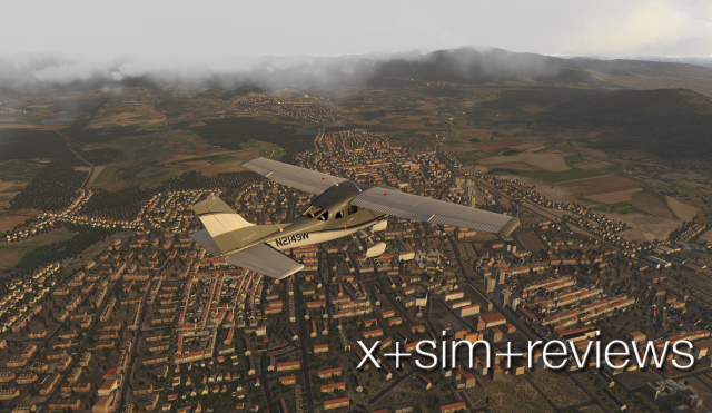
We looked at the basic idea behind the VFR Hungary release last weekend, and also took a bunch of night images of LHBP Budapest International. That said, while Budapest, the airport and city, are central to this massive undertaking, I’d say the main idea of this release was to create a hyper detailed VFR training area. Of course, this could easily be considered a sightseeing or excursion file, and if that works for you, go for it. Still, if you’re working on a PPL (or the equivalent in your area), this is a sweet file to put on your computer.
Why?
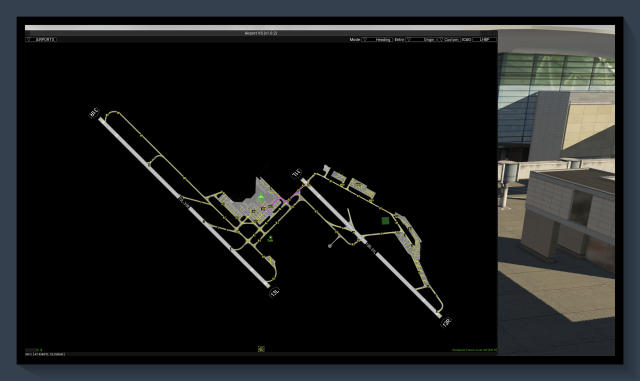
Well, as you can see on the maplet below, there are seven airports included in this package, though one of these, LHBP, is a large commercial airport and shouldn’t be considered a part of the VFR training route developed here.
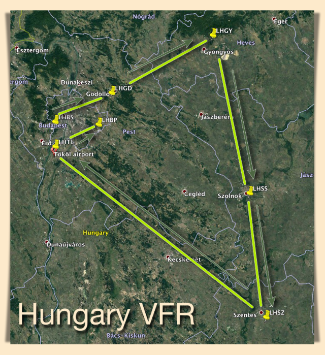
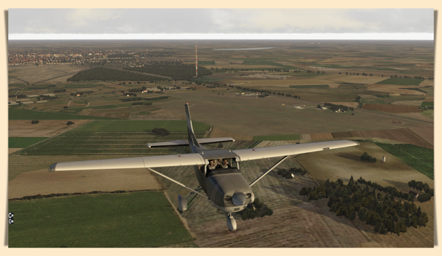
That leaves the remaining six airports in contention, six airports in a relatively small geographic area for you to work on VFR piloting skills. There are VORs and NDBs aplenty (actually, a lot of NDBs and a few VORs), too, and just because these airfields are in Hungary makes not the slightest bit of difference – from a training and/or pilotage point of view. What makes this area so interesting, beyond the obvious piloting opportunity, is the way the routes have been detailed. You’ll find tall radio and television antennae everywhere, and the types of cell towers and industrial smokestacks that do not routinely show up in Xp, so what we’re talking about here is an extra layer of contextual reality that makes this file a more compelling visual environment for training.
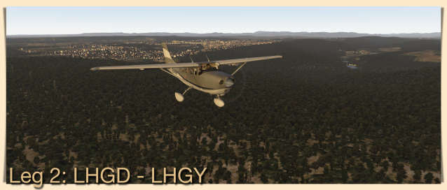
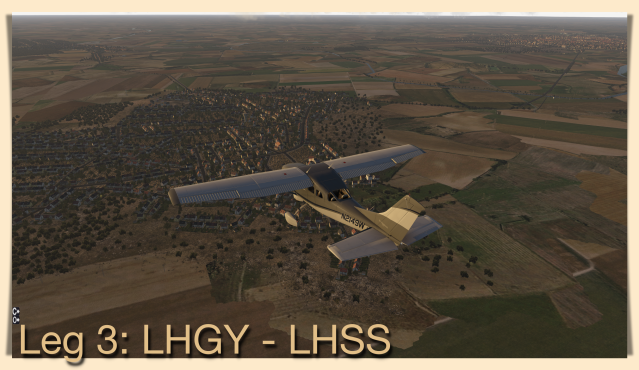
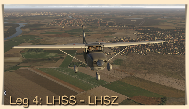
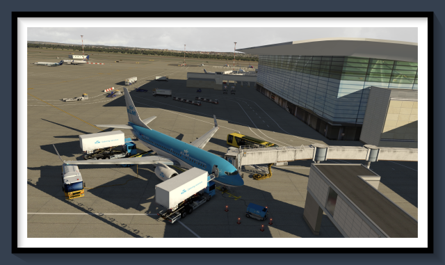
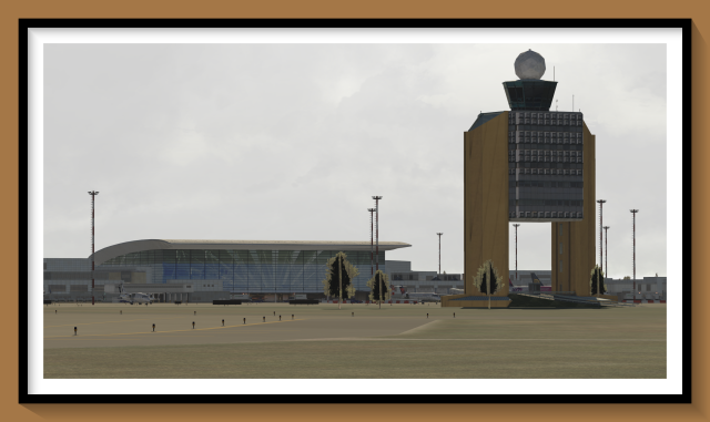
We started the training circuit at LHBS, a suburb on the NW side of Budapest, and worked our way around the circuit in a clockwise direction, first to LHGD, then on to LHGY, LHSS, LHSZ, and finally, to LHTL. We did not land at LHTL, and so ended the tour at Budapest International – in daylight, too! – so we could add a few images of that magnificent airport in order to reveal the greater whole. It’s a payware quality airport and well worth keeping on your list of available heavy metal destinations, too.
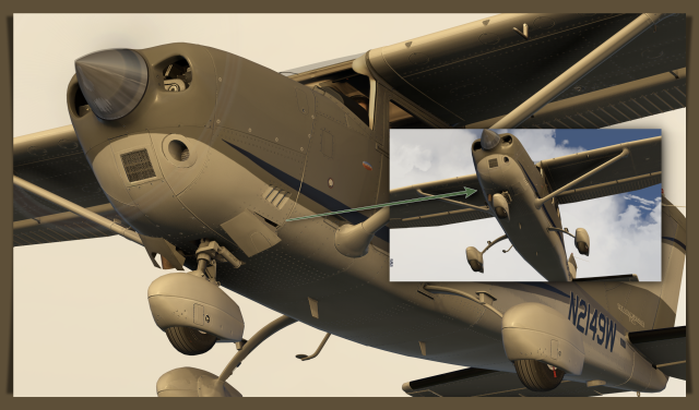
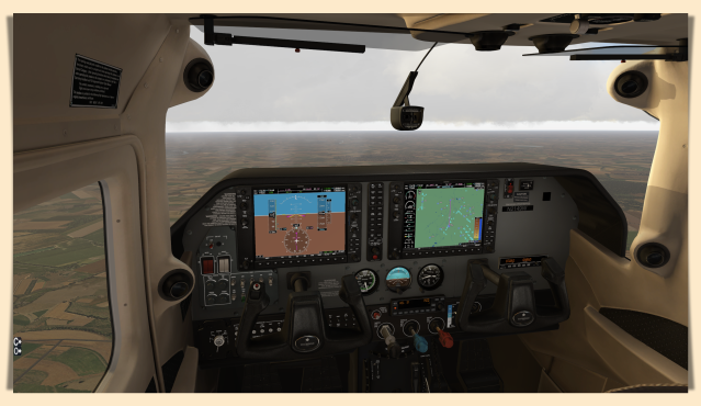
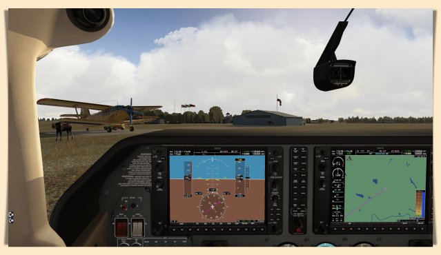
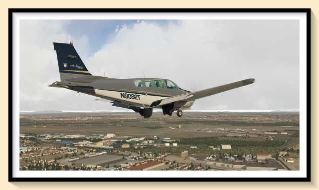
We used just two acf on this circuit, the Carenado Cessna Skywagon with the Garmin G1000 panel add-on, and the Carenado A36 Bonanza. After looking over the various aircraft with the G1000 panel, this has become a favorite here. The panel is crisp and clear, and looks factory fresh – which is the way all well-maintained aircraft should look. No putrid Pipers around Chaos Manor allowed!!! The Bonanza is what it is, a nice looking aircraft with a great v10 panel – that’s full of bugs in v11.
Anyway, this circuit is simple enough for someone in the first stages of ground school, so instructors or student pilots might want to consider adding this to your training regimen. One other note: most of these are grass strips, but they’re all well marked for daylight OPS. Most are not intended (or equipped) for night or IFR OPS.
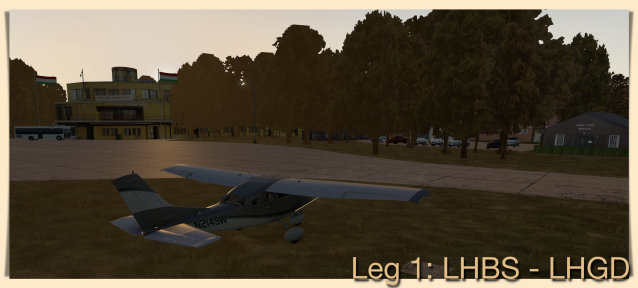
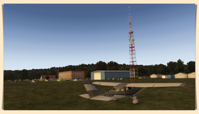
LHBS is an interesting, well developed airport/commercial area located almost in the center of Budapest. It’s an interesting choice to start from because right off the mark you’re in a TCZ. Flying under VATSIM should be doubly fun here, but for training purposes may be a little too much for beginners. Just flying this route with a Garmin will be fun enough the first time around; with you second, why not try a C172 with VOR/NDBs only?

This airport, LHBS, is itself well done and resembles satellite imagery. Most starting positions are on the grass too, and there are no formal, dedicated taxiways. In the image above you can see the worn grass most pilots use to get to the runway.
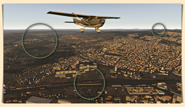
In the image below, note the red and white antenna atop the hill…

After takeoff, you’ll turn for the first airport on the circuit, and that tall antenna will be off your left wingtip. The departure airport is seen below in the leftmost circled area, the antenna in the right circle. Below the aircraft is a large, working rail yard, with several large freight trains and an ICE at rest.
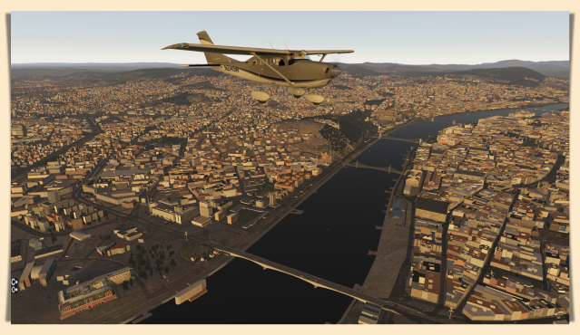
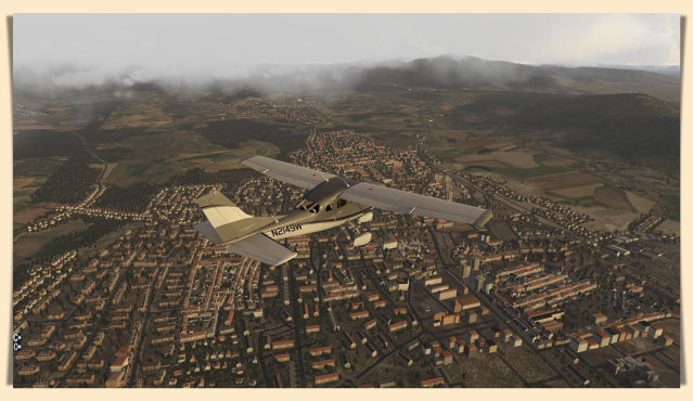
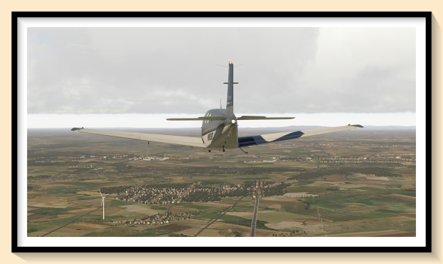
Although not particularly blue, you’ll cross the Danube almost immediately. On my agenda? I’ll take a helicopter tour of this city file, as it’s loaded with well made objects of some truly magnificent structures. You can see several along the river front in this image, including Buda Castle and the Parliament building. A couple of the bridges you can see in these images are quite famous, too. Budapest is frequently cited as one of the most beautiful cities in Europe, and you can get a small taste of that with this file.
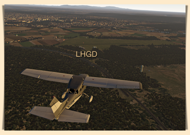
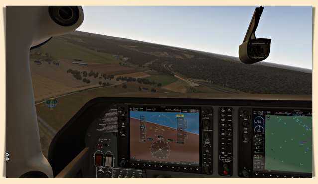
I hate to say it, but I cheated. Instead of using VORs I just plugged in the relevant data and used the Garmin in GPS mode. Note: in the image below you’ll note the small mountain ahead. You’ll land at your first airport, LHGD, about halfway to those formations.
You can just make out the grass strip below, just above the text.
I made a looping approach, and note the hot air balloon below, on a short Base Leg.
The airport is, once again, well made – for a grass strip, anyway.
I reset the G1000 here, the set off for the next airport.
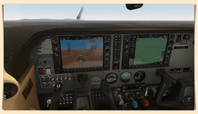
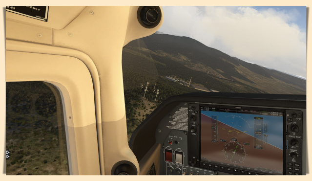
Once again, once on track you’ll see where you’re headed: the right side of that small mountain range (see arrow).
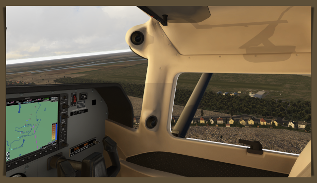
And again…you’ll pass villages that aren’t simple auto-gen; there are churches and other large buildings that have been placed in their correct locales, enabling real VFR landmark training.
Once you come to these radio towers (below) you ought to be able to make out the next airport, another grass airfield – yet this setting is more idyllic looking. I’d love to fly into this airport…it just looks a little bit like heaven in the clouds.
And the airport buildings have been made with care, too. Lots of painters at work, too.
There’s nothing difficult about landing or taking off on grass, by the by. Acceleration and braking can by a bit sluggish, but that’s about the only difference worth noting – at least on dry grass. Wet grass is something else entirely. Wet grass has been likened to greased eel snot, and with good reason.
Off to the third airport, and the terrain now becomes flat agricultural with widely spaced villages. You will find all kinds of towers out here, and if flying low (under 1000 ft AGL) you’ll need to keep an eye out for these.
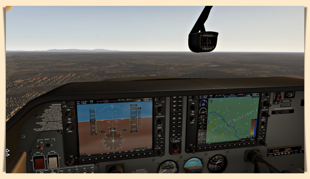
I set an OAT of 34º F, and if you do too, don’t forget to manage engine heat with your cowl flaps. Above, large image, the flaps are open for takeoffs and landings, and in flight you manage temps by changing the the amount of air that flows through the engine compartment by opening or closing these flaps. Another thing to consider when using this or a similar acf; you have almost nothing to back-up NAV instruments if the Garmin tanks on you. Besides a compass…! Mine did. I landed on a highway and reloaded the aircraft, as the nice Fix All Systems button did nothing – which means it was a bug in the software.
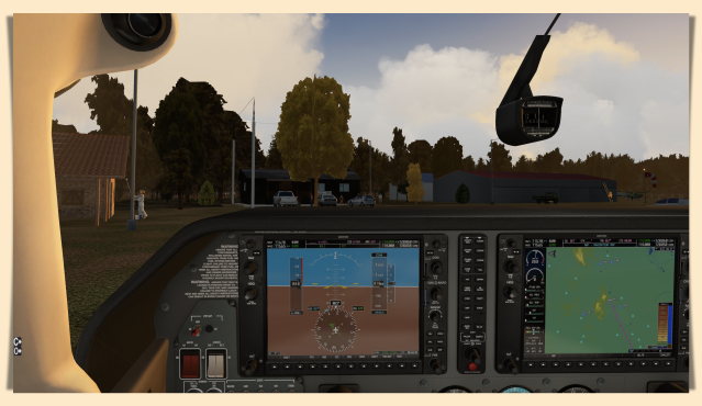
Below, this airport sneaks up on you as it’s almost in the village proper. Once you spot it get into the pattern and land. The strip is a little short, so carefully manage your speed on final. Another trick? As soon as you touch down, retract the flaps. This spoils lift and increases braking pressure, slowing your roll.
This is another well made facility, and you’ll note the village is nicely customized too.

So, reprogram the G1000 and take off again, but be sure to check your fuel state before you leave.
Once airborne you’ll see an air force base nearby, and it’s not modeled, at least not yet. The way ahead is flat agricultural prairie, with only a few small villages along the route.
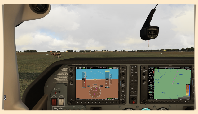
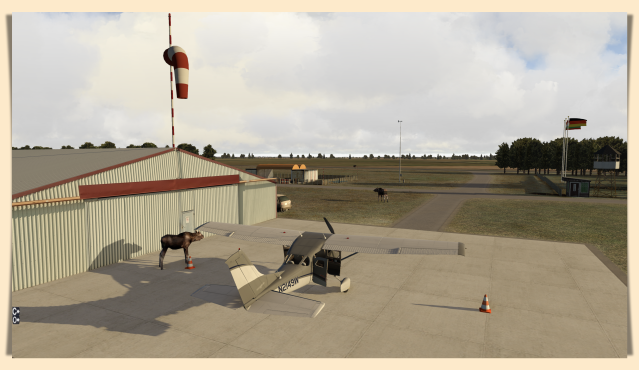
When you come to the next large town (with this radio tower), start looking for the airport. You might notice something on the runway, too. A bunch of four-legged somethings…!

I used these two small farms (visible on the left in these images) as reference points to set up on final.
And once on the ground, look out for grazing…moose?
Nice Antonov, too. If you want one just like this, start grazing through the files at Xp Hungary. Who knows what you’ll find. Even more airports, perhaps?
And yes, park next to the moose and then kill the engine (not the moose!), then go into the diner for a hundred dollar burger while the ground crew tops off your tanks.
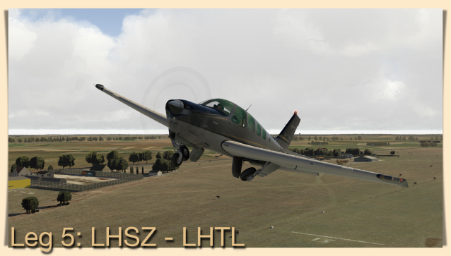
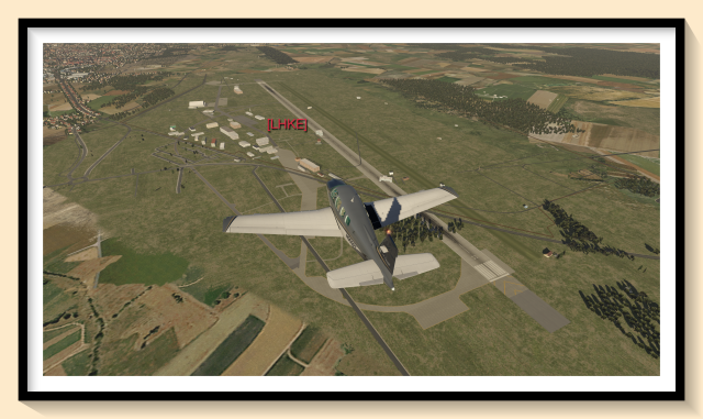
I switched out to the Bonanza here, and programed the Garmin 430 for the next destination, LHTL, an air base on the outskirts of Budapest. My intention? Fly past at low level, then turn for LHBP and land there.
Carenado’s two A-series Bonanzas have yet to be updated for v11 (current version is 3.2) and manipulators are buggy. That in no way explains why the course and heading controls on the Aspen EFD1000 display do not work (yes, I had the manual up and running). That said, the Garmin gave me a heading and the compass worked, so off we went (with no heading bug the A/P is next to useless unless in ALT mode – but why bother? The trim tab works just fine).
About halfway to Budapest you’ll flyover this airport; it is NOT finished and there are trees and houses on the runway.
You’ll also note more antennae, and the occasional wind generator will pop up along the way, too. These are the items that make this file so special, as we’ll see in the next several images.
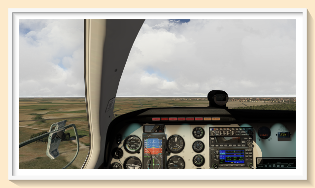
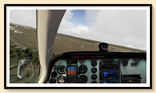
Above, flying past LHTL, and note the power plant beyond. Tune in the NDB for the airport and execute your right turn here, towards LHBP. Keep your eyes peeled for all the antennae along this last leg.

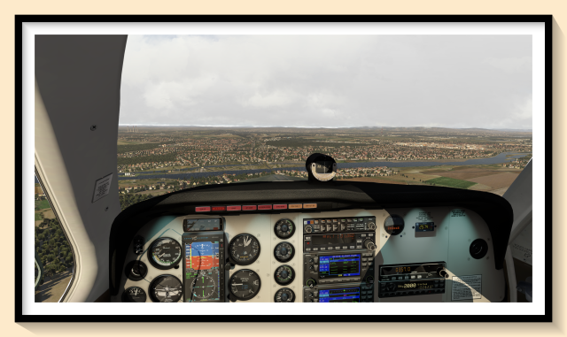
The airport is less than ten miles away now, so get your checklist ready. You’ll enter on base taking this direct route, but if used, ATC may have other ideas.
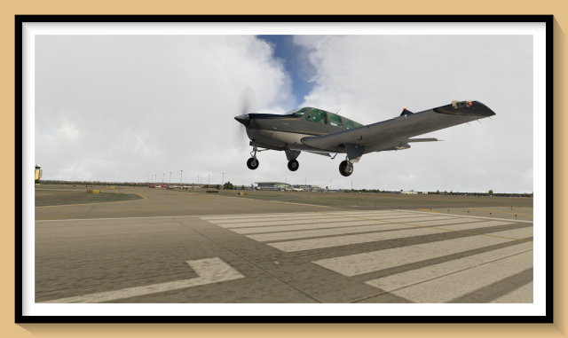
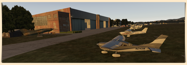
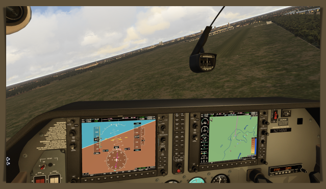
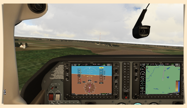
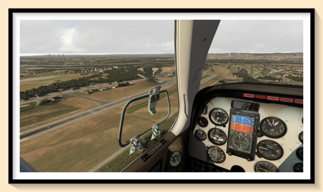
These will be the first concrete runways on your circuit today, so enjoy them! Below, a few images of this airport in daylight, as promised!

Also, do note that the FF AVS works here:
And that’s the end of the trip. Most legs are in the 40-50 mile range, so easy to set up to use in a brief time period – if, for instance, you want to tackle them in short bursts over several days. You might also try adding some bad weather and trying a last approach here, at LHBP, to test your skills.
That said, there are very few areas in X-plane that have been as conscientiously detailed like this area, and that makes this file special. It may not look like it to you while reading this review, but give it a try, see what you think. After you look around the City of Budapest, it’s more likely you’ll simply be impressed.
We hope Xp Hungary keeps working on this file, adds a few more airports. Maybe a Hungary IFR file? For those days, or nights, when good weather just won’t do!
Anyway, this is an easy 10 out of 10, Must Have file.
Later – A
